Serra Malagueta
Serra Malagueta is a mountain range located in the northern part of the island of Santiago, Cape Verde.
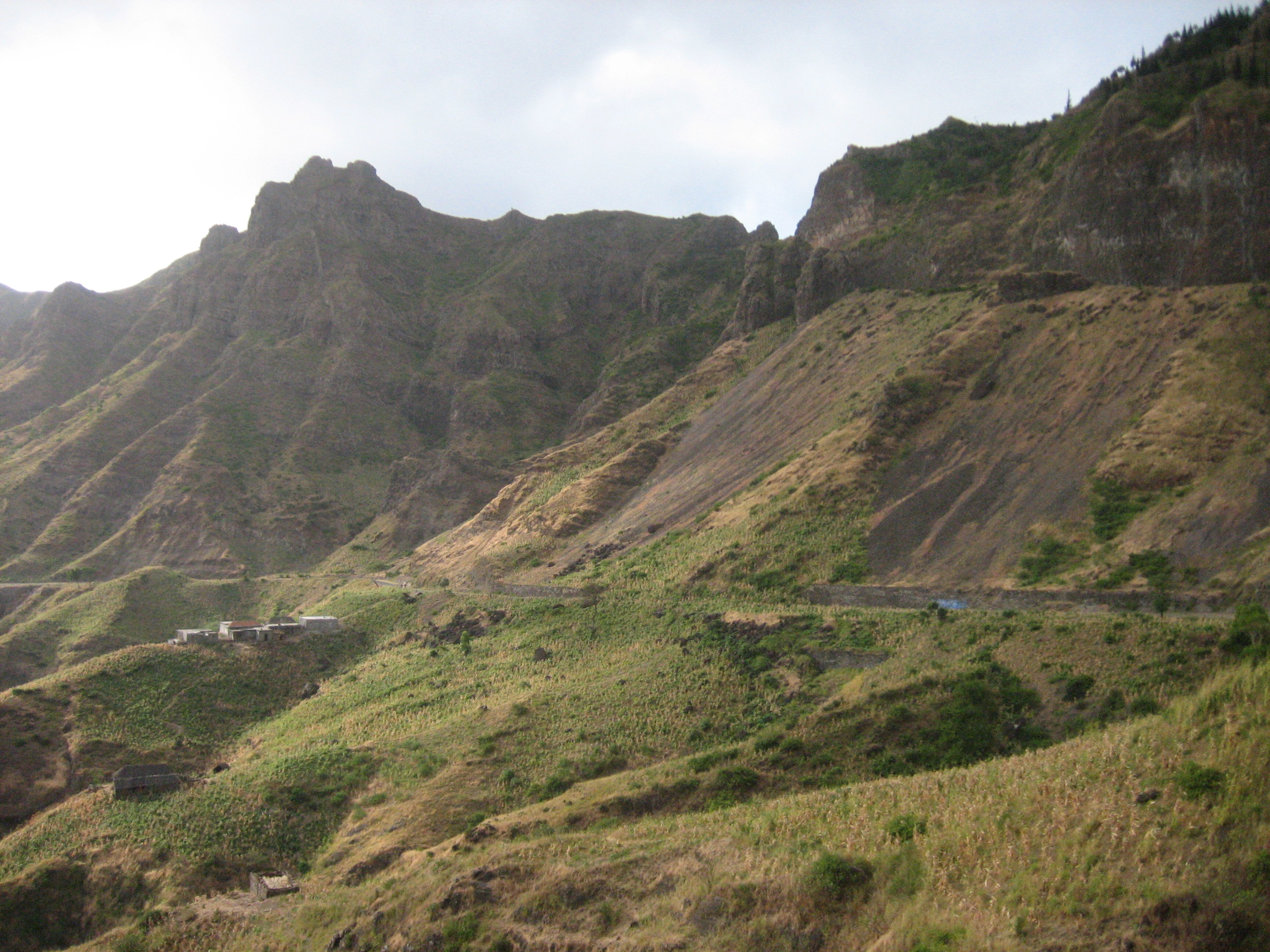
Serra Malagueta is a mountain range located in the northern part of the island of Santiago, Cape Verde. At 1064m elevation, it is the highest point of northern Santiago. The mountain range is protected as the Serra Malagueta Natural Park, which was established on February 24, 2005, and covers 774 hectares. The natural park is situated in the municipalities Tarrafal, São Miguel and Santa Catarina. The summit is in São Miguel, south of the Ribeira Principal valley. The Serra Malagueta formation is of volcanic origin, and was formed between 2.9 and 2.4 million years ago.
Adapted from Wikipedia, CC BY-SA 4.0.
Worth seeing in and around Serra Malagueta
One place within 25 km that the world writes about, in the order of how widely: the ones a visitor has heard of first, then the ones only a local would name.
- 01Serra da Malagueta
Serra Malagueta is a mountain range located in the northern part of the island of Santiago, Cape Verde. At 1064m elevation, it is the highest point of northern Santiago.
1.2 km · mountain range in Cape Verde · Wikipedia
Ranked by the number of language editions of Wikipedia with an article on each, from Wikidata; the sentences are the openings of those articles, CC BY-SA 4.0.
Getting to Serra Malagueta
- Airports
- Nelson Mandela (RAI), 33 km · Aristides Pereira (BVC), 135 km · Amílcar Cabral (SID), 190 km
- Rabil → Serra Malagueta135 km · quickest by road, 44h 44m · $19–27
- Espargos → Serra Malagueta192 km · quickest by road, 61h 4m · $24–33
- São Pedro → Serra Malagueta4956 km · quickest by air, 18h 8m · R$2,620–4,040
- Plan a tripFrom anywhereThe planner compares every way there from wherever you are.
Road and air are today’s quick answer; timetabled trains, buses and ferries load on the results page from the operators’ feeds.
No local-transport research exists yet for Serra Malagueta
Our researched notes are written from a sourced entry: every shared taxi, boat and village bus with its operator, its rule, its fare and the year we saw it, and what could not be confirmed. Nobody has done that work for Serra Malagueta. What is above is what we hold from open sources; nothing here pretends to be more.
- Get inThe port in Praia has direct and indirect connections by ferry to other islands.
- Get aroundMost of the buses ("aluguer") leave from the "central minibus station" at the bottom of the steps that lead from Parque 5 de Julho to the Old Town in Plato besides the market called Sucupira.
- Get aroundAlso of note, the minibuses often have destinations in decals on their sides (e.g.
From Wikivoyage: Santiago (Cape Verde), CC BY-SA. Not yet checked by us; that article was last edited 2022-11.
- 01264 km
- 022,670 km
- 032,882 km
- 043,591 km
- 053,594 km
If you know how people move in Serra Malagueta – the stand, the rule, the fare – tell us, and the note gets an entry.