Ghuwayr Abu Shusha
Ghuwayr Abu Shusha was a Palestinian Arab village in the Tiberias Subdistrict.
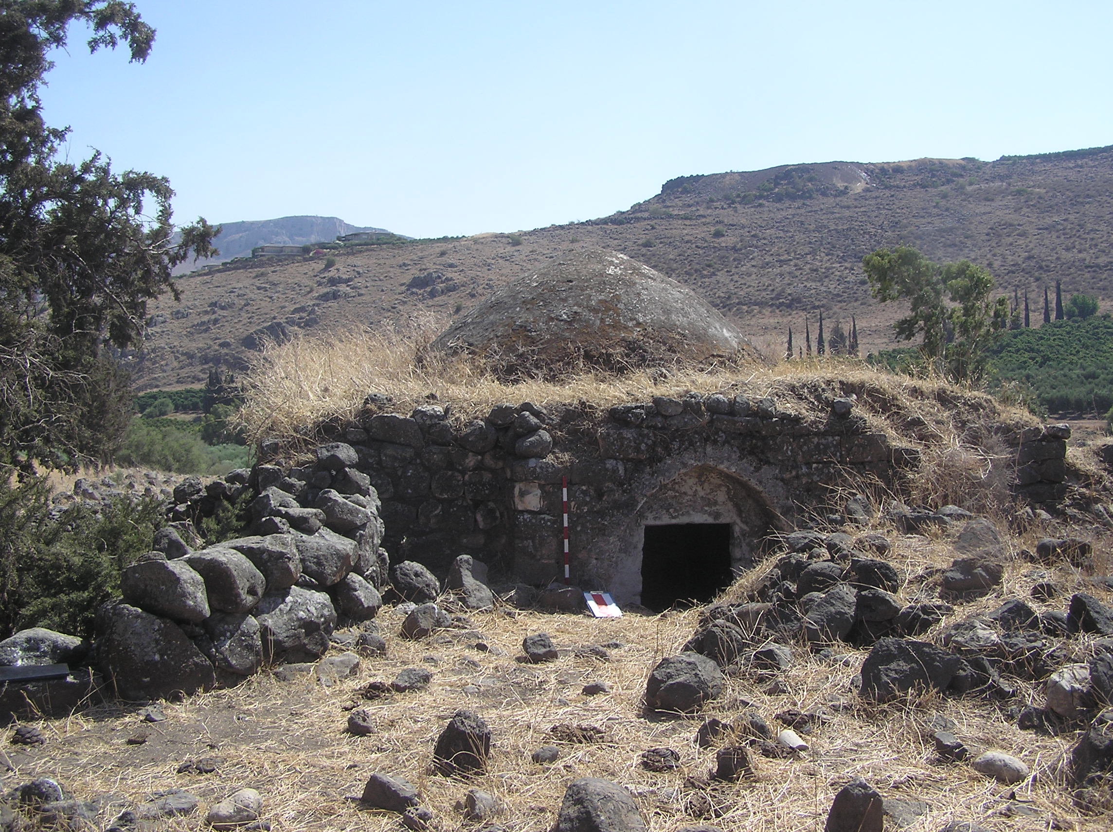
Ghuwayr Abu Shusha was a Palestinian Arab village in the Tiberias Subdistrict. It was depopulated during the 1947–1948 Civil War in Mandatory Palestine on April 21, 1948. It was located 8 km north of Tiberias, nearby Wadi Rubadiyya.
Adapted from Wikipedia, CC BY-SA 4.0.
Worth seeing in and around Ghuwayr Abu Shusha
7 places within 25 km that the world writes about, in the order of how widely: the ones a visitor has heard of first, then the ones only a local would name.
- 01Mount Arbel
Mount Arbel is a mountain in the Lower Galilee near Tiberias in Israel, with high cliffs, views of Mount Hermon and the Golan Heights, a cave-fortress, and ruins of an ancient synagogue. The mountain was formed by geological processes leading to the creation of the Jordan Rift Valley.
3.4 km · Israeli mountain in The Lower Galilee near Tiberias · Wikipedia - 02Khirbat al-Minya
Khirbet Minya, also known as Qasr al-Minya or Ayn Minyat Hisham in Arabic and Horvat/Hurvat Minnim in Hebrew, is an Umayyad-built qasr in eastern Galilee, Israel, about 200 meters west of the northern end of Lake Tiberias. It was erected as a qasr complex, with a palace, mosque, and bath built by a single patron.
3 km · 8th-century Islamic palace in Israel · Wikipedia - 03Zuttiyeh
Mugharet el-Zuttiyeh, also called as the "Skull Cave", is a prehistoric archaeological site in Upper Galilee, Israel. It is situated 2,900 m from the Nahal Amud outlet, approximately 30 m above the wadi bed below sea level).
1.9 km · archaeological site in Israel · Wikipedia - 04Amud cave
Amud Cave is located in the Upper Galilee, in the Nahal Amud gorge. It is situated about 30 m above Nahal Amud, right next to and above the famous pillar for which Nahal Amud is named.
2.1 km · cave · Wikipedia - 05Mount Nitai
Mount Nitai, sometimes spelled Nitay, is a mountain in Israel situated west of the Sea of Galilee and north of the city of Tiberias. Har Nitai is named after Nittai of Arbela.
3.8 km · mountain in Israel · Wikipedia - 06Migdal Synagogue
The Migdal Synagogue or Magdala Synagogue is an ancient former Jewish synagogue, discovered at the ancient city of Magdala, close to the shore of the Sea of Galilee, in northeastern Israel. It is one of few ancient former synagogues that were in use in the Second Temple period, which places them among the oldest synagogues found in Israel.
3 km · Archaeology site in Israel of ancient Magdala, · Wikipedia - 07Khirbet Wadi Hamam
Khirbet Wadi Hammam is an archaeological site in the Lower Galilee, at the foot of Mount Nitai in northern Israel. It lies near the modern village of Wadi al-Hammam, close to the western shore of the Sea of Galilee.
3.4 km · archaeological site in Israel · Wikipedia
Ranked by the number of language editions of Wikipedia with an article on each, from Wikidata; the sentences are the openings of those articles, CC BY-SA 4.0.
Getting to Ghuwayr Abu Shusha
- Airports
- Beirut Rafic Hariri (BEY), 107 km · Marka International (Amman Civil) (ADJ), 108 km · Ben Gurion (TLV), 110 km
- Beirut → Ghuwayr Abu Shusha146 km · quickest by road, 4h 37m · $28–38
- Amman → Ghuwayr Abu Shusha106 km · quickest by road, 2h 21m · JD5–7
- Tel Aviv → Ghuwayr Abu Shusha68 km · quickest by road, 1h 26m · ₪32–42
- Plan a tripFrom anywhereThe planner compares every way there from wherever you are.
Road and air are today’s quick answer; timetabled trains, buses and ferries load on the results page from the operators’ feeds.
No local-transport research exists yet for Ghuwayr Abu Shusha
Our researched notes are written from a sourced entry: every shared taxi, boat and village bus with its operator, its rule, its fare and the year we saw it, and what could not be confirmed. Nobody has done that work for Ghuwayr Abu Shusha. What is above is what we hold from open sources; nothing here pretends to be more.
- Get inFrom Jenin (and consequently Nablus and Ramallah) you can take a shared taxi (sherut/serviis) or hitch-hike to the border north (₪5-15 depending on the start) and cross on foot.
From Wikivoyage: Tiberias, CC BY-SA. Not yet checked by us; that article was last edited 2026-07.
- 01281 km
- 02365 km
- 03494 km
- 04654 km
- 051,027 km
If you know how people move in Ghuwayr Abu Shusha – the stand, the rule, the fare – tell us, and the note gets an entry.
Next door to Ghuwayr Abu Shusha
Ghuwayr Abu Shusha is 46 km from Irbid, the nearest large city, whose note carries the wider picture.