Edenkoben
Edenkoben is a municipality in the Südliche Weinstraße district, in Rhineland-Palatinate, Germany.
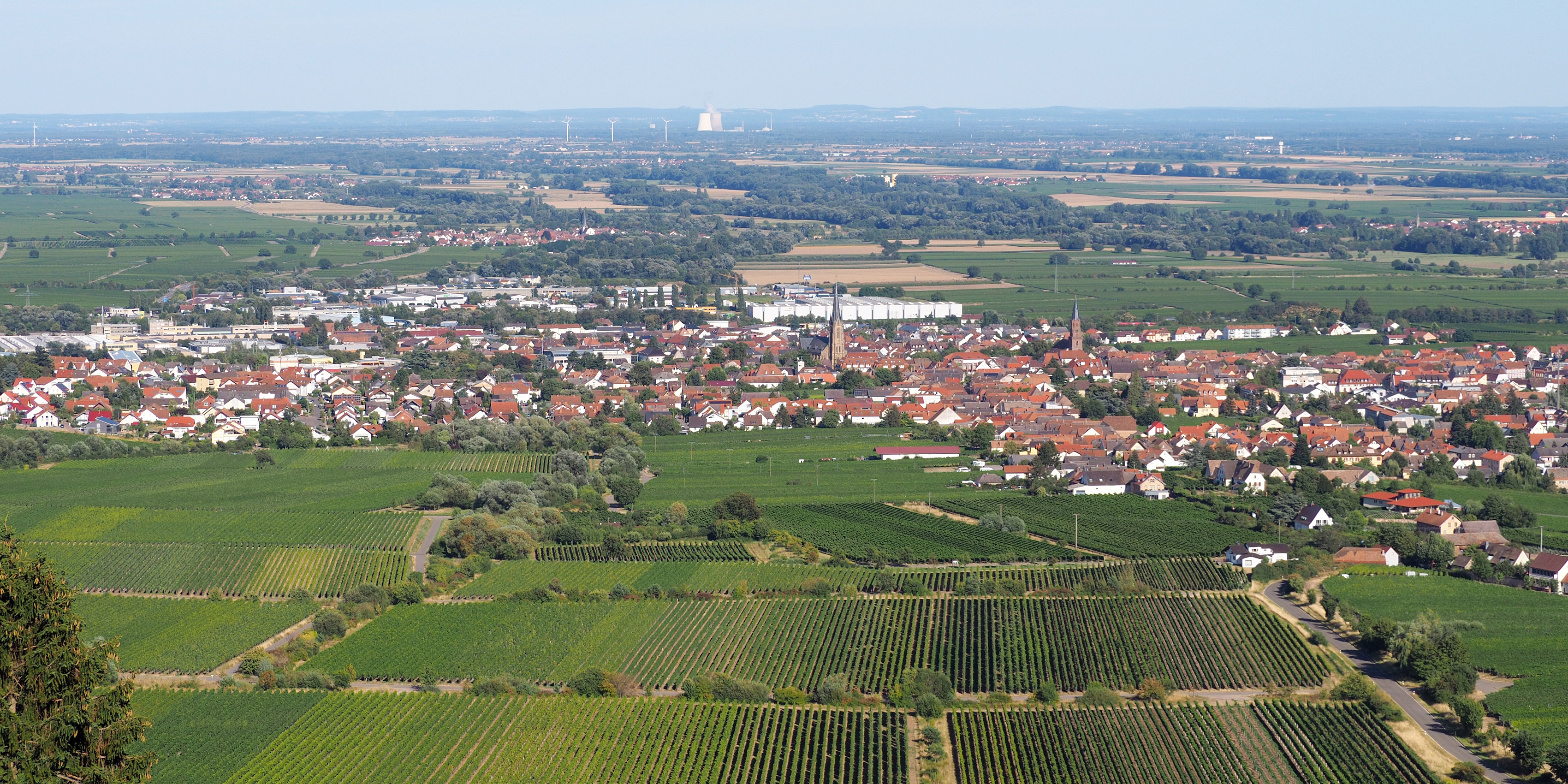
Edenkoben is a municipality in the Südliche Weinstraße district, in Rhineland-Palatinate, Germany. It lies approximately halfway between Landau and Neustadt an der Weinstraße. Edenkoben is one of the towns situated along the German Wine Route. Edenkoben is the seat of the Verbandsgemeinde Edenkoben.
Adapted from Wikipedia, CC BY-SA 4.0.
Worth seeing in and around Edenkoben
9 places within 25 km that the world writes about, in the order of how widely: the ones a visitor has heard of first, then the ones only a local would name.
- 01Hambach Castle
Hambach Castle is a castle near the urban district Hambach of Neustadt an der Weinstraße in Rhineland-Palatinate, Germany. It is considered a symbol of the German democracy movement because of the Hambacher Fest which was held there in 1832.
4.8 km · castle near the urban district Hambach of Neustadt an der Weinstraße in Rhineland-Palatinate, Germany · Wikipedia - 02Blättersberg
The Blättersberg near Rhodt unter Rietburg in the Rhenish-Palatine county of Südliche Weinstraße is a mountain, 613.2 m above sea level, in the Palatine Forest in the German state of Rhineland-Palatinate. The mountain has a north summit and a south summit; on the latter is the Ludwig observation tower.
5 km · mountain · Wikipedia - 03Wetterkreuzberg
The Wetterkreuzberg is a hill in the Haardt range on the eastern edge of the Palatine Forest in the German state of Rhineland-Palatinate.
3.8 km · mountain in Germany · Wikipedia - 04Breitenberg
The Breitenberg near Sankt Martin in the Rhineland-Palatinate county of Südliche Weinstraße is a hill, 545.2 m above sea level, and subpeak of the Kalmit, the highest mountain in the Palatinate Forest. It is part of the Haardt mountains.
4.2 km · hill in Rhineland-Palatinate, Germany · Wikipedia - 05Hochberg (Haardt)
The Hochberg is a 635.3-metre-high mountain in the central Haardt in the Palatine Forest in Germany. It lies on the territory of the municipality of Sankt Martin in the county of Südliche Weinstraße in the state of Rhineland-Palatinate.
4.8 km · mountain · Wikipedia - 06Taubenkopf
The Taubenkopf is a hill, 603.8 m above sea level, in the German state of Rhineland-Palatinate. It is part of the mountain chain of the Haardt in the Palatine Forest and lies in the municipal territory of Diedesfeld in the borough of Neustadt an der Weinstraße.
5.4 km · hill in Rhineland-Palatinate, Germany · Wikipedia - 07Hüttenberg
The Hüttenberg near Maikammer in the Rhineland-Palatinate county of Südliche Weinstraße is a subpeak, 620.1 m above sea level, of the Kalmit the highest mountain in the Haardt in the eastern Palatinate Forest of Germany. There is a blockfield, the Hüttenberg Felsenmeer, along the crest.
5.8 km · mountain in Germany · Wikipedia - 08Rietburg
The Rietburg is a ruined hillside castle on the edge of the Palatinate Forest above the village of Rhodt in the county of Südliche Weinstrasse in the German state of Rhineland-Palatinate. The remains of this castle are located on the side of the 613-metre-high Blättersberg mountain.
3.9 km · castle ruin · Wikipedia - 09Kalmithaus
The Kalmithaus, also called the Ludwigshafener Hut, near Maikammer in the Rhineland-Palatinate county of Südliche Weinstraße is a refuge hut in the Palatinate Forest run by the Ludwigshafen-Mannheim branch of the Palatinate Forest Club. It is located in the southern part of the Haardt mountains at the summit of its highest peak, the Kalmit ), and is thus the highest hut in the Palatinate Forest.
5.4 km · mountain in Germany · Wikipedia
Ranked by the number of language editions of Wikipedia with an article on each, from Wikidata; the sentences are the openings of those articles, CC BY-SA 4.0.
Getting to Edenkoben
- Airports
- Karlsruhe Baden-Baden (FKB), 56 km · Frankfurt Main (FRA), 88 km · Strasbourg (SXB), 91 km
- Rheinmünster → Edenkoben60 km · quickest by road, 1h 10m · €8–11
- Frankfurt am Main → Edenkoben101 km · quickest by road, 1h 29m · €13–18
- Frankfurt am Main (Lautzenhausen) → Edenkoben100 km · quickest by road, 1h 27m · €12–17
- Plan a tripFrom anywhereThe planner compares every way there from wherever you are.
Road and air are today’s quick answer; timetabled trains, buses and ferries load on the results page from the operators’ feeds.
No local-transport research exists yet for Edenkoben
Our researched notes are written from a sourced entry: every shared taxi, boat and village bus with its operator, its rule, its fare and the year we saw it, and what could not be confirmed. Nobody has done that work for Edenkoben. What is above is what we hold from open sources; nothing here pretends to be more.
- Go nextStrasbourg (France): Only an hour's drive from the southern border, perfect for a day trip to Alsace.
From Wikivoyage: Palatinate, CC BY-SA. Not yet checked by us; that article was last edited 2026-05.
- 01364 km
- 02495 km
- 03586 km
- 04692 km
- 05812 km
If you know how people move in Edenkoben – the stand, the rule, the fare – tell us, and the note gets an entry.
Next door to Edenkoben
Edenkoben is 33 km from Mannheim, the nearest large city, whose note carries the wider picture.
- Maikammermunicipality in Germany2.6 km
- Burrweilermunicipality of Germany5.7 km
- Weyher in der Pfalzmunicipality of Germany4 km
- Sankt Martinmunicipality of Germany2.9 km
- Böchingenmunicipality of Germany5.8 km
- Roschbachmunicipality of Germany4.1 km