Botany Bay
Botany Bay is an open oceanic embayment, located in Sydney, New South Wales, Australia, 13 km (8 mi) south of the Sydney central business district.
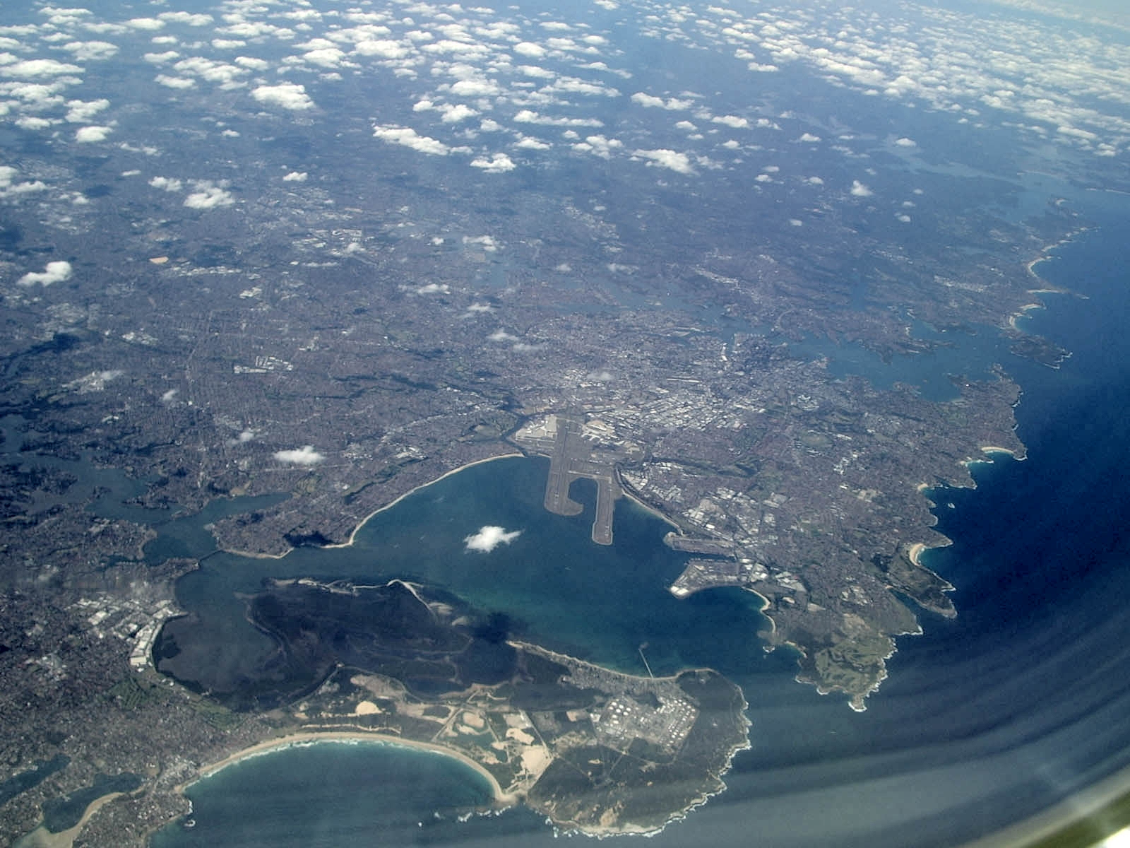
Botany Bay is an open oceanic embayment, located in Sydney, New South Wales, Australia, 13 km (8 mi) south of the Sydney central business district. Its source is the confluence of the Georges River at Taren Point and Sans Souci as well as the Cooks River at Kyeemagh, which flows 10 km (6 mi) to the east before meeting its mouth at the Tasman Sea, midpoint between the suburbs of La Perouse and Kurnell. The northern headland of the entrance to the bay from the Tasman Sea is Cape Banks, and, on the southern side, the outer headland is Cape Solander, and the inner headland is Sutherland Point.
Adapted from Wikipedia, CC BY-SA 4.0.
Worth seeing in and around Botany Bay
3 places within 25 km that the world writes about, in the order of how widely: the ones a visitor has heard of first, then the ones only a local would name.
- 01Kamay Botany Bay National Park
The Kamay Botany Bay National Park is a heritage-listed protected national park in the eastern part of Botany Bay in Sydney, New South Wales, Australia. The 456-hectare national park is situated approximately 16 kilometres south-east of the Sydney central business district, on the northern and southern headlands of Botany Bay.
2.4 km · National Park in New South Wales, Australia · Wikipedia - 02La Perouse Mission Church
The La Perouse Mission Church is a heritage-listed former church building and now vacant building and unused church located at 46 Adina Avenue, La Perouse, New South Wales, Australia. It was built from 1894 to 1930.
1.8 km · church in New South Wales, Australia · Wikipedia - 03Eastern Suburbs Memorial Park
Eastern Suburbs Memorial Park, Eastern Suburbs Crematorium and Botany General Cemetery, is a cemetery and crematorium on Bunnerong Road in Matraville, New South Wales, in the eastern suburbs district of Sydney, Australia.
2.8 km · cemetery in Sydney, Australia · Wikipedia
Ranked by the number of language editions of Wikipedia with an article on each, from Wikidata; the sentences are the openings of those articles, CC BY-SA 4.0.
What Wikivoyage says to see
- 01Mascot
A mixed developmental area on the northwestern shores of Botany Bay.
From Wikivoyage: Botany Bay, CC BY-SA 4.0. Not yet checked by us.
Things to do
Planespotting from the carpark behind the old control tower on the shore of Botany Bay adjacent to the main north-south runway. The carpark is closed after dark. There is a small beach and access to the security fence only metres from the main runway. At dawn you may see some of Sydney's racehorses being led into the water here for a swim.
From Wikivoyage: Botany Bay, CC BY-SA 4.0. Not yet checked by us.
Where to eat
Hong Ha, 1151 Botany Rd, Mascot, honghabakery@gmail.com. 6AM – 4:30PM. This tiny Vietnamese bakery is an institution. Visit the original store, which gets queues down the street at lunchtime, and order their famous chicken roll (with optional fresh chilli).
- 01The Grounds of Alexandria
7a/2 Huntley St, Alexandria (depart at Green Square Station, and follow Bourke Road southwest (approx 10 minute walk)).
- 02The Goni's Schnitzelria
After 12 years at The White Cockatoo Hotel, Goni's has now relocated with the same old menu.
From Wikivoyage: Botany Bay, CC BY-SA 4.0. Not yet checked by us.
Getting to Botany Bay
- Airports
- Sydney Kingsford Smith (SYD), 8 km · Newcastle (NTL), 145 km
- Williamtown → Botany Bay144 km · quickest by road, 3h 12m · A$22–30
- Gold Coast → Botany Bay699 km · quickest by air, 4h 53m · A$210–310
- Melbourne → Botany Bay703 km · quickest by air, 4h 55m · A$210–320
- Plan a tripFrom anywhereThe planner compares every way there from wherever you are.
Road and air are today’s quick answer; timetabled trains, buses and ferries load on the results page from the operators’ feeds.
No local-transport research exists yet for Botany Bay
Our researched notes are written from a sourced entry: every shared taxi, boat and village bus with its operator, its rule, its fare and the year we saw it, and what could not be confirmed. Nobody has done that work for Botany Bay. What is above is what we hold from open sources; nothing here pretends to be more.
- Get inThere is no ferry to La Perouse, but there is a plan to reinstate a ferry service (F10) to Kurnell which was ceased in 1974 due to a storm.
From Wikivoyage: La Perouse, CC BY-SA. Not yet checked by us; that article was last edited 2026-02.
- 01994 km
- 021,089 km
- 031,289 km
- 041,857 km
- 054,277 km
If you know how people move in Botany Bay – the stand, the rule, the fare – tell us, and the note gets an entry.
Next door to Botany Bay
Botany Bay is 15 km from Sydney, the nearest large city, whose note carries the wider picture.
- La Perousesuburb of Sydney, New South Wales, Australia1.4 km
- Kurnellsuburb of Sydney, New South Wales, Australia3.4 km
- Phillip Baysuburb of Sydney, New South Wales, Australia2.3 km
- Little Baysuburb of Sydney, New South Wales, Australia2.2 km
- Chifleysuburb of Sydney, New South Wales, Australia3.4 km
- Port Botanysuburb of Sydney, New South Wales, Australia3 km