Yalding
Yalding is a village and civil parish in the Borough of Maidstone in Kent, England.
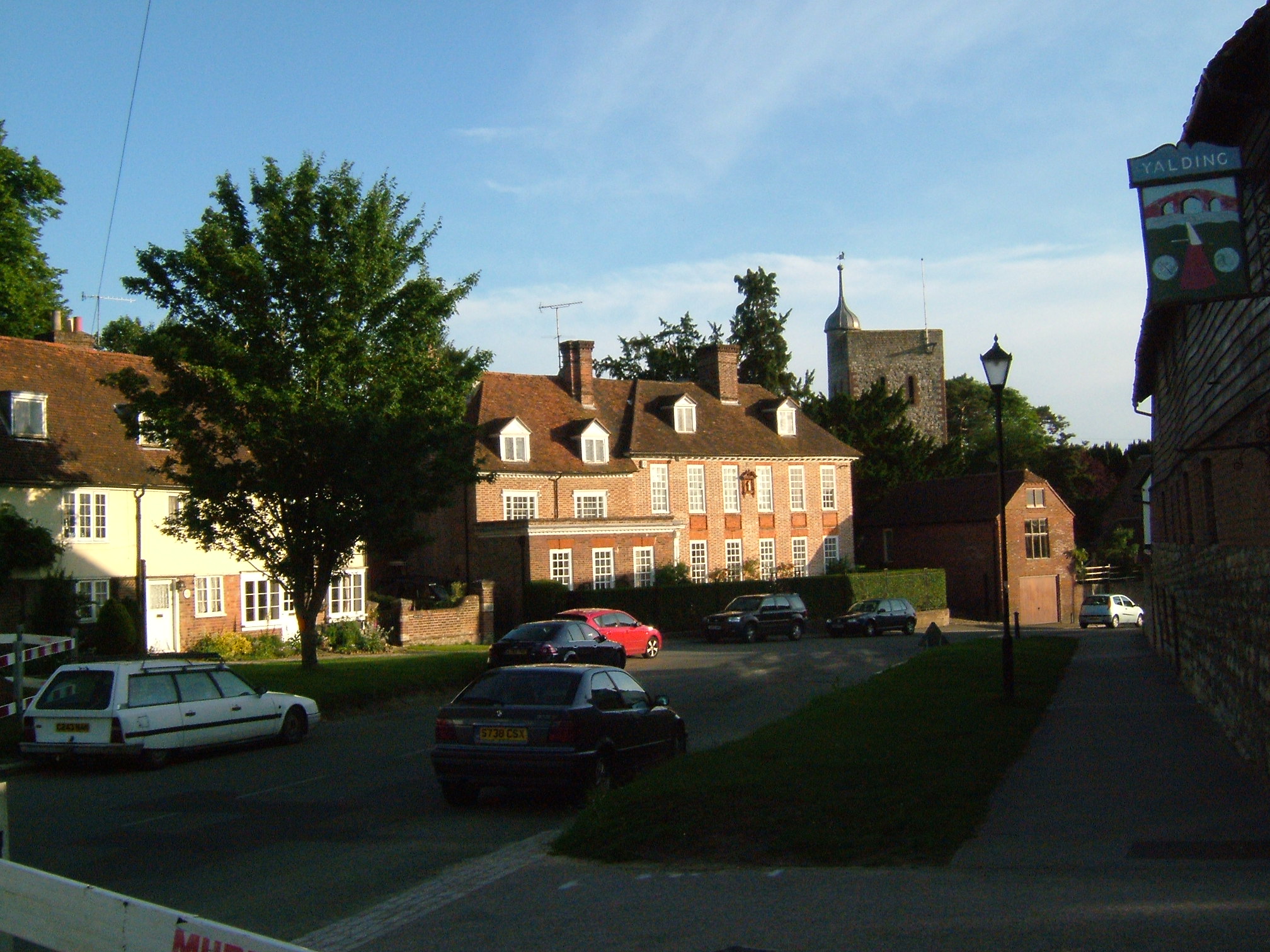
Yalding is a village and civil parish in the Borough of Maidstone in Kent, England. The village is situated 6 miles (9.7 km) south west of Maidstone at a point where the Rivers Teise and Beult join the River Medway. At the 2001 census, the parish, which includes the villages of Benover to the southeast, Laddingford to the southwest and Queen Street, had a population of 2,236. increasing to 2,418 at the 2011 Census.
Adapted from Wikipedia, CC BY-SA 4.0.
Worth seeing in and around Yalding
10 places within 25 km that the world writes about, in the order of how widely: the ones a visitor has heard of first, then the ones only a local would name.
- 01St Mary's Church, Hunton
St Mary's Church is a parish church in Hunton, Kent, England. It was begun in the late 11th or the 12th century and is a Grade I listed building.
2.7 km · Grade I listed church in Hunton, Maidstone, Kent, England, UK · Wikipedia - 02St Mary's Church, Nettlestead
St Mary the Virgin is a parish church in Nettlestead, Kent, begun in the 13th century.
2.4 km · church in Nettlestead, Kent, England, UK · Wikipedia - 03The Hop Farm Country Park
The Hop Farm is a 400-acre Country Park in Beltring, near East Peckham in the English county of Kent. The farm is over 450 years old and has the largest collection of oast houses in the world.
3.4 km · country park in Kent, England · Wikipedia - 04All Saints Church, West Farleigh
All Saints is a parish church in West Farleigh, Kent. It was begun in the 11th century and is a Grade I listed building.
4 km · Grade I listed church in West Farleigh, Maidstone, Kent, England, UK · Wikipedia - 05Nettlestead Place
Nettlestead Place is a country house in Nettlestead, Kent, England. The house and its gatehouse are each separately Grade I listed buildings.
2.4 km · Grade I listed country house in Nettlestead, Kent, England, UK · Wikipedia - 06Quarry Wood, Kent
Quarry Wood is a 26-hectare nature reserve east of West Farleigh, which is south-west of Maidstone in Kent. It is managed by the Kent Wildlife Trust.
3 km · park in United Kingdom · Wikipedia - 07Wateringbury SSSI
Wateringbury SSSI is a 0.2-hectare geological Site of Special Scientific Interest in Wateringbury west of Maidstone in Kent. It is a Geological Conservation Review site.
3.6 km · UK Site of Special Scientific Interest · Wikipedia - 08Teston Bridge
Teston Bridge is a road bridge across the River Medway, between Teston and West Farleigh in Kent, England.
3.5 km · Grade I listed bridge in Teston, Kent, England · Wikipedia - 09West Farleigh Hall
Smiths Hall, known as West Farleigh Hall from the early 20th century until the 1990s, is an 18th-century country house in West Farleigh, Kent.
3.1 km · Grade I listed country house in West Farleigh, Kent, England, UK · Wikipedia - 10Barham Court
Barham Court is an English country house in the village of Teston, Kent.
3.8 km · country house in Teston, Kent, England, UK · Wikipedia
Ranked by the number of language editions of Wikipedia with an article on each, from Wikidata; the sentences are the openings of those articles, CC BY-SA 4.0.
Getting to Yalding
- Airports
- London Gatwick (LGW), 44 km · London Heathrow (LHR), 68 km · London Stansted (STN), 75 km
- Stations
- Wateringbury railway station, 2.8 km · Yalding railway station, 1.2 km · Beltring railway station, 2.7 km · Teston Crossing Halt railway station, 3.6 km
- London → Yalding50 km · quickest by road, 1h 41m · £5–7
- London, Essex → Yalding50 km · quickest by road, 1h 41m · £5–7
- Luton, Luton → Yalding94 km · quickest by road, 2h 17m · £11–15
- Plan a tripFrom anywhereThe planner compares every way there from wherever you are.
Road and air are today’s quick answer; timetabled trains, buses and ferries load on the results page from the operators’ feeds.
No local-transport research exists yet for Yalding
Our researched notes are written from a sourced entry: every shared taxi, boat and village bus with its operator, its rule, its fare and the year we saw it, and what could not be confirmed. Nobody has done that work for Yalding. What is above is what we hold from open sources; nothing here pretends to be more.
- 01135 km
- 02355 km
- 03385 km
- 04608 km
- 05644 km
If you know how people move in Yalding – the stand, the rule, the fare – tell us, and the note gets an entry.
Next door to Yalding
Yalding is 50 km from London, the nearest large city, whose note carries the wider picture.
- East Peckhamvillage and civil parish in Kent, England3.8 km
- Nettlesteadvillage and civil parish in Kent, United Kingdom2.6 km
- Wateringburyvillage and civil parish in Kent, England, UK3.5 km
- Huntonvillage and civil parish in Kent, England, UK2.7 km
- East Farleighvillage and civil parish in Kent, United Kingdom3.9 km
- Testonvillage and civil parish in Kent, United Kingdom3.5 km