Woodingdean
Woodingdean is an eastern suburb of the city of Brighton and Hove, East Sussex, separated from the main part of the city by downland and the Brighton Racecourse.
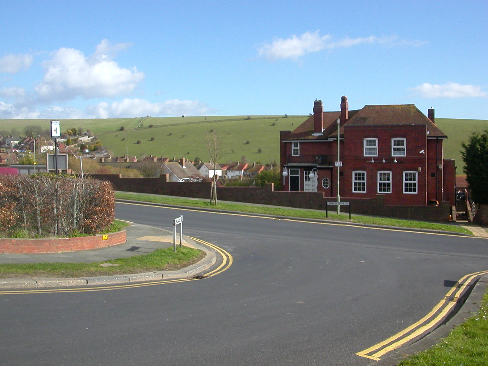
Woodingdean is an eastern suburb of the city of Brighton and Hove, East Sussex, separated from the main part of the city by downland and the Brighton Racecourse. The name Woodingdean came from Woodendean Farm which was situated in the south end of what is now Ovingdean.
Adapted from Wikipedia, CC BY-SA 4.0.
Worth seeing in and around Woodingdean
10 places within 25 km that the world writes about, in the order of how widely: the ones a visitor has heard of first, then the ones only a local would name.
- 01University of Sussex
The University of Sussex is a public research university located in Falmer, East Sussex, England. It lies mostly within the city boundaries of Brighton and Hove.
3.4 km · university in Brighton and Hove, UK · Wikipedia - 02Brighton Community Stadium
Falmer Stadium, currently known as the American Express Stadium for sponsorship reasons and more commonly referred to as the Amex, is a football stadium in Brighton and Hove, East Sussex, England. With a capacity of 32,500, it is the second-largest stadium in South East England, and the 30th-largest stadium in the United Kingdom.
3 km · association football stadium in Brighton & Hove · Wikipedia - 03University of Brighton
The University of Brighton is a public university based in Brighton on the south coast of England. Its roots can be traced back to 1858 when the Brighton School of Art was opened in the Royal Pavilion.
3.5 km · university in England, United Kingdom · Wikipedia - 04St Mark's Church, Brighton
St Mark's Church is a former Anglican church in the Kemptown area of Brighton, part of the English city of Brighton and Hove. Originally intended as the private chapel of the adjacent St Mary's Hall school, it was partly built in 1838 at the request of Frederick Hervey, 1st Marquess of Bristol; but arguments over whether or not it should also be open to the public delayed its completion for more than 10 years.
3.6 km · grade II listed church in Brighton and Hove, East Sussex, England, UK · Wikipedia - 05Ovingdean Rectory
Ovingdean Rectory is a clergy house at Ovingdean, East Sussex, England. The building was built from 1804 to 1807, replacing an earlier rectory described as "a mean, thatched parsonage-house" in a letter to Sir William Burrell There are mathematical tiles on the southern and western exterior.
2.3 km · clergy house in Brighton and Hove, East Sussex, England, UK · Wikipedia - 06Moulsecoomb Place
Moulsecoomb Place is a large 18th-century house on Lewes Road in the Moulsecoomb area of the English coastal city of Brighton and Hove. Originally a farmhouse based in an agricultural area in the parish of Patcham, north of Brighton, it was bought and extensively remodelled in 1790 for a long-established local family.
3.5 km · historic site in Brighton and Hove, United Kingdom · Wikipedia - 07Wild Park
Wild Park is a 239.8-hectare Local Nature Reserve adjacent to Lewes Road in Brighton, East Sussex. It is owned and managed by Brighton and Hove City Council.
3.9 km · park in United Kingdom · Wikipedia - 08Hillside
Hillside is an 18th-century Grade II* listed building in Rottingdean, in the city of Brighton and Hove. The house contains a gazebo listed for its special architectural or historic interest, and also contains a Grade II listed barn.
3.3 km · house in Rottingdean, East Sussex, England, UK · Wikipedia - 09Beacon Hill
Beacon Hill is an 18.6-hectare Local Nature Reserve in Rottingdean, on the eastern outskirts of Brighton in East Sussex. It is owned and managed by Brighton and Hove Council.
3.1 km · park in East Sussex, United Kingdom · Wikipedia - 10Sussex Square
Sussex Square is a garden square in Brighton in East Sussex, England. It is located in the Kemp Town section of the city, noted for its Regency architecture.
3.6 km · residential square in Brighton, England · Wikipedia
Ranked by the number of language editions of Wikipedia with an article on each, from Wikidata; the sentences are the openings of those articles, CC BY-SA 4.0.
Getting to Woodingdean
- Airports
- London Gatwick (LGW), 36 km · London Heathrow (LHR), 76 km · London Luton (LTN), 117 km
- Stations
- Falmer railway station, 3.1 km · Moulsecoomb railway station, 3.6 km
- London → Woodingdean75 km · quickest by road, 2h 18m · £8–11
- Luton, Luton → Woodingdean118 km · quickest by road, 2h 20m · £14–19
- London, Essex → Woodingdean75 km · quickest by road, 2h 18m · £8–11
- Plan a tripFrom anywhereThe planner compares every way there from wherever you are.
Road and air are today’s quick answer; timetabled trains, buses and ferries load on the results page from the operators’ feeds.
No local-transport research exists yet for Woodingdean
Our researched notes are written from a sourced entry: every shared taxi, boat and village bus with its operator, its rule, its fare and the year we saw it, and what could not be confirmed. Nobody has done that work for Woodingdean. What is above is what we hold from open sources; nothing here pretends to be more.
- Go nextDieppe, France – by ferry from Newhaven Harbour, about east of Brighton.
From Wikivoyage: Brighton, CC BY-SA. Not yet checked by us; that article was last edited 2026-09.
- 0188 km
- 02324 km
- 03439 km
- 04626 km
- 05661 km
If you know how people move in Woodingdean – the stand, the rule, the fare – tell us, and the note gets an entry.
Next door to Woodingdean
- Rottingdeanvillage in Brighton and Hove, East Sussex, England2.4 km
- Ovingdeanvillage in Brighton and Hove, East Sussex, England2.4 km
- Balsdeanabandoned hamlet in East Sussex, England, UK2.5 km
- Whitehawksuburb in the east of Brighton, England2.8 km
- Moulsecoomb and Bevendeanelectoral ward of the unitary authority of Brighton and Hove3 km
- Bear Road, Brightonarea of Brighton, England3.1 km