Wiggonholt
Wiggonholt is a village and former civil parish, now in the parish of Parham, in the Horsham district of West Sussex, England.
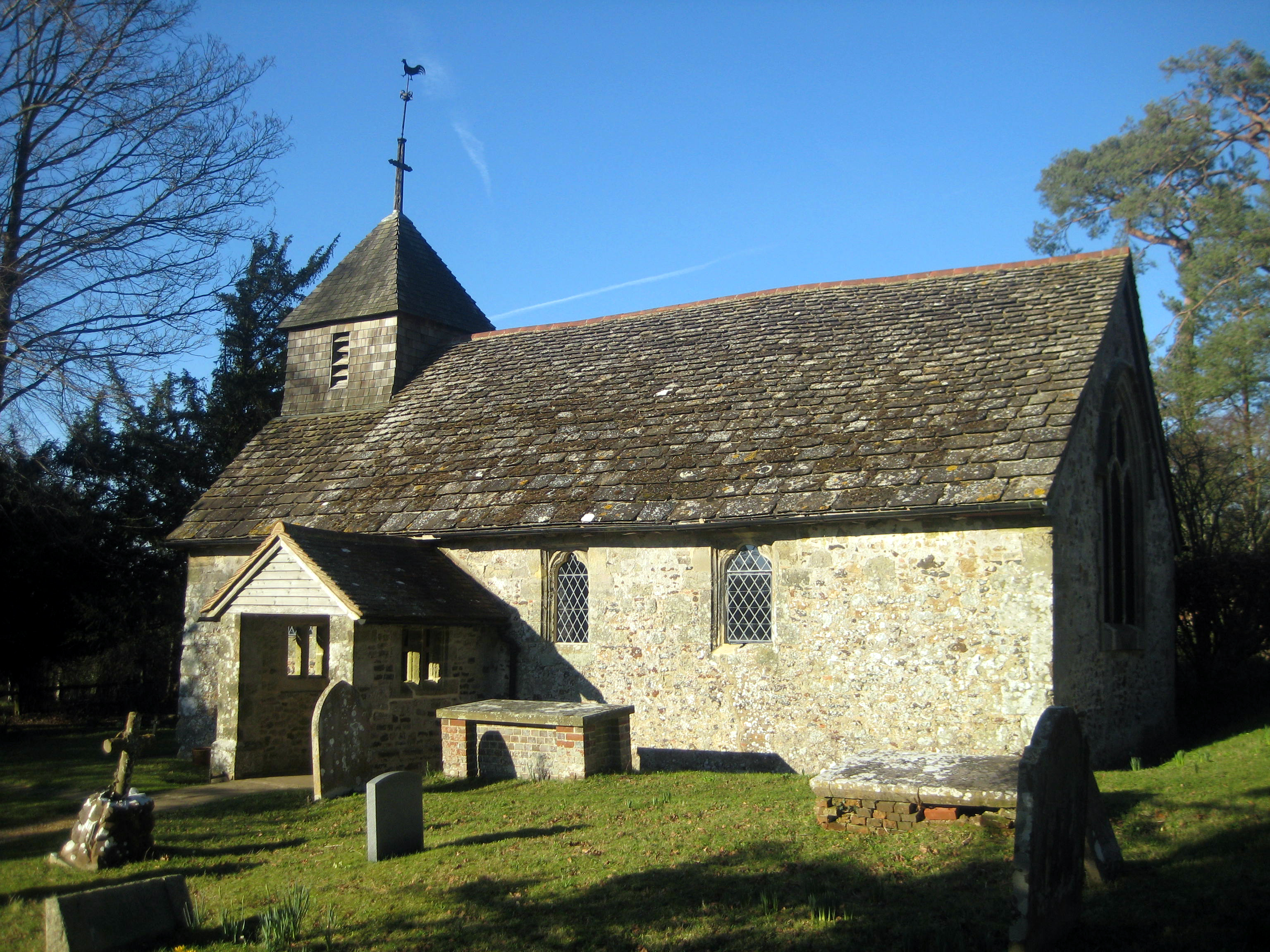
Wiggonholt is a village and former civil parish, now in the parish of Parham, in the Horsham district of West Sussex, England. It is 1.5 miles (2.4 km) southeast of Pulborough on the A283 road. The village consists of a farm, a few houses and a small Church of England parish church. In 1931 the parish had a population of 54. On 1 April 1933 the parish was abolished and merged with Parham.
Adapted from Wikipedia, CC BY-SA 4.0.
Worth seeing in and around Wiggonholt
10 places within 25 km that the world writes about, in the order of how widely: the ones a visitor has heard of first, then the ones only a local would name.
- 01Parham House
Parham Park is a country estate in the civil parish of Parham, between Storrington and Pulborough in West Sussex, England, within the South Downs National Park. Its centrepiece, Parham House, is a Grade I-listed Elizabethan country house begun in 1577 for the Palmer family on the site of an earlier fortified manor.
2.4 km · Elizabethan house in Parham, Horsham, West Sussex, England · Wikipedia - 02Hardham Priory
Hardham Priory was an Augustinian priory in Hardham, West Sussex, England. It was founded around 1248 by Sir William Dawtrey as a priory of Black Canons of St Augustine, which was at first called Heringham Priory.
3 km · monastery in Coldwaltham, West Sussex, England, UK · Wikipedia - 03St Botolph's Church, Hardham
St Botolph's Church is the Church of England parish church of Hardham, West Sussex. It is in Horsham District and is a Grade I listed building.
2.7 km · Grade I listed church in Coldwaltham, Horsham, West Sussex, England, UK · Wikipedia - 04Greatham Church
Greatham Church is the Anglican parish church of the hamlet of Greatham in the district of Horsham, one of seven local government districts in the English county of West Sussex. The tiny single-room building has been described variously as "delightful" and "one of the most appealing churches in Sussex".
2 km · church in Greatham, West Sussex, England, UK · Wikipedia - 05St Mary's Church, West Chiltington
St Mary's Church is the Grade I listed Anglican parish church of West Chiltington, a village in the Horsham district of West Sussex, England. The 12th-century building, described as a "showpiece" and "the most attractive part" of the Wealden village, retains many features of historical and architectural interest.
3.2 km · Grade I listed church in West Chiltington, West Sussex, England, UK · Wikipedia - 06The Parish Church of St Mary
St. Mary's Church, Pulborough, also known as The Parish Church of St Mary, is a Grade I listed building in Pulborough, West Sussex.
2.7 km · church in Pulborough, West Sussex, England, UK · Wikipedia - 07Old Place
Old Place is a Grade II* listed building in Pulborough, West Sussex, England. This building was originally part of Old Place Manor, though the exact role is unclear.
3 km · building in Pulborough, Horsham, England, UK · Wikipedia - 08Old Swan Bridge
The Old Swan Bridge, also known as Pulborough Bridge, is a stone bridge and Grade II listed building over the River Arun between Pulborough and Coldwaltham in West Sussex, south-eastern England.
2.6 km · bridge in Pulborough, West Sussex, England · Wikipedia - 09Old Place Manor
Old Place Manor is a Grade II listed building on Coombelands Lane, in Pulborough, West Sussex, England. The oldest parts of the house date from the 15th century, with a 16th-century roof on the northern side.
3 km · manor house in Pulborough, Horsham, West Sussex, England, UK · Wikipedia - 10Pulborough Brooks
Pulborough Brooks is a 160-hectare biological Site of Special Scientific Interest south of Pulborough in West Sussex. It is part of the Pulborough Brooks nature reserve, which is owned and managed by the Royal Society for the Protection of Birds.
1 km · Site of Special Scientific Interest in West Sussex, UK · Wikipedia
Ranked by the number of language editions of Wikipedia with an article on each, from Wikidata; the sentences are the openings of those articles, CC BY-SA 4.0.
Getting to Wiggonholt
- Airports
- London Gatwick (LGW), 31 km · London Heathrow (LHR), 59 km · London Luton (LTN), 104 km
- Stations
- Pulborough railway station, 2.9 km
- London → Wiggonholt68 km · quickest by road, 2h 23m · £7–10
- Luton, Luton → Wiggonholt105 km · quickest by road, 2h 39m · £11–15
- London, Essex → Wiggonholt68 km · quickest by road, 2h 23m · £7–10
- Plan a tripFrom anywhereThe planner compares every way there from wherever you are.
Road and air are today’s quick answer; timetabled trains, buses and ferries load on the results page from the operators’ feeds.
No local-transport research exists yet for Wiggonholt
Our researched notes are written from a sourced entry: every shared taxi, boat and village bus with its operator, its rule, its fare and the year we saw it, and what could not be confirmed. Nobody has done that work for Wiggonholt. What is above is what we hold from open sources; nothing here pretends to be more.
- Get inFerries to Newhaven and Portsmouth, and the London airports (especially Gatwick) are handy for overseas visitors.
- Go nextOr you could head south to Newhaven and catch a ferry to Dieppe in France.
From Wikivoyage: South Downs, CC BY-SA. Not yet checked by us; that article was last edited 2026-08.
- 0164 km
- 02294 km
- 03455 km
- 04601 km
- 05637 km
If you know how people move in Wiggonholt – the stand, the rule, the fare – tell us, and the note gets an entry.
Next door to Wiggonholt
- Pulboroughvillage and civil parish in West Sussex, England2.8 km
- Storringtonvillage in West Sussex, England, UK3.3 km
- West Chiltingtonvillage in West Sussex, England, UK3.3 km
- Coldwalthamvillage in West Sussex, England, UK3.9 km
- Parhamvillage and civil parish in West Sussex, UK2.4 km
- Storrington and Sullingtoncivil parish in West Sussex, England, UK3.3 km