Whyteleafe
Whyteleafe is a village in the district of Tandridge, Surrey, England, with a few streets falling inside the London Borough of Croydon.
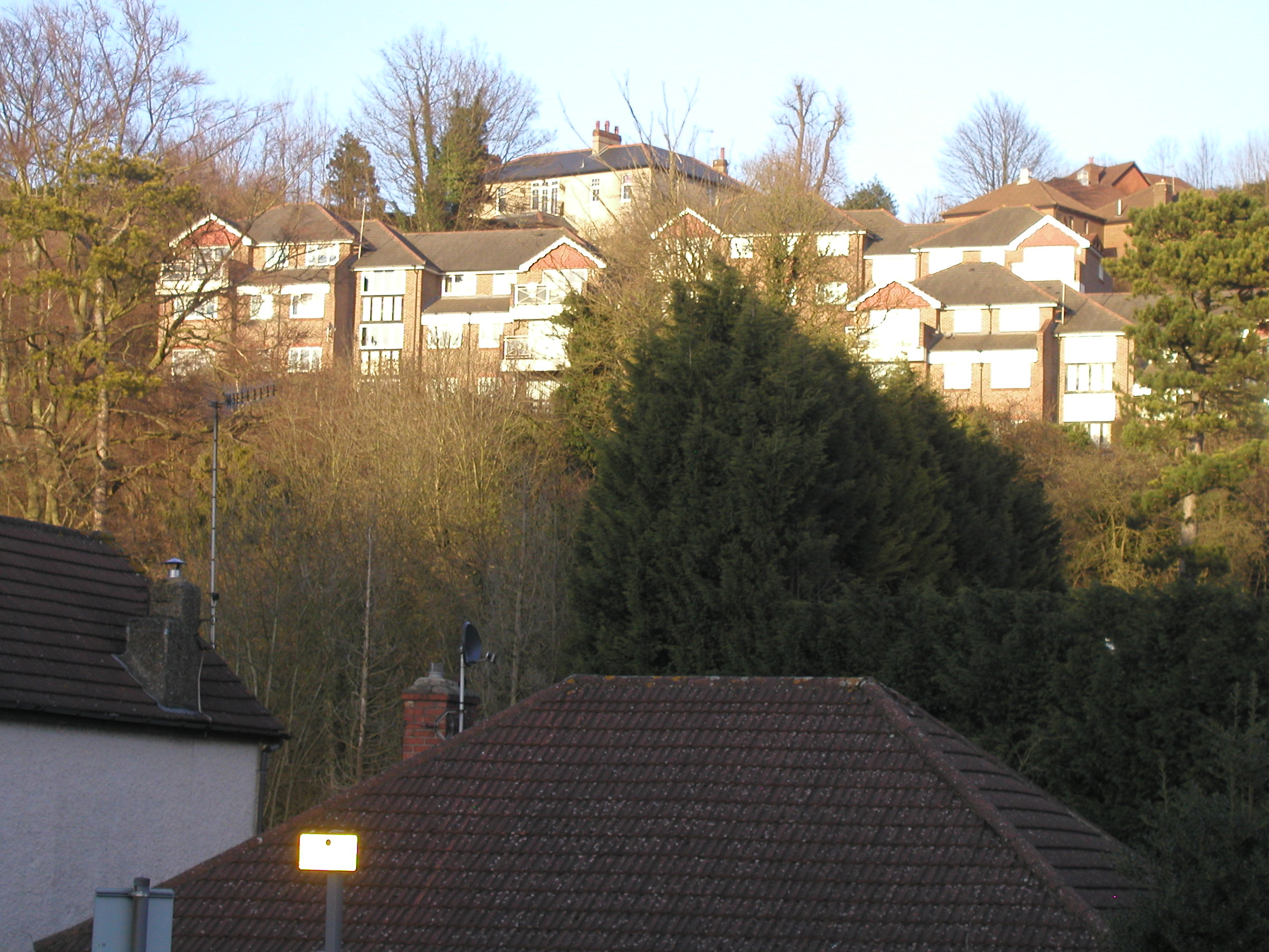
Whyteleafe is a village in the district of Tandridge, Surrey, England, with a few streets falling inside the London Borough of Croydon. The village, in a dry valley of the North Downs, has three railway stations. Neighbouring villages and towns include Woldingham, Caterham, Coulsdon, Warlingham, and Kenley. To the west are Kenley Aerodrome, Kenley Common, Coxes Wood, and Blize Wood. To the east are Riddlesdown, the Dobbin and Marden Park.
Adapted from Wikipedia, CC BY-SA 4.0.
Worth seeing in and around Whyteleafe
6 places within 25 km that the world writes about, in the order of how widely: the ones a visitor has heard of first, then the ones only a local would name.
- 01Church of St Peter and St Paul
The Church of Saints Peter and Paul at Chaldon, Surrey, is a Church of England parish church in the Diocese of Southwark. The building was begun before 1086 and is Grade I listed.
3.9 km · church at Chaldon, Surrey, England, UK · Wikipedia - 02Sacred Heart Church, Caterham
Sacred Heart Church or formally the Church of the Sacred Heart of Jesus is a Roman Catholic parish church in Caterham, Surrey, England designed by Ingress Bell and built in 1881. It is situated between Essendene Road and Whyteleafe Road off the High Street.
2.4 km · grade II listed church in Caterham-on-the-Hill, Tandridge, Surrey, England, UK · Wikipedia - 03Church of All Saints
All Saints is a church of England church in Croydon, London, England. It is a Grade I listed building.
3.1 km · church in Sanderstead, London · Wikipedia - 04Happy Valley Park
Happy Valley Park is a public park in Coulsdon in the London Borough of Croydon. It is owned and managed by Croydon Council.
2.7 km · public park in London, England · Wikipedia - 05Purley Council Offices Including Attached Railings
Purley Council Offices, also known as Purley Town Hall, is a former municipal building in Brighton Road, Purley, London. The structure, which was the headquarters of Coulsdon and Purley Urban District Council, is a Grade II listed building.
3.9 km · building in Croydon, London, England, UK · Wikipedia - 06Dollypers Hill
Dollypers Hill is a 12-hectare nature reserve south east of Coulsdon in the London Borough of Croydon. It is managed by the Surrey Wildlife Trust.
2.2 km · park · Wikipedia
Ranked by the number of language editions of Wikipedia with an article on each, from Wikidata; the sentences are the openings of those articles, CC BY-SA 4.0.
Getting to Whyteleafe
- Airports
- London Gatwick (LGW), 19 km · London Heathrow (LHR), 32 km · London Luton (LTN), 66 km
- Stations
- Coulsdon South railway station, 3.9 km · Purley railway station, 3.8 km · Woldingham railway station, 3 km · Caterham railway station, 2.9 km · Whyteleafe South railway station, 800 m
- Luton, Luton → Whyteleafe68 km · quickest by road, 1h 58m · £10–13
- London, Essex → Whyteleafe22 km · quickest by road, 1h 13m · £2.5–3
- Birmingham, West Midlands → Whyteleafe180 km · quickest by road, 3h 29m · £22–29
- Plan a tripFrom anywhereThe planner compares every way there from wherever you are.
Road and air are today’s quick answer; timetabled trains, buses and ferries load on the results page from the operators’ feeds.
No local-transport research exists yet for Whyteleafe
Our researched notes are written from a sourced entry: every shared taxi, boat and village bus with its operator, its rule, its fare and the year we saw it, and what could not be confirmed. Nobody has done that work for Whyteleafe. What is above is what we hold from open sources; nothing here pretends to be more.
- Get inWhile the runway is usable by aircraft up to Boeing 737/Airbus A320 size, it is prohibited for airline operators to sell tickets for flights in and out of the airport, thus there are no scheduled or holiday charter flights from the airport.
From Wikivoyage: London/South, CC BY-SA. Not yet checked by us; that article was last edited 2026-09.
- 01110 km
- 02320 km
- 03408 km
- 04580 km
- 05616 km
If you know how people move in Whyteleafe – the stand, the rule, the fare – tell us, and the note gets an entry.
Next door to Whyteleafe
Whyteleafe is 22 km from London, the nearest large city, whose note carries the wider picture.
- Caterhamtown in Tandridge district, Surrey, England3.2 km
- Chaldonvillage in Tandridge, Surrey, England, UK3.8 km
- Warlinghamvillage in Tandridge district, Surrey, England1.8 km
- Purleytown in South London within the London Borough of Croydon3.8 km
- Woldinghamvillage in Surrey, England, UK4 km
- Sandersteadarea of London3 km