West Roxbury
West Roxbury is a neighborhood in Boston, Massachusetts, United States, bordered by Roslindale and Jamaica Plain to the northeast, the village of Chestnut Hill and the town of Brookline to the north, the city of Newton to the northwest, the towns of Dedham and Needham to the southwest, and Hyde Park to the southeast.
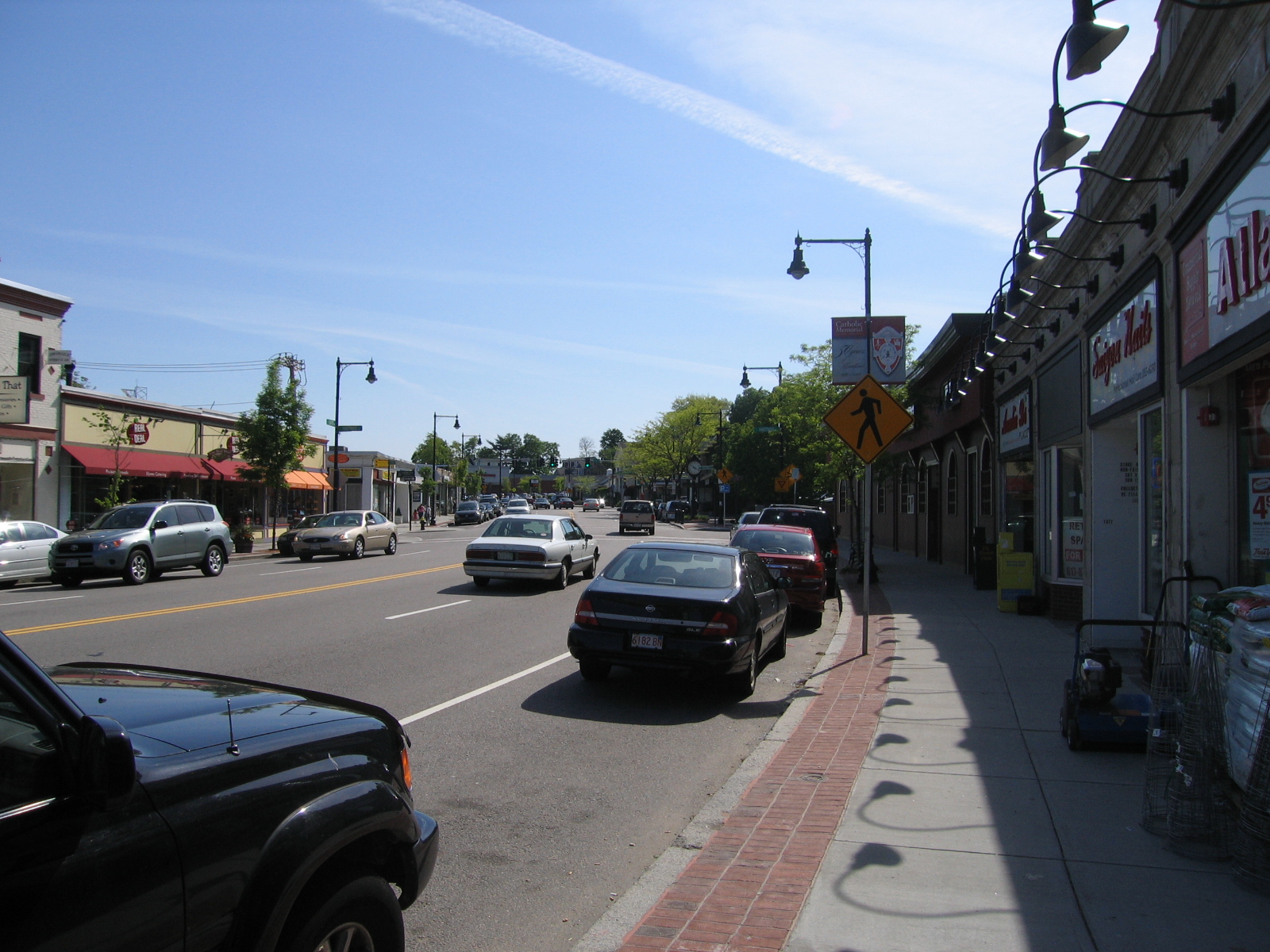
West Roxbury is a neighborhood in Boston, Massachusetts, United States, bordered by Roslindale and Jamaica Plain to the northeast, the village of Chestnut Hill and the town of Brookline to the north, the city of Newton to the northwest, the towns of Dedham and Needham to the southwest, and Hyde Park to the southeast. It is separated from Roxbury by Roslindale and Jamaica Plain.
Adapted from Wikipedia, CC BY-SA 4.0.
Worth seeing in and around West Roxbury
10 places within 25 km that the world writes about, in the order of how widely: the ones a visitor has heard of first, then the ones only a local would name.
- 01Arnold Arboretum
The Arnold Arboretum is a botanical research institution and free public park affiliated with Harvard University and located in the Jamaica Plain and Roslindale neighborhoods of Boston. Established in 1872, it is the oldest public arboretum in North America.
3 km · botanical garden of the Harvard University · Wikipedia - 02Melkite Greek Catholic Eparchy of Newton
Melkite Greek Catholic Eparchy of Newton is a Melkite Greek Catholic Church ecclesiastical territory of the Catholic Church. The eparchy is named for Newton, Massachusetts, and encompasses the entire United States.
2.4 km · eparchy of the Melkite Greek Catholic Church · Wikipedia - 03Annunciation Melkite Catholic Cathedral
Our Lady of the Annunciation Melkite Greek Catholic Cathedral in the West Roxbury neighborhood of Boston, Massachusetts, is a modern cathedral inspired by Byzantine architecture. It is the principal church of the Melkite Greek Catholic Eparchy of Newton, which encompasses the entire United States, the seat of its hierarch, currently Bishop Francois Beyrouti, and the parish church of the Melkite Greek Catholic community in Greater Boston.
2.4 km · church in Massachusetts, United States · Wikipedia - 04Larz Anderson Park
Larz Anderson Park is a wooded, landscaped, and waterscaped 64-acre parkland in Brookline, Massachusetts that is listed on the National Register of Historic Places. The southeast corner of the park is in Boston.
3.8 km · urban park in Boston and Brookline, Massachusetts · Wikipedia - 05Cutler Park
Cutler Park Reservation is a state-owned nature preserve and public recreation area that lies between Route 128/I-95 and the Charles River in Needham, Massachusetts. The state park's 772 acres contain the largest remaining freshwater marsh on the middle Charles River.
4 km · state park in Massachusetts · Wikipedia - 06Mother Brook
Mother Brook is an artificial waterway in Dedham, and Hyde Park, Massachusetts, and the first man-made canal in the present-day United States. Constructed in 1639 by settlers of the Massachusetts Bay Colony, it diverts water from the Charles River to the Neponset River and was originally designed to power water mills.
3.7 km · canal in Norfolk and Suffolk counties, Massachusetts, United States · Wikipedia - 07Stony Brook Reservation
Stony Brook Reservation is a woodland park in Boston and Dedham, Massachusetts, a unit of the Metropolitan Park System of Greater Boston, part of the state park system of Massachusetts. It was established in 1894 as one of the five original reservations created by the Metropolitan Park Commission.
3 km · state park in Boston at the headwaters of Stony Brook · Wikipedia - 08Walnut Hills Cemetery
Walnut Hills Cemetery is a historic cemetery on Grove Street and Allandale Road in Brookline, Massachusetts. It encompasses 45.26 acres, with mature trees and puddingstone outcrops, and was laid out in 1875 in the then-fashionable rural cemetery style.
2.6 km · cemetery in Brookline, Massachusetts · Wikipedia - 09Larz Anderson Auto Museum
Larz Anderson Auto Museum is located in the Anderson Carriage House on the grounds of Larz Anderson Park in Brookline, Massachusetts, and is the oldest collection of motorcars in the United States. The museum is a non-profit educational institution with community events, lectures, children's programs, walking tours of the park, and an ever-changing series of exhibits on motor vehicles and the automobile's impact on society and culture.
3.7 km · automobile museum in Larz Anderson Park, Massachusetts · Wikipedia - 10St. Mary's Church
St. Mary of the Assumption Church (commonly referred to as St.
3.7 km · church in Massachusetts, United States · Wikipedia
Ranked by the number of language editions of Wikipedia with an article on each, from Wikidata; the sentences are the openings of those articles, CC BY-SA 4.0.
Getting to West Roxbury
- Airports
- Boston Logan (BOS), 15 km · Rhode Island T. F. Green (PVD), 66 km · Bradley (BDL), 132 km
- Stations
- Forest Hills station, 3.8 km · West Roxbury station, 900 m · Roslindale Village station, 1.8 km
- Providence/Warwick → West Roxbury66 km · quickest by road, 1h 39m · $6–8
- Portland → West Roxbury4073 km · quickest by air, 9h 14m · $460–700
- Hartford → West Roxbury139 km · quickest by road, 2h 35m · $13–17
- Plan a tripFrom anywhereThe planner compares every way there from wherever you are.
Road and air are today’s quick answer; timetabled trains, buses and ferries load on the results page from the operators’ feeds.
No local-transport research exists yet for West Roxbury
Our researched notes are written from a sourced entry: every shared taxi, boat and village bus with its operator, its rule, its fare and the year we saw it, and what could not be confirmed. Nobody has done that work for West Roxbury. What is above is what we hold from open sources; nothing here pretends to be more.
- Get inThere are a few ferries plying their trades between Boston and Provincetown, and another company connects Plymouth to P-town.
From Wikivoyage: Eastern Massachusetts, CC BY-SA. Not yet checked by us; that article was last edited 2026-07.
- 01246 km
- 02272 km
- 032,723 km
- 042,739 km
- 052,841 km
If you know how people move in West Roxbury – the stand, the rule, the fare – tell us, and the note gets an entry.
Next door to West Roxbury
West Roxbury is 10 km from South Boston, the nearest large city, whose note carries the wider picture.
- Brook Farmintentional community2.4 km
- South Bostonneighborhood of Boston, Massachusetts, United States1.8 km
- Hyde Parkneighborhood of Boston, Massachusetts, United States3.3 km
- Roslindaleneighborhood in Boston, Massachusetts1.8 km
- Stony Brook Reservation Parkwayshistoric district in the United States1.5 km