Weetwood
Weetwood is an area between Headingley and Meanwood in north-west Leeds, West Yorkshire, England.
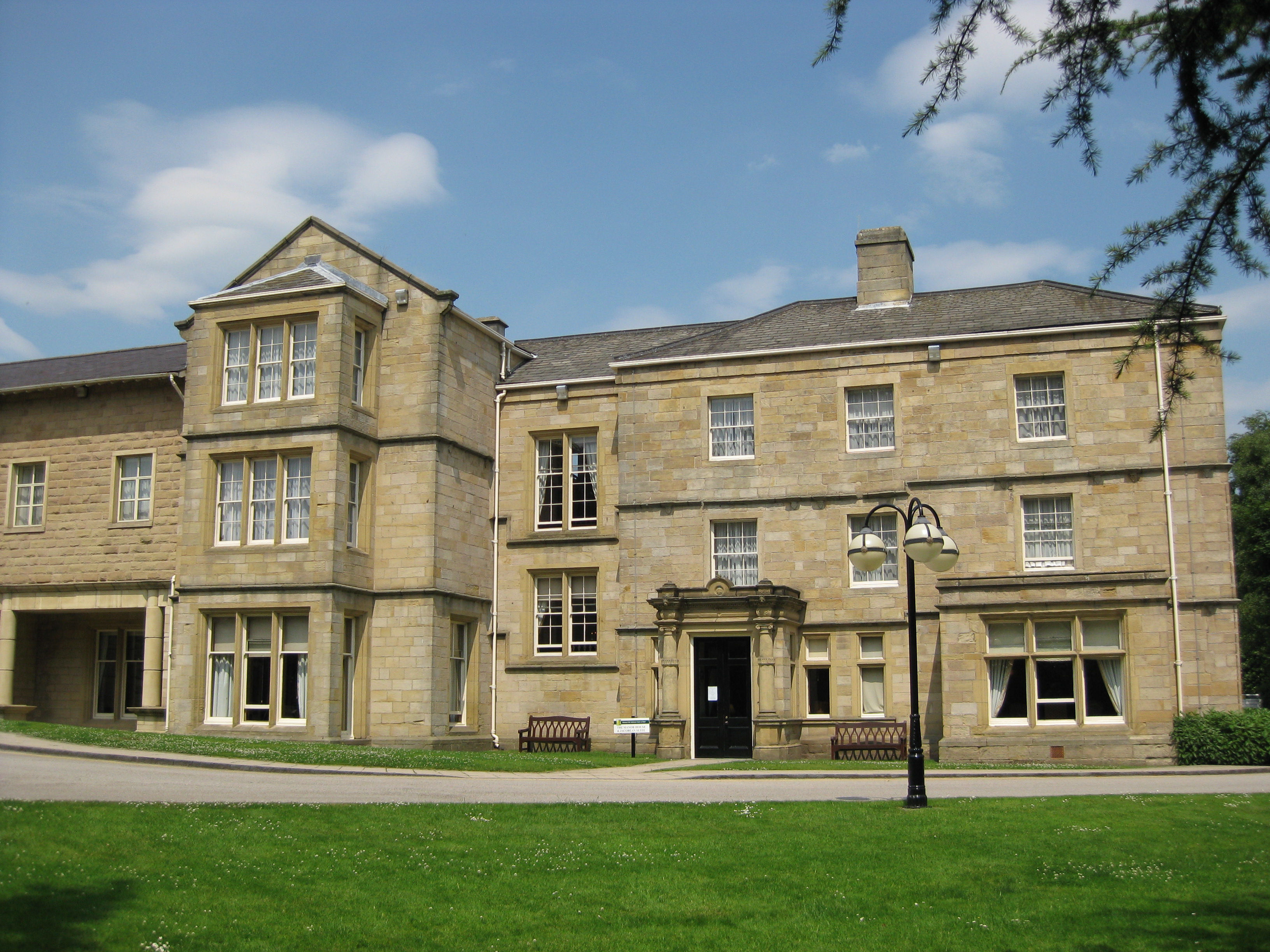
Weetwood is an area between Headingley and Meanwood in north-west Leeds, West Yorkshire, England. It is bounded on the north by the A6120, on the west by the A660, on the east by Meanwood Beck and to the south by Hollin Lane. Weetwood Lane runs north and south through it.
Adapted from Wikipedia, CC BY-SA 4.0.
Worth seeing in and around Weetwood
10 places within 25 km that the world writes about, in the order of how widely: the ones a visitor has heard of first, then the ones only a local would name.
- 01Headingley Stadium
Headingley Stadium is a stadium complex in Headingley, Leeds, West Yorkshire, England. Linked by a two-sided stand housing common facilities, it comprises two separate grounds: Headingley Cricket Ground and Headingley Rugby Stadium.
2.4 km · sports ground in Leeds, West Yorkshire, England · Wikipedia - 02Kirkstall Abbey
Kirkstall Abbey is a ruined Cistercian monastery in Kirkstall, north-west of Leeds city centre in West Yorkshire, England. It is set in a public park on the north bank of the River Aire.
2.4 km · Cistercian monastery in West Yorkshire, England, United Kingdom · Wikipedia - 03Headingley Cricket Ground
Headingley Cricket Ground is a cricket ground in the Headingley Stadium complex in Headingley, Leeds, England. It adjoins the Headingley Rugby Stadium through a shared main stand, although the main entrance to the cricket ground is at the opposite Kirkstall Lane end.
2.4 km · cricket ground · Wikipedia - 04Leeds Grand Mosque
Leeds Grand Mosque is a mosque in Leeds, England with a regular congregation of 3,000. It is located at 9 Woodsley Road, Hyde Park, Leeds, LS6 1SN West Yorkshire, England.
3.8 km · mosque in West Yorkshire, England, United Kingdom · Wikipedia - 05Headingley Rugby Stadium
Headingley Rugby Stadium is a rugby league stadium in Headingley, Leeds and shares the same site as Headingley Cricket Ground. It is the home ground of the Leeds Rhinos, and is the fifth largest rugby league stadium in England.
2.5 km · stadium · Wikipedia - 06Memorial to Queen Victoria
A Memorial to Queen Victoria stands in Woodhouse Moor, Leeds, West Yorkshire, England. The memorial consists of figures and a frieze in bronze on a plinth and pedestal of Portland stone.
3.7 km · memorial in Leeds, West Yorkshire, England, UK · Wikipedia - 07Kirkstall Road Viaduct
Kirkstall Road Viaduct is a Grade II listed railway viaduct carrying the Harrogate line over the A65 Kirkstall Road, the River Aire, and the Leeds and Liverpool Canal in Burley, Leeds, West Yorkshire. It was built in 1849 by the engineer Thomas Grainger for the Leeds and Thirsk Railway.
4 km · railway viaduct in Leeds, West Yorkshire, England, UK · Wikipedia - 08Our Lady of Lourdes Church, Leeds
Our Lady of Lourdes Church is a Roman Catholic church in the parish of St Jeanne Jugan, Leeds. It was built by the Society of Jesus in the 1920s and it is situated on Cardigan Road in Burley, Leeds.
3 km · Catholic church in Leeds, UK · Wikipedia - 09St Michael and All Angels Church
Headingley Parish Church or the Parish Church of St Michael and All Angels in Headingley, a suburb of Leeds, in West Yorkshire, England is a Victorian Church of England parish church. It is a Grade II* listed building.
2.3 km · church in Headingley, UK · Wikipedia - 10Church of St John the Baptist
The Grade I listed, mainly Norman Church of Saint John the Baptist in Adel, Leeds, West Yorkshire, England has been described by Nicholas Pevsner as 'one of the best and most complete Norman churches in Yorkshire'. It is most notable for its magnificent south doorway with surrounding carvings, and highly carved Norman chancel arch.
2.1 km · church in Leeds, United Kingdom · Wikipedia
Ranked by the number of language editions of Wikipedia with an article on each, from Wikidata; the sentences are the openings of those articles, CC BY-SA 4.0.
Getting to Weetwood
- Airports
- Leeds Bradford (LBA), 6 km · Manchester (MAN), 71 km · Liverpool John Lennon (LPL), 100 km
- Stations
- Headingley railway station, 2.4 km · Burley Park railway station, 3.1 km · Horsforth railway station, 2.9 km · Kirkstall Forge railway station, 3 km
- Manchester, Greater Manchester → Weetwood58 km · quickest by road, 1h 36m · £7–9
- Liverpool → Weetwood29 km · quickest by road, 1h 1m · £3.5–5
- Nottingham, Leicestershire → Weetwood42 km · quickest by road, 1h 16m · £4–6
- Plan a tripFrom anywhereThe planner compares every way there from wherever you are.
Road and air are today’s quick answer; timetabled trains, buses and ferries load on the results page from the operators’ feeds.
No local-transport research exists yet for Weetwood
Our researched notes are written from a sourced entry: every shared taxi, boat and village bus with its operator, its rule, its fare and the year we saw it, and what could not be confirmed. Nobody has done that work for Weetwood. What is above is what we hold from open sources; nothing here pretends to be more.
- Get inFerries sail overnight from Rotterdam (Netherlands) to Kingston upon Hull.
- Get inHull is an hour by train or car from Leeds, and the ferry port is 3 miles east of Hull city centre: buses run from there to the railway station.
- Go nextLeeds is a major transport hub, so many outlying attractions can be done as day trips.
From Wikivoyage: Leeds, CC BY-SA. Not yet checked by us; that article was last edited 2026-09.
- 01299 km
- 02332 km
- 03351 km
- 04360 km
- 05362 km
If you know how people move in Weetwood – the stand, the rule, the fare – tell us, and the note gets an entry.
Next door to Weetwood
Weetwood is 5 km from Leeds, the nearest large city, whose note carries the wider picture.
- Horsforthsuburb and civil parish within the City of Leeds in West Yorkshire, England3.6 km
- Headingleysuburb of Leeds in West Yorkshire, England2.1 km
- Bramleyarea of Leeds, West Yorkshire, England4 km
- Kirkstallsuburb of Leeds2.6 km
- Burleyarea of Leeds, West Yorkshire, England3.8 km
- Adelvillage in Leeds, West Yorkshire1.1 km