Upper Sheringham
Upper Sheringham is a village and civil parish in the English county of Norfolk.
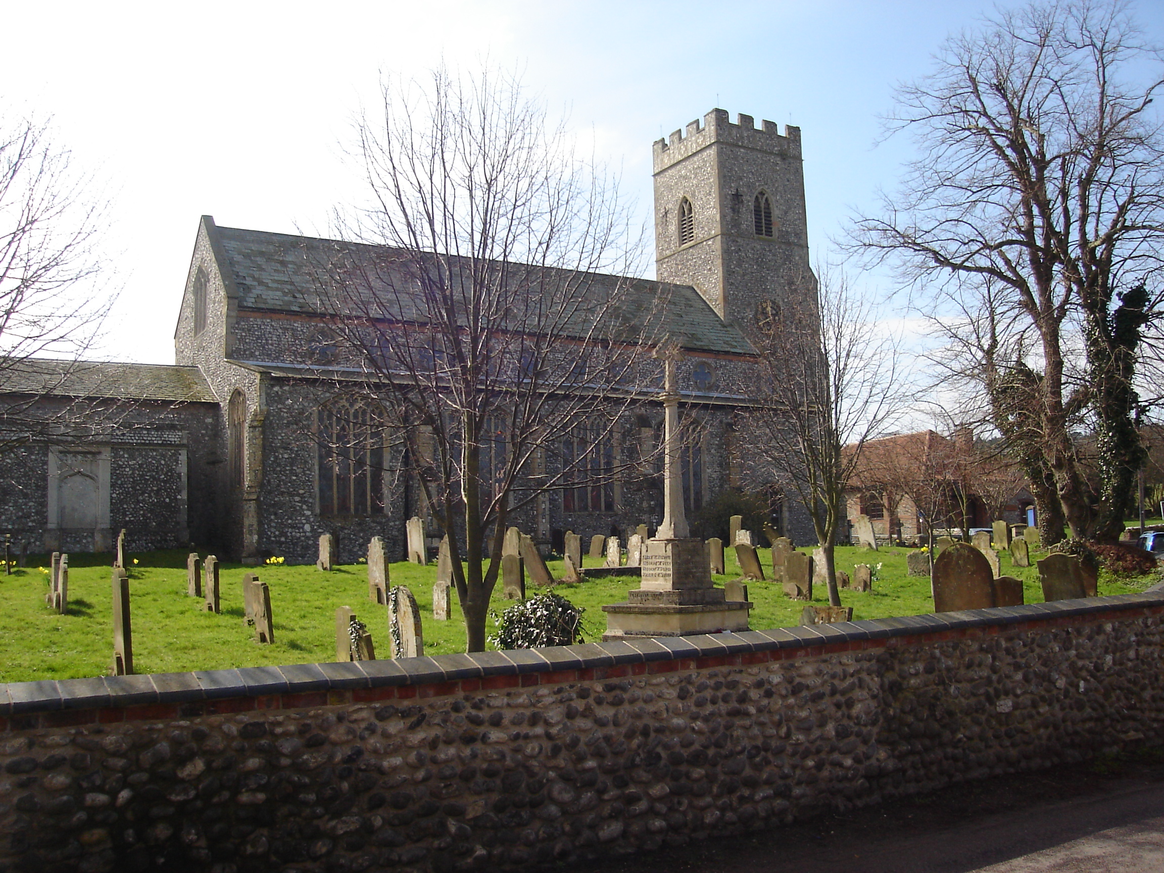
Upper Sheringham is a village and civil parish in the English county of Norfolk. The village is 26.8 miles (43.1 km) north-north-west of Norwich, 6 miles (9.7 km) west of Cromer and 132 miles (212 km) north-north-east of London. The village is 1.2 miles (1.9 km) from the town of Sheringham.
Adapted from Wikipedia, CC BY-SA 4.0.
Worth seeing in and around Upper Sheringham
10 places within 25 km that the world writes about, in the order of how widely: the ones a visitor has heard of first, then the ones only a local would name.
- 01Sheringham Museum
Sheringham Museum at the Mo is a museum in the town of Sheringham, Norfolk, England. The current museum opened in April 2010 and rehoused the former collection originally held in converted fishermen's cottages behind the main street.
2.2 km · museum in Sheringham, Norfolk, England, United Kingdom · Wikipedia - 02Beeston Hill Y Station
Beeston Hill Y Station was a secret listening station located on the summit of Beeston Hill, Sheringham in the English county of Norfolk.
2.7 km · secret listening station located on Beeston Hill, Sheringham · Wikipedia - 03Sheringham Hall
Sheringham Hall is a Grade II* listed building which stands in the grounds of its park. The house is close to the village of Upper Sheringham in the English County of Norfolk in the United Kingdom.
1.2 km · country house in Upper Sheringham, Norfolk, England, UK · Wikipedia - 04Sheringham and Beeston Regis Commons
Sheringham and Beeston Regis Commons is a 24.9-hectare biological Site of Special Scientific Interest in Sheringham in Norfolk, England. It is a Nature Conservation Review site and part of the Norfolk Valley Fens Special Area of Conservation and Norfolk Coast Area of Outstanding Natural Beauty.
2 km · site of Special Scientific Interest in Norfolk, England · Wikipedia - 05Weybourne Cliffs
Weybourne Cliffs is a 40.9-hectare biological and geological Site of Special Scientific Interest at Weybourne, west of Sheringham in the English county of Norfolk. It is a Geological Conservation Review site.
2 km · UK Site of Special Scientific Interest · Wikipedia - 06Weybourne Town Pit
Weybourne Town Pit is a 0.7-hectare geological Site of Special Scientific Interest west of Sheringham in Norfolk, England. It is a Geological Conservation Review site and it is in the Norfolk Coast Area of Outstanding Natural Beauty.
2 km · UK Site of Special Scientific Interest · Wikipedia - 07North Norfolk Railway
The North Norfolk Railway – also known as the "Poppy Line" – is a 5+1⁄4-mile heritage steam railway in Norfolk, England, running between the towns of Sheringham and Holt. The North Norfolk Railway is owned and operated as a public limited company, originally called Central Norfolk Enterprises Limited.
2.4 km · heritage railway in Norfolk, United Kingdom · Wikipedia - 08Sheringham Little Theatre
Sheringham Little Theatre is a theatre in Sheringham, Norfolk, England. It stages live theatre and music, and film screenings.
1.9 km · theatre and cinema in Sheringham, Norfolk, England · Wikipedia - 09Weybourne Priory
Weybourne Priory was a small Augustinian medieval monastic house in Weybourne, Norfolk, England. Its ruins, including a Saxon tower, lie adjacent to the parish church of All Saints Church, Weybourne.
3.5 km · monastery in Weybourne, North Norfolk, England, UK · Wikipedia - 10Church of All Saints
All Saints' Church, Weybourne is the parish church of the village of Weybourne in North Norfolk, England. The building is principally medieval in origin, though built on Saxon foundations, and remains today as the surviving element of Weybourne Priory, a medieval Augustinian priory complex dissolved during the Reformation, the ruins of which still stand adjacent to the church.
3.5 km · church in Weybourne, Norfolk, England, UK · Wikipedia
Ranked by the number of language editions of Wikipedia with an article on each, from Wikidata; the sentences are the openings of those articles, CC BY-SA 4.0.
Getting to Upper Sheringham
- Airports
- London Stansted (STN), 133 km · London Luton (LTN), 158 km · East Midlands (EMA), 169 km
- Stations
- Sheringham railway station, 1.8 km · West Runton railway station, 3.8 km · Sheringham railway station (North Norfolk Railway), 1.7 km · Kelling Heath Park railway station, 3.5 km · Weybourne railway station, 2.7 km
- London, Essex → Upper Sheringham182 km · quickest by road, 3h 47m · £19–26
- London → Upper Sheringham182 km · quickest by road, 3h 47m · £19–26
- Luton, Luton → Upper Sheringham160 km · quickest by road, 3h 16m · £17–23
- Plan a tripFrom anywhereThe planner compares every way there from wherever you are.
Road and air are today’s quick answer; timetabled trains, buses and ferries load on the results page from the operators’ feeds.
No local-transport research exists yet for Upper Sheringham
Our researched notes are written from a sourced entry: every shared taxi, boat and village bus with its operator, its rule, its fare and the year we saw it, and what could not be confirmed. Nobody has done that work for Upper Sheringham. What is above is what we hold from open sources; nothing here pretends to be more.
- Get aroundFerry tours depart from Morston Quay, in the next village.
From Wikivoyage: Cley next the Sea, CC BY-SA. Not yet checked by us; that article was last edited 2026-09.
- 01256 km
- 02303 km
- 03445 km
- 04505 km
- 05537 km
If you know how people move in Upper Sheringham – the stand, the rule, the fare – tell us, and the note gets an entry.
Next door to Upper Sheringham
- Sheringhamseaside town in Norfolk, England1.8 km
- Beeston Regisvillage in Norfolk, England2 km
- Weybournevillage and civil parish in Norfolk, United Kingdom3.7 km
- West Beckhamvillage in Norfolk, England, UK2.7 km
- Bodhamvillage and civil parish in Norfolk, England2.5 km
- East Beckhamvillage in Norfolk, England, UK2.7 km