Tillicoultry
Tillicoultry is a town in Clackmannanshire, Scotland.
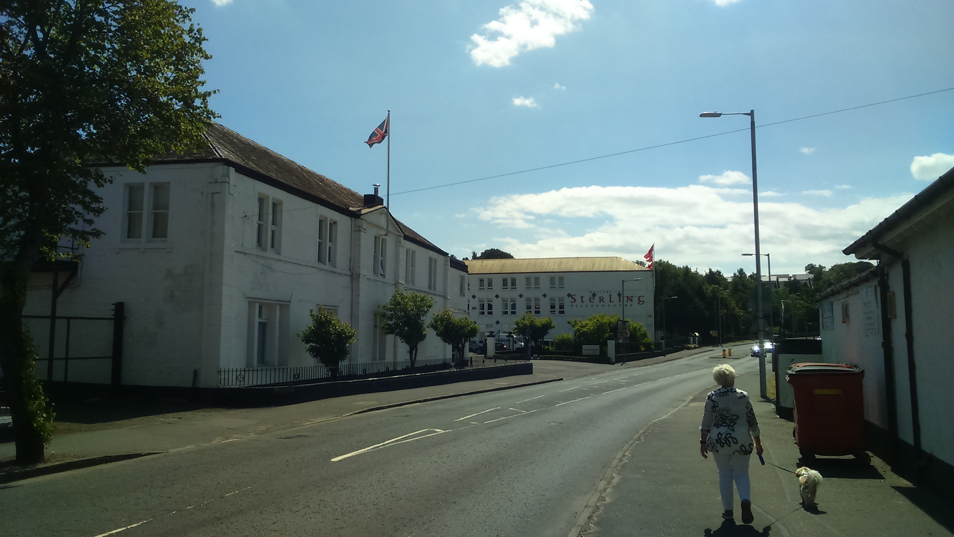
Tillicoultry is a town in Clackmannanshire, Scotland. Tillicoultry is usually referred to as Tilly by the locals.
Adapted from Wikipedia, CC BY-SA 4.0.
Worth seeing in and around Tillicoultry
10 places within 25 km that the world writes about, in the order of how widely: the ones a visitor has heard of first, then the ones only a local would name.
- 01Castle Campbell
Castle Campbell is a medieval castle situated above the town of Dollar, Clackmannanshire, in central Scotland. It was the lowland seat of the earls and dukes of Argyll, chiefs of Clan Campbell, from the 15th to the 19th century, and was visited by Mary, Queen of Scots, in the 16th century.
4.8 km · castle in Clackmannanshire, Scotland, UK · Wikipedia - 02Alloa Tower
Alloa Tower in Alloa, Clackmannanshire, in central Scotland, is an early 14th-century tower house that served as the medieval residence of the Erskine family, later Earls of Mar. Retaining its original timber roof and battlements, the tower is one of the earliest and largest Scottish tower houses, with immensely thick walls.
5.3 km · castle in Clackmannanshire, Scotland, UK · Wikipedia - 03Clackmannan Tower
The Clackmannan Tower is a historic five-storey tower house situated at the summit of King's Seat Hill in Clackmannan, Clackmannanshire, Scotland. It dates back to at least the 14th century when it was inhabited by King David II of Scotland and later sold to his cousin Robert Bruce, 2nd Baron of Clackmannan in 1359.
5.1 km · tower house in Clackmannanshire, Scotland, UK · Wikipedia - 04Recreation Park
Recreation Park, also known as Recreation Grounds, "The Recs" and The Indodrill Stadium for sponsorship reasons, is a football stadium in Alloa, Clackmannanshire, Scotland. It is the home ground of Scottish Professional Football League team Alloa Athletic, who have played there since 1895.
4.6 km · football stadium in Alloa, Clackmannanshire, Scotland, UK · Wikipedia - 05Gartmorn Dam
Gartmorn Dam is an artificial freshwater loch north-east of Alloa, Clackmannanshire, Scotland, UK, built in 1711–12 as a reservoir to supply water to hydraulic machines used in Alloa's mining industry. It was commissioned by John Erskine, 23rd and 6th Earl of Mar, to designs by George Sorocold, and is one of the earliest constructed reservoirs in Scotland.
2.7 km · 1711-12 reservoir near Alloa, Clackmannanshire, Scotland, UK, outflows west to Brothie Burn · Wikipedia - 06Gean House
Gean House, or The Gean, is an early 20th-century Arts and Crafts style mansion, located on Tullibody Road, Alloa, Scotland. It was owned and used as a venue for events but has now been restored to a private residence since October 2018.
5.3 km · house in Alloa, Clackmannanshire, Scotland, UK · Wikipedia - 07Sauchie Tower
Sauchie Tower, also known as Devon Tower, is a 15th-century tower house in Clackmannanshire, Scotland. The tower is located by the village of Fishcross, 1 kilometre north of Sauchie and 2.5 kilometres north of Alloa, close to the River Devon.
2.6 km · tower house, later house, in Clackmannanshire, Scotland, UK · Wikipedia - 08Ben Cleuch
Ben Cleuch, from Scottish Gaelic: Beinn Cloiche, lit. 'stony prominent hill' is a hill in the Ochil Hills range, part of the Central Lowlands of Scotland. It is the highest point in the range, Clackmannanshire and the Central Belt of Scotland; the summit is marked by a trig point within a stone windshelter and a viewpoint indicator.
4 km · mountain in Clackmannanshire, Scotland, UK · Wikipedia - 09St. Mungo's Parish Church
The church is named after Saint Mungo, patron saint and founder of the city of Glasgow. It belongs to the Church of Scotland Presbytery of Stirling and serves the parish of Alloa.
5.6 km · church in Clackmannanshire, Scotland, UK · Wikipedia - 10Town Hall, Marshill, Alloa
Alloa Town Hall is a municipal building in Marshill, Alloa, Scotland. The structure, which was the meeting place of Alloa Burgh Council, is a Category C listed building.
5.2 km · town hall in Alloa, Clackmannanshire, Scotland, UK · Wikipedia
Ranked by the number of language editions of Wikipedia with an article on each, from Wikidata; the sentences are the openings of those articles, CC BY-SA 4.0.
Getting to Tillicoultry
- Airports
- Edinburgh (EDI), 32 km · Glasgow (GLA), 53 km · Glasgow Prestwick (PIK), 89 km
- Stations
- Alloa railway station, 4.8 km · Forest Mill railway station, 5.1 km
- Glasgow → Tillicoultry45 km · quickest by road, 1h 6m · £5–7
- Prestwick, South Ayrshire → Tillicoultry91 km · quickest by road, 2h 3m · £10–13
- Aberdeen → Tillicoultry149 km · quickest by road, 2h 47m · £16–22
- Plan a tripFrom anywhereThe planner compares every way there from wherever you are.
Road and air are today’s quick answer; timetabled trains, buses and ferries load on the results page from the operators’ feeds.
No local-transport research exists yet for Tillicoultry
Our researched notes are written from a sourced entry: every shared taxi, boat and village bus with its operator, its rule, its fare and the year we saw it, and what could not be confirmed. Nobody has done that work for Tillicoultry. What is above is what we hold from open sources; nothing here pretends to be more.
- Get inIt's within bicycle range of Edinburgh but cyclists must cross the Forth via the old road bridge A9000, then use B981 Ferry Toll Road onto A985 west.
From Wikivoyage: Culross, CC BY-SA. Not yet checked by us; that article was last edited 2026-09.
- 01108 km
- 02108 km
- 03131 km
- 04182 km
- 05184 km
If you know how people move in Tillicoultry – the stand, the rule, the fare – tell us, and the note gets an entry.
Next door to Tillicoultry
Tillicoultry is 41 km from Edinburgh, the nearest large city, whose note carries the wider picture.
- Alloatown in Clackmannanshire, Scotland, UK5.2 km
- Clackmannantown in Clackmannanshire, Scotland, UK4.9 km
- Dollarsmall town in Clackmannanshire, Scotland, UK4.7 km
- Alvatown in Clackmannanshire, Scotland, UK3.6 km
- Coalsnaughtonvillage in Clackmannanshire, Scotland, UK1.3 km
- Sauchievillage in Clackmannanshire, Scotland, UK3.4 km