The Flats
The Flats is a mixed-use industrial, recreational, entertainment, and residential area of the Cuyahoga Valley neighborhood of Cleveland, Ohio, U.S.
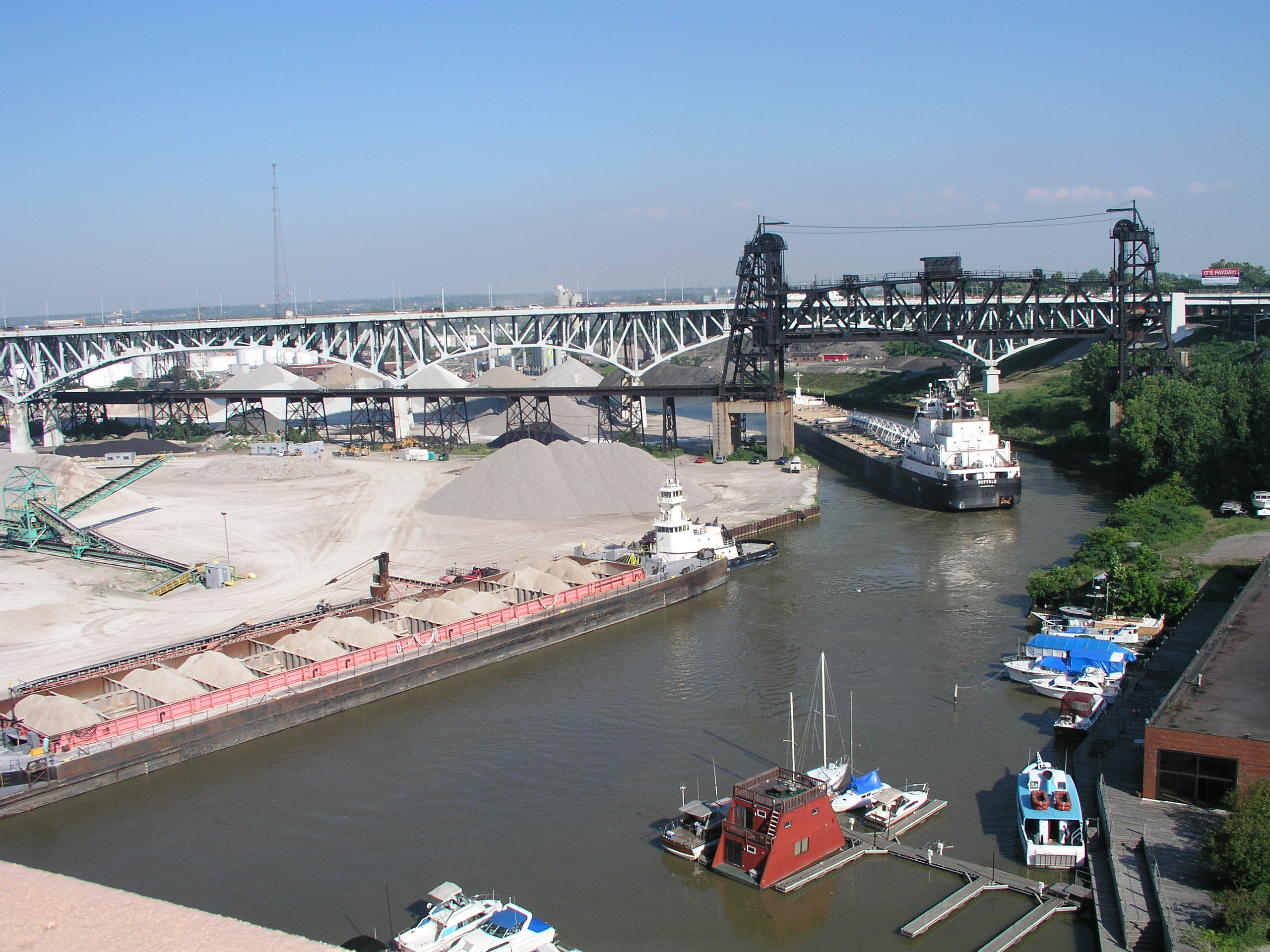
The Flats is a mixed-use industrial, recreational, entertainment, and residential area of the Cuyahoga Valley neighborhood of Cleveland, Ohio, U.S. The name reflects its low-lying topography on the banks of the Cuyahoga River.
Adapted from Wikipedia, CC BY-SA 4.0.
Worth seeing in and around The Flats
10 places within 25 km that the world writes about, in the order of how widely: the ones a visitor has heard of first, then the ones only a local would name.
- 01Rock and Roll Hall of Fame
The Rock and Roll Hall of Fame, also simply referred to as the Rock Hall, is a museum and hall of fame located in downtown Cleveland, Ohio, United States, on the shore of Lake Erie. The museum documents the history of rock music and the artists, producers, engineers, and other personnel who have influenced its development.
1.8 km · music museum in Cleveland, Ohio, United States · Wikipedia - 02Progressive Field
Progressive Field is a baseball stadium in the downtown area of Cleveland, Ohio. It is the ballpark of the Cleveland Guardians of Major League Baseball and, together with Rocket Arena, is part of the Gateway Sports and Entertainment Complex.
1 km · baseball park in Cleveland · Wikipedia - 03Key Tower
Key Tower is a 57 story skyscraper on Public Square in downtown Cleveland, Ohio. Designed by architect César Pelli and completed in 1991, the 947-foot building is the tallest in the state of Ohio, the 42nd-tallest in the United States, and the 165th-tallest in the world.
1 km · skyscraper in Cleveland, Ohio · Wikipedia - 04Terminal Tower
Terminal Tower is a 52-story, 708 ft, landmark skyscraper located on Public Square in the downtown core of Cleveland, Ohio, United States. Built during the skyscraper boom of the 1920s and 1930s, it was the second-tallest building in the world when it was completed in 1927.
700 m · landmark skyscraper in Downtown Cleveland, Ohio, United States · Wikipedia - 05Cleveland State University
Cleveland State University is a public research university in Cleveland, Ohio, United States. It was established in 1964 and opened for classes in 1965 after acquiring the entirety of Fenn College, a private school that had been in operation since 1923.
2 km · public research university in Cleveland, Ohio · Wikipedia - 06Diocese of Cleveland
The Diocese of Cleveland is a diocese of the Catholic Church in northeastern Ohio in the United States. It is a suffragan diocese of the Archdiocese of Cincinnati.
2.4 km · diocese of the Catholic Church in the United States · Wikipedia - 07200 Public Square
200 Public Square is a skyscraper in Cleveland, Ohio. The building, located on Public Square in Downtown Cleveland, reaches 45 stories and 658 feet with 1.2 million square feet of office space.
1 km · Third tallest building in Cleveland, Ohio · Wikipedia - 08St. Theodosius Russian Orthodox Cathedral
St. Theodosius Cathedral is an Eastern Orthodox church located on Starkweather Avenue in the West Side neighborhood of Tremont in Cleveland, Ohio.
2 km · Russian Orthodox Cathedral in Cleveland, Ohio, United States · Wikipedia - 09Erieview Tower
The Erieview Tower is a skyscraper featuring elements of the International style located in downtown Cleveland, Ohio, United States. The building has 40 stories, rises to a height of 529 ft, and has 703,000 square feet of office space.
1.6 km · skyscraper in Cleveland, Ohio · Wikipedia - 10One Cleveland Center
One Cleveland Center is the sixth tallest skyscraper in downtown Cleveland, Ohio. The building has 31 stories, rises to a height of 450.01 feet, and is located at 1375 East 9th Street.
1.4 km · fifth tallest skyscraper located in downtown Cleveland, Ohio · Wikipedia
Ranked by the number of language editions of Wikipedia with an article on each, from Wikidata; the sentences are the openings of those articles, CC BY-SA 4.0.
Getting to The Flats
- Airports
- Cleveland Hopkins (CLE), 16 km · Windsor (YQG), 136 km · Detroit Metropolitan Wayne County (DTW), 159 km
- Stations
- Cleveland Burke Lakefront Airport, 3 km · Cleveland Lakefront station, 1.5 km
- Detroit → The Flats144 km · quickest by road, 4h 7m · $22–30
- Pittsburgh → The Flats91 km · quickest by road, 2h 6m · $9–12
- Columbus → The Flats15 km · quickest by road, 33 min · $1.5–2
- Plan a tripFrom anywhereThe planner compares every way there from wherever you are.
Road and air are today’s quick answer; timetabled trains, buses and ferries load on the results page from the operators’ feeds.
No local-transport research exists yet for The Flats
Our researched notes are written from a sourced entry: every shared taxi, boat and village bus with its operator, its rule, its fare and the year we saw it, and what could not be confirmed. Nobody has done that work for The Flats. What is above is what we hold from open sources; nothing here pretends to be more.
- Get inincluding stops in South Bend, Elkhart, Waterloo, Toledo, Sandusky, Elyria, Cleveland, Alliance, Pittsburgh, Connellsville, Cumberland, Martinsburg, Harpers Ferry, and Rockville.
- Go nextLocated west of Cleveland, a group of picturesque and festive islands in Lake Erie are accessible via ferry.
From Wikivoyage: Cleveland, CC BY-SA. Not yet checked by us; that article was last edited 2026-09.
- 01723 km
- 021,087 km
- 032,615 km
- 042,709 km
- 052,841 km
If you know how people move in The Flats – the stand, the rule, the fare – tell us, and the note gets an entry.
Next door to The Flats
- Greater Clevelandmetropolitan area of Cleveland, Ohio, United States1.5 km
- Ohio Cityneighborhood in Cleveland, Ohio, United States1.5 km