Taybeh, Ramallah
Taybeh is a Palestinian village in the West Bank, 15 kilometers northeast of Jerusalem and 12 kilometers northeast of Ramallah, in the Ramallah and al-Bireh Governorate of Palestine.
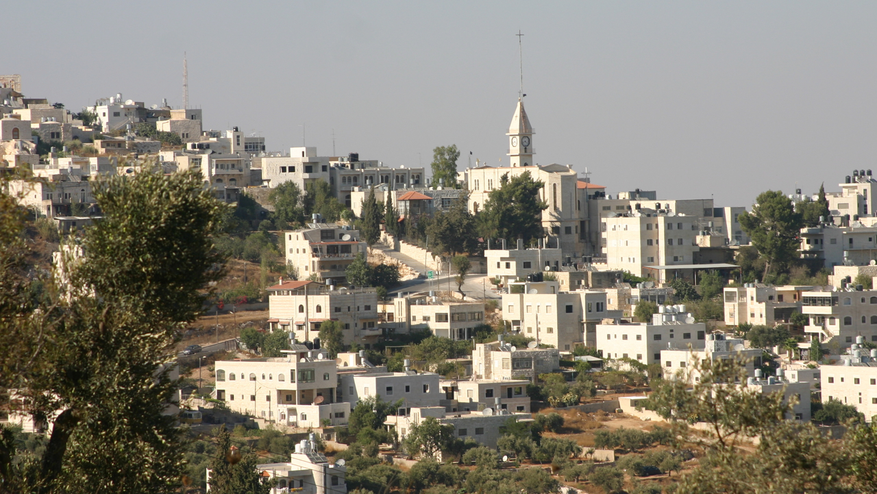
Taybeh is a Palestinian village in the West Bank, 15 kilometers northeast of Jerusalem and 12 kilometers northeast of Ramallah, in the Ramallah and al-Bireh Governorate of Palestine. It is 850 meters above sea level. According to the Palestinian Central Bureau of Statistics, Taybeh had a population of 1,340 in 2017.
Adapted from Wikipedia, CC BY-SA 4.0.
Worth seeing in and around Taybeh, Ramallah
3 places within 25 km that the world writes about, in the order of how widely: the ones a visitor has heard of first, then the ones only a local would name.
- 01Tall Asur
Tall Asur,, is an irregularly shaped plateau, marking the geographical boundary between Samaria to its north and Judea to its south. It is one of the highest points in the West Bank of the State of Palestine; with an altitude of approximately 1,020 metres above sea level.
3 km · mountain in Palestine · Wikipedia - 02Et-Tell
Et-Tell or Khirbet et-Tell is an archaeological site in the West Bank in Palestine. The site is commonly identified with the biblical city of Ai.
4.3 km · archaeological site · Wikipedia - 03Yovel Cave
Yovel Cave is a massive karst cave located near the Israeli settlement of Ofra in the Benjamin region. It is recognized as the largest natural underground site in Israel.
4 km · karst cave in Ofra, Israel · Wikipedia
Ranked by the number of language editions of Wikipedia with an article on each, from Wikidata; the sentences are the openings of those articles, CC BY-SA 4.0.
Getting to Taybeh, Ramallah
- Airports
- Ben Gurion (TLV), 40 km · Marka International (Amman Civil) (ADJ), 65 km · Queen Alia (AMM), 70 km
- Eilat → Taybeh, Ramallah269 km · quickest by road, 5h 55m · ₪115–150
- Amman → Taybeh, Ramallah61 km · quickest by road, 1h 57m · JD3.5–4.5
- El Arish → Taybeh, Ramallah170 km · quickest by road, 5h 10m · E£390–520
- Plan a tripFrom anywhereThe planner compares every way there from wherever you are.
Road and air are today’s quick answer; timetabled trains, buses and ferries load on the results page from the operators’ feeds.
No local-transport research exists yet for Taybeh, Ramallah
Our researched notes are written from a sourced entry: every shared taxi, boat and village bus with its operator, its rule, its fare and the year we saw it, and what could not be confirmed. Nobody has done that work for Taybeh, Ramallah. What is above is what we hold from open sources; nothing here pretends to be more.
- Get inFor reaching other Palestinian cities, service taxis (shared taxis, pronounced servees) are preferable over Egged buses.
- Get aroundYou are almost always advised to use shared taxis which will be quicker although marginally more expensive.
- Get aroundBuses, like shared taxis will also tend to wait until full before departing.
- Get aroundShared taxis (servees) are common between Palestinian cities, and often the best means of travel.
- Get aroundMost shared taxis have fixed bus-stations, often car-parks near the centre of towns or cities.
From Wikivoyage: West Bank, CC BY-SA. Not yet checked by us; that article was last edited 2026-09.
- 01182 km
- 02265 km
- 03392 km
- 04703 km
- 051,064 km
If you know how people move in Taybeh, Ramallah – the stand, the rule, the fare – tell us, and the note gets an entry.
Next door to Taybeh, Ramallah
Taybeh, Ramallah is 20 km from East Jerusalem, the nearest large city, whose note carries the wider picture.
- AiCanaanite royal city5.6 km
- Silwadtown in Ramallah and al-Bireh Governorate5.2 km
- OfraIsraeli settlement in the West Bank3.8 km
- AmonaIsraeli settlement in Binyamin which was evacuated by the Israeli government2.2 km
- Ein Yabrudmunicipality in Ramallah and al-Bireh Governorate, Palestine4.9 km
- Kokhav HaShaharIsraeli settlement in the shomron, occupied West Bank4.5 km