Tattenhoe
Tattenhoe and Tattenhoe Park are adjacent neighbourhoods of Milton Keynes, Buckinghamshire, England, in the ancient ecclesiastic parish of Tattenhoe.
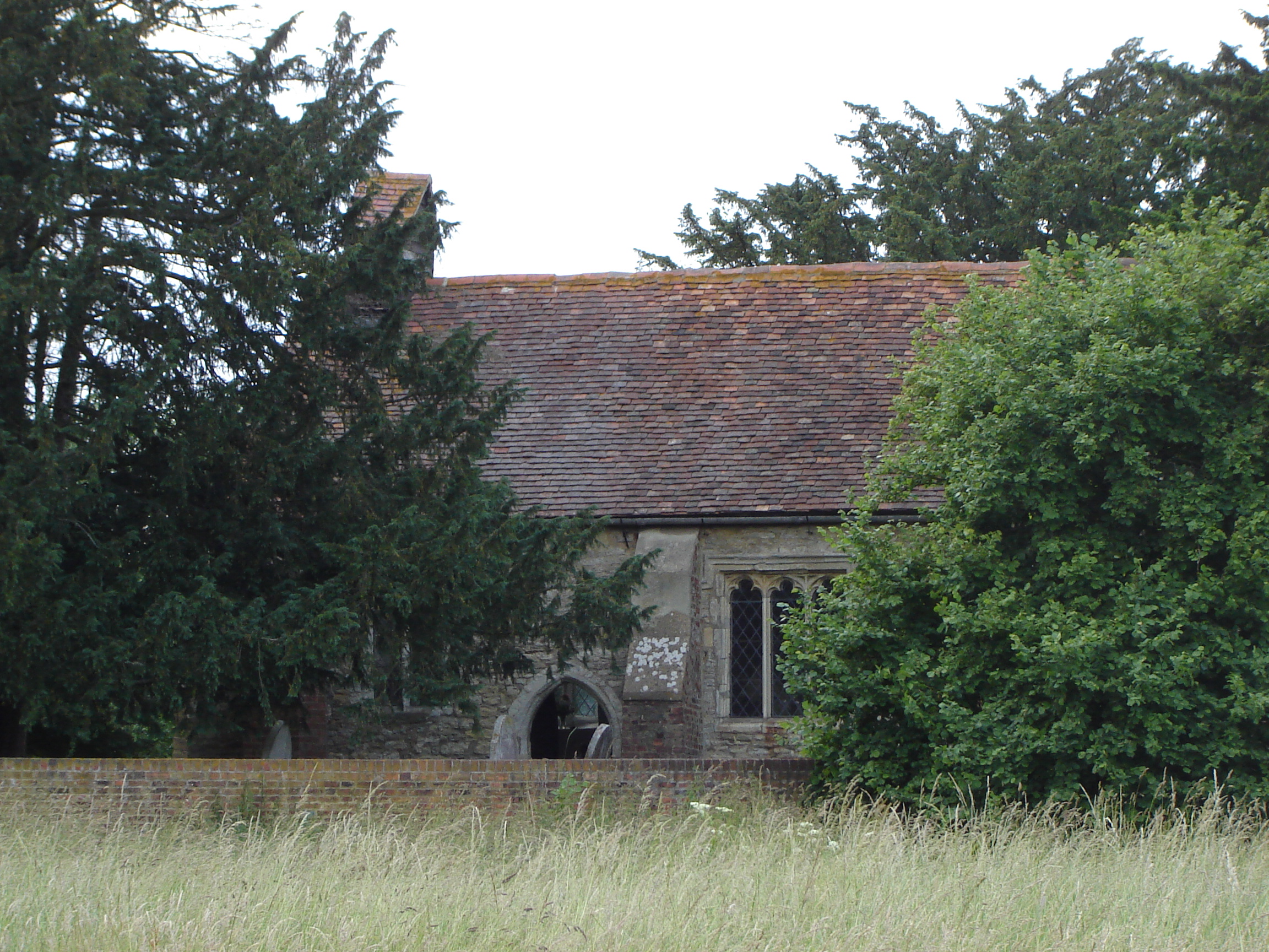
Tattenhoe and Tattenhoe Park are adjacent neighbourhoods of Milton Keynes, Buckinghamshire, England, in the ancient ecclesiastic parish of Tattenhoe. They are located at the south-western edge of the city, next to Whaddon in Aylesbury Vale, not far from the ruins of Snelshall Priory.
Adapted from Wikipedia, CC BY-SA 4.0.
Worth seeing in and around Tattenhoe
10 places within 25 km that the world writes about, in the order of how widely: the ones a visitor has heard of first, then the ones only a local would name.
- 01Bletchley Park
Bletchley Park is an English country house and estate in Bletchley, Milton Keynes, that became the principal centre of Allied code-breaking during the Second World War. During World War II, the estate housed the Government Code and Cypher School, which regularly penetrated the secret communications of the Axis powers – most importantly the German Enigma and Lorenz ciphers.
3.3 km · WWII code-breaking site and British country house, and museum, United Kingdom · Wikipedia - 02National Bowl
The National Bowl is an entertainment venue located in Milton Keynes, Buckinghamshire, England. The site was a former clay pit, filled in and raised to form an amphitheatre using sub-soil excavated by the many new developments in the area.
3.1 km · concert stage in Milton Keynes, UK · Wikipedia - 03The National Museum of Computing
The National Museum of Computing is a UK-based museum that is dedicated to collecting and restoring historic computer systems, and is home to the world's largest collection of working historic computers. The museum is located on Bletchley Park in Milton Keynes, Buckinghamshire.
3.2 km · museum in Milton Keynes, United Kingdom · Wikipedia - 04Hut 8
Hut 8 was a section in the Government Code and Cypher School at Bletchley Park tasked with solving German naval Enigma messages. The section was led initially by Alan Turing.
3.3 km · section in the Government Code and Cypher School at Bletchley Park · Wikipedia - 05Hut 6
Hut 6 was a wartime section of the Government Code and Cypher School at Bletchley Park, Buckinghamshire, Britain, to solve German Army and Air Force Enigma machine cyphers. Hut 8, by contrast, attacked Naval Enigma.
3.3 km · unit of Bletchley Park decryption centre · Wikipedia - 06Whaddon Hall
Whaddon Hall is a country house in Whaddon, Buckinghamshire, England. It is a Grade II listed building.
2.5 km · country house in Whaddon, Aylesbury Vale, Buckinghamshire, MK17 · Wikipedia - 07St. Mary's Church, Shenley
St. Mary's Church, Shenley is an ecumenical church located in Shenley Church End, Milton Keynes, England.
2.8 km · Grade I listed church in Shenley Church End, Milton Keynes, Buckinghamshire, England, UK · Wikipedia - 08Oxley Mead
Oxley Mead is a 3.7 hectares biological Site of Special Scientific Interest in the Oxley Park district of Shenley Church End in Milton Keynes, Buckinghamshire. The site is an ancient hay meadow which has a nationally rare plant community, due to its traditional management, with a hay cut followed by cattle grazing, and no use of fertilisers or herbicides.
1.6 km · biological Site of Special Scientific Interest in Buckinghamshire, England · Wikipedia - 09St Giles's Church, Tattenhoe
St. Giles's Church is a small 16th century Church of England church in Tattenhoe, a district in south-west Milton Keynes, Buckinghamshire, England.
300 m · church in Tattenhoe, Buckinghamshire, England, UK · Wikipedia - 10Milton Keynes College
Milton Keynes College is a general further education and training college, serving the City of Milton Keynes. It also serves the surrounding areas.
3.6 km · college in Milton Keynes, UK · Wikipedia
Ranked by the number of language editions of Wikipedia with an article on each, from Wikidata; the sentences are the openings of those articles, CC BY-SA 4.0.
Getting to Tattenhoe
- Airports
- London Luton (LTN), 32 km · London Heathrow (LHR), 63 km · London Stansted (STN), 71 km
- Stations
- Bletchley railway station, 3.7 km · Denbigh Hall railway station, 3.5 km
- London → Tattenhoe71 km · quickest by road, 1h 59m · £8–11
- London, Essex → Tattenhoe71 km · quickest by road, 1h 59m · £8–11
- Birmingham, West Midlands → Tattenhoe93 km · quickest by road, 2h 5m · £11–15
- Plan a tripFrom anywhereThe planner compares every way there from wherever you are.
Road and air are today’s quick answer; timetabled trains, buses and ferries load on the results page from the operators’ feeds.
No local-transport research exists yet for Tattenhoe
Our researched notes are written from a sourced entry: every shared taxi, boat and village bus with its operator, its rule, its fare and the year we saw it, and what could not be confirmed. Nobody has done that work for Tattenhoe. What is above is what we hold from open sources; nothing here pretends to be more.
- Get inAn off-road cycleway follows the route of the A413 and runs to Buckingham.
From Wikivoyage: Winslow (England), CC BY-SA. Not yet checked by us; that article was last edited 2026-09.
- 01150 km
- 02283 km
- 03414 km
- 04490 km
- 05525 km
If you know how people move in Tattenhoe – the stand, the rule, the fare – tell us, and the note gets an entry.
Next door to Tattenhoe
Tattenhoe is 60 km from Brent, the nearest large city, whose note carries the wider picture.
- Newton Longvillevillage in Buckinghamshire, England, UK2.8 km
- Whaddonvillage and civil parish in Buckinghamshire, United Kingdom2.6 km
- West Bletchleycivil parish in Milton Keynes, England2.7 km
- Shenley Brook Endcivil parish in Milton Keynes, England1.3 km
- Shenley Church Endsuburb and civil parish in Milton Keynes, Buckinghamshire, England, UK2.8 km
- Loughton & Great Holmcivil parish in Milton Keynes, Buckinghamshire, England3.4 km