South Omaha Main Street Historic District
The South Omaha Main Street Historic District is located along South 24th Street between M and O Streets in South Omaha, Nebraska.
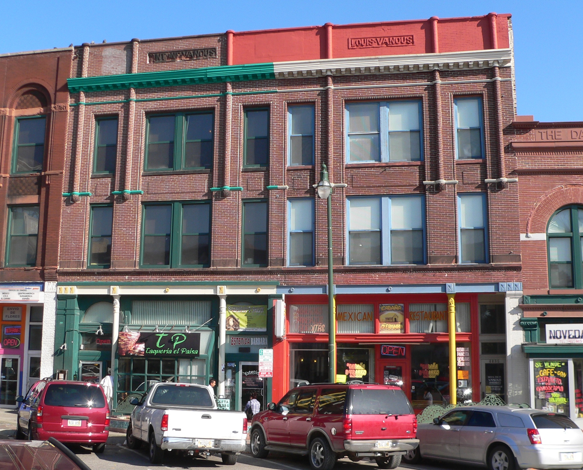
The South Omaha Main Street Historic District is located along South 24th Street between M and O Streets in South Omaha, Nebraska. It was added to the National Register of Historic Places in 1989. Home to dozens of historically important buildings, including the Packer's National Bank Building, the historic district included 129 acres (0.52 km2) and more than 32 buildings when listed.
Adapted from Wikipedia, CC BY-SA 4.0.
Worth seeing in and around South Omaha Main Street Historic District
10 places within 25 km that the world writes about, in the order of how widely: the ones a visitor has heard of first, then the ones only a local would name.
- 01Omaha’s Henry Doorly Zoo and Aquarium
Omaha's Henry Doorly Zoo and Aquarium is a zoo in Omaha, Nebraska. It is accredited by the Association of Zoos and Aquariums and a member of the World Association of Zoos and Aquariums.
2.3 km · zoo in the United States · Wikipedia - 02Johnny Rosenblatt Stadium
Johnny Rosenblatt Stadium was a baseball stadium in Omaha, Nebraska, United States. It was the former home to the annual NCAA Division I College World Series and the Triple-A Omaha Royals.
2.2 km · defunct baseball park in Omaha, Nebraska · Wikipedia - 03Immaculate Conception Church and School
The Immaculate Conception Church and School are located at 2708 South 24th Street in the South Omaha area of Omaha, Nebraska, United States. The 1926 church and its former school building, built in 1912, were added to the National Register of Historic Places in 1998.
2.7 km · Catholic church in Omaha, Nebraska, United States · Wikipedia - 04Lauritzen Gardens
Lauritzen Gardens are a botanical gardens and arboretum located at 100 Bancroft Street, South Omaha, Nebraska, United States. The gardens originally opened in 1994 as the Omaha Botanical Gardens.
4 km · botanical garden in Omaha, Nebraska · Wikipedia - 05St. Joseph Parish Complex
The Saint Joseph Parish Complex is located at 1730 South 16th Street in South Omaha, Nebraska within the Roman Catholic Archdiocese of Omaha.
3.7 km · church building in Nebraska, United States of America · Wikipedia - 06Brown Park
Brown Park is located at 5708 South 15th Street in the Brown Park neighborhood of South Omaha, Nebraska. The baseball field at the park is more than 100 years old, and hosted games played by Ty Cobb and others.
1.3 km · park in South Omaha, Nebraska · Wikipedia - 07El Museo Latino
El Museo Latino is a museum featuring Latino and Hispanic art and history that is located at 4701 South 25th Street in South Omaha, Nebraska. Established in 1993, by Magdalena García, it is the first Latino art and history museum and cultural center in the Midwest.
300 m · museum featuring Latino and Hispanic art and history · Wikipedia - 08Kenefick Park
Kenefick Park is a public park at 100 Bancroft Street in South Omaha, Nebraska, named for John Kenefick, a former chairman and CEO of Union Pacific Railroad. It is located at the southwest point of the Lauritzen Gardens, Omaha's botanical gardens, just north of Interstate 80, and just west of the Missouri River and the Iowa state border.
3.5 km · public park in South Omaha, Nebraska · Wikipedia - 09Livestock Exchange Building
The Livestock Exchange Building in Omaha, Nebraska, United States, was built in 1926 at 4920 South 30 Street in South Omaha. It was designed as the centerpiece of the Union Stockyards by architect George Prinz and built by Peter Kiewit and Sons in the Romanesque Revival and Northern Italian Renaissance Revival styles.
800 m · building in Omaha, Nebraska, U.S · Wikipedia - 10Packer's National Bank Building
Packer's National Bank Building is located at 4939 South 24th Street in the South Omaha Main Street Historic District in south Omaha, Nebraska. It was built in 1907.
100 m · building in Nebraska, United States · Wikipedia
Ranked by the number of language editions of Wikipedia with an article on each, from Wikidata; the sentences are the openings of those articles, CC BY-SA 4.0.
Getting to South Omaha Main Street Historic District
- Airports
- Eppley Airfield (OMA), 11 km · Des Moines (DSM), 194 km · Kansas City (MCI), 237 km
- Des Moines → South Omaha Main Street Historic DistrictTrain, bus, flight, ferry and road, side by side
- Kansas City → South Omaha Main Street Historic DistrictTrain, bus, flight, ferry and road, side by side
- Minneapolis → South Omaha Main Street Historic DistrictTrain, bus, flight, ferry and road, side by side
- Plan a tripFrom anywhereThe planner compares every way there from wherever you are.
No local-transport research exists yet for South Omaha Main Street Historic District
Our researched notes are written from a sourced entry: every shared taxi, boat and village bus with its operator, its rule, its fare and the year we saw it, and what could not be confirmed. Nobody has done that work for South Omaha Main Street Historic District. What is above is what we hold from open sources; nothing here pretends to be more.
- Get inThe airport is also served by two FBOs for General Aviation services, and at least two charter operations.
From Wikivoyage: Omaha, CC BY-SA. Not yet checked by us; that article was last edited 2026-09.
- 011,911 km
- 022,230 km
- 032,242 km
- 042,309 km
- 052,323 km
If you know how people move in South Omaha Main Street Historic District – the stand, the rule, the fare – tell us, and the note gets an entry.
Next door to South Omaha Main Street Historic District
South Omaha Main Street Historic District is 5 km from Omaha, the nearest large city, whose note carries the wider picture.
- Hanscom Parkneighborhood in Omaha, Nebraska, United States of America3.7 km
- Omaha Quartermaster Depot Historic Districthistoric district in Nebraska, United States3.9 km
- Sheelytownhuman settlement in South Omaha, Nebraska, United States of America2.7 km
- South Omahaneighbourhood of Omaha1.3 km