Sham Chung
Sham Chung is a Hakka village and an area of Neolithic settlement in Hong Kong.
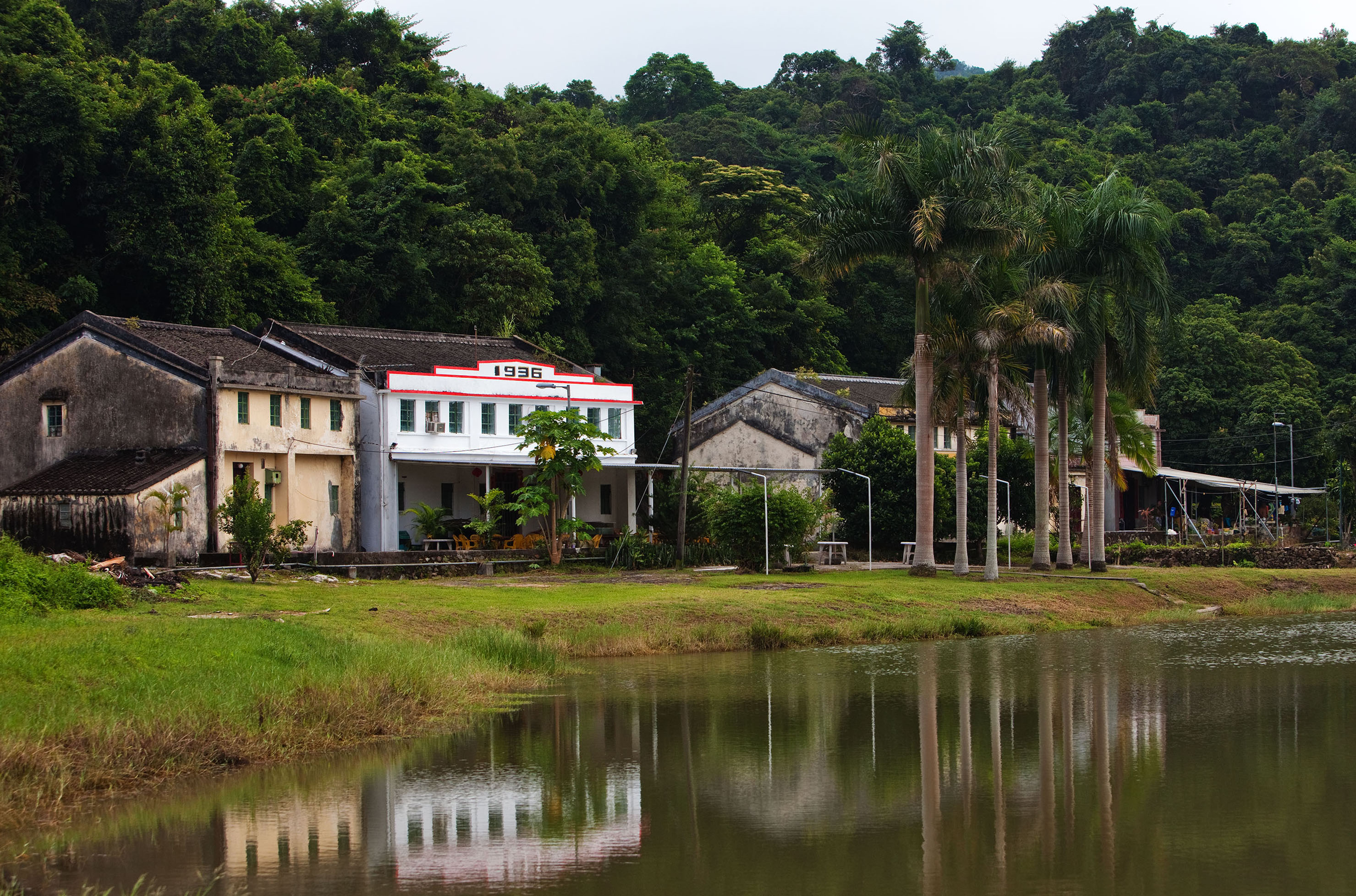
Sham Chung is a Hakka village and an area of Neolithic settlement in Hong Kong. It is located in the south of Tolo Channel, beside Three Fathoms Cove on the Sai Kung Peninsula. Administratively, it is part of Tai Po District.
Adapted from Wikipedia, CC BY-SA 4.0.
Worth seeing in and around Sham Chung
5 places within 25 km that the world writes about, in the order of how widely: the ones a visitor has heard of first, then the ones only a local would name.
- 01Shek Uk Shan
Shek Uk Shan is the highest mountain in Sai Kung Peninsula, Hong Kong. A signal station is located by the top of the peak.
1.6 km · mountain in Hong Kong · Wikipedia - 02Sai Kung West Country Park
Sai Kung West Country Park is a 30 square kilometres country park on the Sai Kung Peninsula in northeast Hong Kong.
2.3 km · country park on the Sai Kung Peninsula in Hong Kong · Wikipedia - 03Kai Kung Shan
Kai Kung Shan is a mountain that lies within the western part of Sai Kung Peninsula in northeastern Hong Kong. Its summit is 399 metres above sea level.
2.9 km · Hill in Sai Kung, Hong Kong · Wikipedia - 04Wa Mei Shan
Wa Mei Shan is a mountain in northeastern Hong Kong on Sai Kung Peninsula. It is located within Tai Po District.
2.7 km · mountain in Lam Tsuen Country Park, Hong Kong · Wikipedia - 05Wong Tei Tung
Wong Tei Tung was believed to be an Upper Paleolithic settlement in Hong Kong, but it is now dated 7700 to 2200 years old. It is located near Sham Chung, near to the Three Fathoms Cove on the Sai Kung Peninsula.
1 km · archaeological site in Hong Kong · Wikipedia
Ranked by the number of language editions of Wikipedia with an article on each, from Wikidata; the sentences are the openings of those articles, CC BY-SA 4.0.
Getting to Sham Chung
- Airports
- Hong Kong (HKG), 41 km · Shenzhen Bao'an (SZX), 54 km · Macau (MFM), 79 km
- Hong Kong → Sham Chung23 km · quickest by road, 51 min · HK$25–33
- Shenzhen → Sham Chung13 km · quickest by road, 32 min · ¥7–10
- Nossa Senhora do Carmo → Sham Chung57 km · quickest by road, 1h 44m · $6–9
- Plan a tripFrom anywhereThe planner compares every way there from wherever you are.
Road and air are today’s quick answer; timetabled trains, buses and ferries load on the results page from the operators’ feeds.
No local-transport research exists yet for Sham Chung
Our researched notes are written from a sourced entry: every shared taxi, boat and village bus with its operator, its rule, its fare and the year we saw it, and what could not be confirmed. Nobody has done that work for Sham Chung. What is above is what we hold from open sources; nothing here pretends to be more.
- Get inTuen Mun Ferry Pier provides a line by Fortune Ferry from Tuen Mun to Tai O.
From Wikivoyage: Hong Kong/New Territories, CC BY-SA. Not yet checked by us; that article was last edited 2026-09.
- 01473 km
- 02710 km
- 03748 km
- 041,022 km
- 051,071 km
If you know how people move in Sham Chung – the stand, the rule, the fare – tell us, and the note gets an entry.
Next door to Sham Chung
Sham Chung is 13 km from Sha Tin, the nearest large city, whose note carries the wider picture.
- Kei Ling Hahuman settlement in Hong Kong3.6 km
- Sai Kengvillage of Hong Kong3.4 km
- Yung Shue Ovillage of Hong Kong1.8 km
- New Territories EastArea of Hong Kong2.9 km
- Nai ChungArea and village in Hong Kong3.5 km
- Shap Sze Heungarea of Hong Kong3.9 km