Rainow
Rainow is a village and civil parish in Cheshire, England, in the valley of the River Dean and next to the B5470 road between Macclesfield and Kettleshulme.
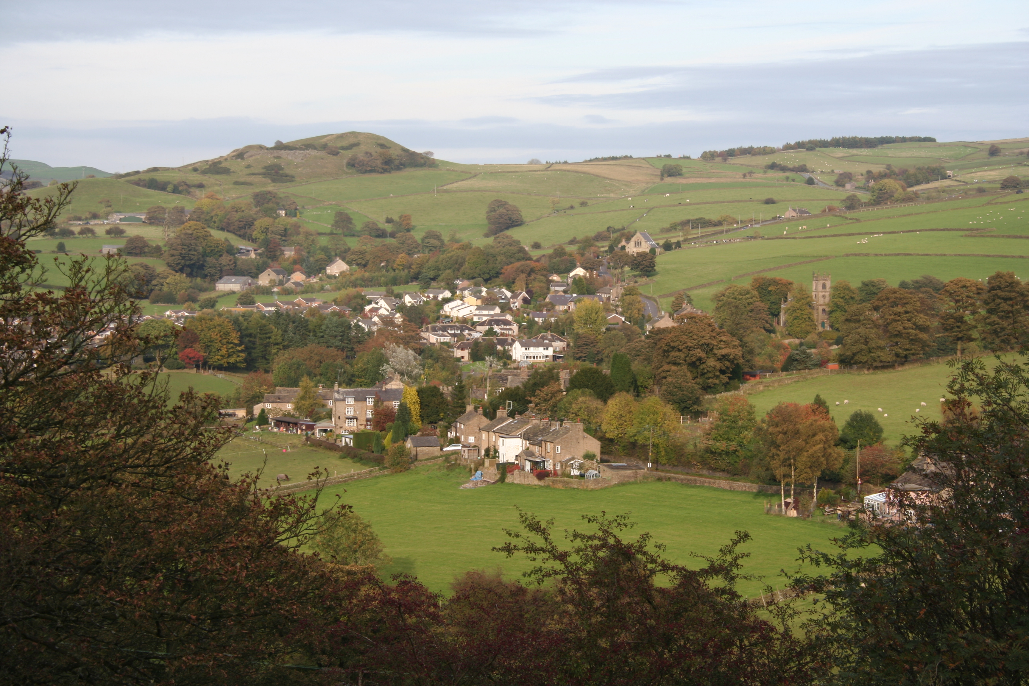
Rainow is a village and civil parish in Cheshire, England, in the valley of the River Dean and next to the B5470 road between Macclesfield and Kettleshulme. It straddles the eastern side of the Peak District border of Derbyshire and Cheshire, and is surrounded by pasture farmland. The Peak District Boundary Walk runs past the village. The village's name comes from the Old English hræfn + hōh, meaning "hill-spur frequented by ravens". It is a former mill village and has a population of around 2,500.
Adapted from Wikipedia, CC BY-SA 4.0.
Worth seeing in and around Rainow
10 places within 25 km that the world writes about, in the order of how widely: the ones a visitor has heard of first, then the ones only a local would name.
- 01Holy Trinity Church, Hurdsfield
Holy Trinity Church is in Hurdsfield Road, Macclesfield, Cheshire, England. It is an active Anglican parish church in the deanery of Macclesfield, the archdeaconry of Macclesfield, and the diocese of Chester.
3.2 km · grade II listed church in Macclesfield, Cheshire East, Cheshire, England, UK · Wikipedia - 02Jenkin Chapel
Jenkin Chapel is an Anglican parish church in Saltersford, Cheshire, England. Standing in an isolated position on the western slopes of the Pennines, 4.3 miles northeast of Macclesfield, it is recorded in the National Heritage List for England as a designated Grade II* listed building.
3.4 km · Grade II* church in Rainow, Cheshire, England, UK · Wikipedia - 03Shrigley Hall
Shrigley Hall is a former country house standing to the northwest of the village of Pott Shrigley, Cheshire, England. It has since been used as a school, when a chapel was added, and later as a hotel and country club operated by The Hotel Collection.
3.7 km · country house in Cheshire, England, UK · Wikipedia - 04St Christopher's Church, Pott Shrigley
St Christopher's Church is in the small village of Pott Shrigley, Cheshire, England. The church is recorded in the National Heritage List for England as a designated Grade I listed building.
3 km · church in Cheshire East, Cheshire, England, UK · Wikipedia - 05Tegg's Nose
Tegg's Nose is a hill east of Macclesfield in Cheshire, England. It has a short ridge with a high point of 380 metres at SJ947725, terminating in a promontory at the southern end.
3.7 km · country park and hill in Cheshire East, UK · Wikipedia - 06Holy Trinity Church, Rainow
Holy Trinity Church is in the village of Rainow, Cheshire, England. It is an active Anglican parish church in the deanery of Macclesfield, the archdeaconry of Macclesfield, and the diocese of Chester.
300 m · Grade II listed church in Cheshire, England, UK · Wikipedia - 07St John the Baptist's Church, Bollington
St John the Baptist's Church is a redundant Anglican parish church in Church Street, Bollington, Cheshire, England. It is recorded in the National Heritage List for England as a designated Grade II listed building.
1.9 km · Grade II listed church in Cheshire, England, UK · Wikipedia - 08Hurdsfield House
Hurdsfield House is a former country house, now surrounded by housing, in the town of Macclesfield, Cheshire, England. It was built for a branch of the Brocklehurst family.
3.3 km · grade II listed English country house in Cheshire, England, UK · Wikipedia - 09Ingersley Hall
Ingersley Hall, later Savio House, stands to the east of the town of Bollington, Cheshire, England. The house was built in about 1775 for John Gaskell.
1.2 km · Grade II listed English country house in Rainow, Cheshire, England, UK · Wikipedia - 10Lamaload Reservoir
Lamaload Reservoir is a reservoir near Rainow, Cheshire, England. It lies in the South West Peak within the Peak District National Park, to the west of the Goyt Valley, and is fed by the River Dean.
2.5 km · reservoir in Cheshire, England, UK · Wikipedia
Ranked by the number of language editions of Wikipedia with an article on each, from Wikidata; the sentences are the openings of those articles, CC BY-SA 4.0.
Getting to Rainow
- Airports
- Manchester (MAN), 15 km · Liverpool John Lennon (LPL), 52 km · Leeds Bradford (LBA), 70 km
- Stations
- Macclesfield Hibel Road railway station, 3.8 km
- Liverpool → Rainow62 km · quickest by road, 1h 40m · £7–10
- Leeds, West Yorkshire → Rainow67 km · quickest by road, 2h 1m · £9–12
- Nottingham, Leicestershire → Rainow72 km · quickest by road, 2h 13m · £8–11
- Plan a tripFrom anywhereThe planner compares every way there from wherever you are.
Road and air are today’s quick answer; timetabled trains, buses and ferries load on the results page from the operators’ feeds.
No local-transport research exists yet for Rainow
Our researched notes are written from a sourced entry: every shared taxi, boat and village bus with its operator, its rule, its fare and the year we saw it, and what could not be confirmed. Nobody has done that work for Rainow. What is above is what we hold from open sources; nothing here pretends to be more.
- Go nextAfter taking in the splendid scenery and trekking to your heart's content, either camping out overnight or staying in Buxton, you might want to continue on to Sheffield, another post-industrial Northern city with more to offer than that description suggests.
From Wikivoyage: Macclesfield, CC BY-SA. Not yet checked by us; that article was last edited 2026-09.
- 01293 km
- 02293 km
- 03323 km
- 04358 km
- 05384 km
If you know how people move in Rainow – the stand, the rule, the fare – tell us, and the note gets an entry.
Next door to Rainow
Rainow is 24 km from Manchester, the nearest large city, whose note carries the wider picture.
- Bollingtontown and civil parish in Cheshire, England2 km
- Pott Shrigleyvillage in Cheshire, England2.9 km
- Higher Hurdsfieldvillage and civil parish in Cheshire East, Cheshire, UK1.9 km
- Kerridgevillage in Cheshire, UK1.6 km