Pillowell
Pillowell is a small English village in Gloucestershire, on the south-eastern edge of the Forest of Dean.
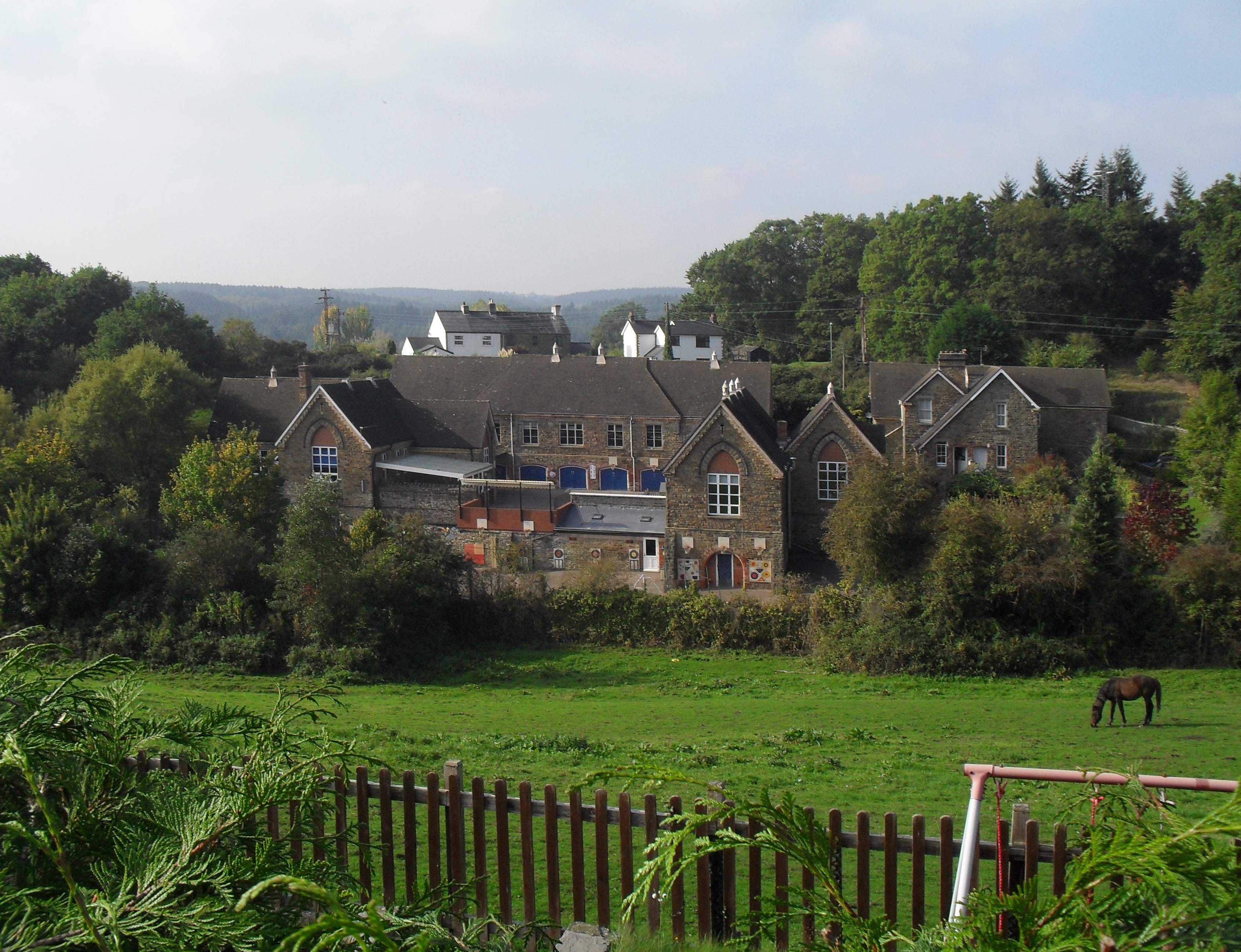
Pillowell is a small English village in Gloucestershire, on the south-eastern edge of the Forest of Dean. Once a mining village, much of it now lies in a conservation area.
Adapted from Wikipedia, CC BY-SA 4.0.
Worth seeing in and around Pillowell
3 places within 25 km that the world writes about, in the order of how widely: the ones a visitor has heard of first, then the ones only a local would name.
- 01Dean Forest Railway
The Dean Forest Railway is a 4+1⁄4-mile long heritage railway that runs between Lydney and Parkend in the Forest of Dean, Gloucestershire, England. The route was part of the former Severn and Wye Railway which ran from Lydney to Cinderford.
900 m · heritage railway in Gloucestershire, England, UK · Wikipedia - 02Lydney Town Hall
Lydney Town Hall is a municipal structure in the High Street, Lydney, Gloucestershire, England. The structure, which is used as an events venue, is listed by the local authority as a "building of local architectural or historical interest".
3.6 km · municipal Building in England · Wikipedia - 03Parkend Ironworks
Parkend Ironworks, also known as Parkend Furnace, in the village of Parkend, in the Forest of Dean, Gloucestershire, England, was a coke-fired furnace built in 1799. Most of the works were demolished between 1890 and 1908, but the engine house survived and is arguably the best preserved example of its kind to be found in the United Kingdom.
1.8 km · historic site in England, UK · Wikipedia
Ranked by the number of language editions of Wikipedia with an article on each, from Wikidata; the sentences are the openings of those articles, CC BY-SA 4.0.
Getting to Pillowell
- Airports
- Bristol (BRS), 43 km · Cardiff (CWL), 68 km · Birmingham (BHX), 95 km
- Stations
- Lydney Town railway station, 3.4 km · Norchard railway station, 2.1 km · Parkend railway station, 1.7 km · Whitecroft railway station, 800 m
- Bristol → Pillowell34 km · quickest by road, 1h 8m · £4.5–6
- Cardiff → Pillowell54 km · quickest by road, 1h 38m · £6–8
- Birmingham, West Midlands → Pillowell92 km · quickest by road, 2h 31m · £11–14
- Plan a tripFrom anywhereThe planner compares every way there from wherever you are.
Road and air are today’s quick answer; timetabled trains, buses and ferries load on the results page from the operators’ feeds.
No local-transport research exists yet for Pillowell
Our researched notes are written from a sourced entry: every shared taxi, boat and village bus with its operator, its rule, its fare and the year we saw it, and what could not be confirmed. Nobody has done that work for Pillowell. What is above is what we hold from open sources; nothing here pretends to be more.
- Go nextThe bridge over the river, which opened in 1906 and replaced a ferry (which promptly went bankrupt owing to an inevitable loss of custom), is particularly fine.
From Wikivoyage: Tintern, CC BY-SA. Not yet checked by us; that article was last edited 2026-09.
- 01147 km
- 02161 km
- 03458 km
- 04494 km
- 05510 km
If you know how people move in Pillowell – the stand, the rule, the fare – tell us, and the note gets an entry.
Next door to Pillowell
Pillowell is 34 km from Bristol, the nearest large city, whose note carries the wider picture.
- Lydneytown in Gloucestershire, UK3.1 km
- West Deancivil parish in Forest of Dean, Gloucestershire, UK2.4 km
- Breamvillage in Gloucestershire, United Kingdom2.3 km
- Yorkleyvillage in Gloucestershire, England, UK1.1 km
- Allastonvillage in Gloucestershire, England, UK2.9 km
- Brain's Greenvillage in Gloucestershire, England, UK3.6 km