Pevensey
Pevensey is a village and civil parish in the Wealden district of East Sussex, England.
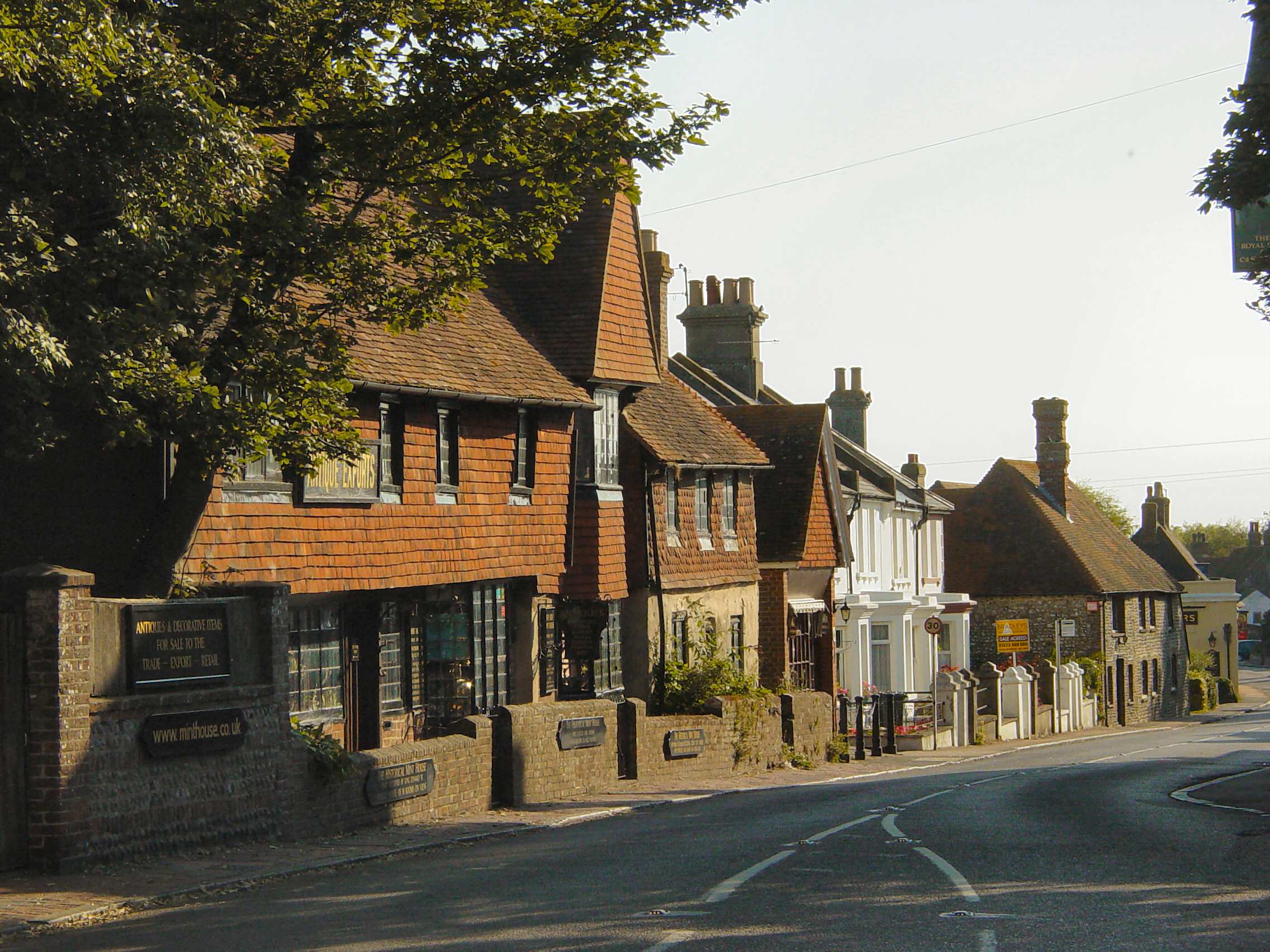
Pevensey is a village and civil parish in the Wealden district of East Sussex, England. The main village is located five miles (8 km) north-east of Eastbourne, one mile (1.6 km) inland from Pevensey Bay. The settlement of Pevensey Bay forms part of the parish. It was here that William the Conqueror made the landing in his invasion of England in 1066 after crossing the English Channel from Normandy.
Adapted from Wikipedia, CC BY-SA 4.0.
Worth seeing in and around Pevensey
7 places within 25 km that the world writes about, in the order of how widely: the ones a visitor has heard of first, then the ones only a local would name.
- 01Castrum Anderitum
Anderitum was a Saxon Shore fort in the Roman province of Britannia. The ruins adjoin the west end of the village of Pevensey in East Sussex, England.
400 m · 3rd century Roman fort in the province of Britannia · Wikipedia - 02Pevensey Levels
Pevensey Levels is a 3,603.2-hectare biological Site of Special Scientific Interest between Bexhill-on-Sea and Hailsham in East Sussex. It is a Nature Conservation Review site, Grade I, a Ramsar site and a Special Area of Conservation.
2.1 km · site of Special Scientific Interest in East Sussex · Wikipedia - 03Priory Lane
Priory Lane is an association football stadium located in Langney, an eastern suburb of Eastbourne, East Sussex, England. It is the home of Eastbourne Borough, who play in the National League South.
2.2 km · stadium in Eastbourne, England · Wikipedia - 04St. Nicolas Church, Pevensey
St Nicolas' Church is the Anglican parish church of the village of Pevensey in the Wealden district of East Sussex, England. The church is a Grade I Listed building.
100 m · church in Pevensey, East Sussex, England, UK · Wikipedia - 05St Mary's Church, Westham
St Mary's Church, Westham, is an active Anglican parish church in High Street, Westham, East Sussex, England, standing to the west of Pevensey Castle. The earliest fabric in the church, in the south wall of the nave and in the transept, dates from the late 11th century.
700 m · church in Westham, East Sussex, England, UK · Wikipedia - 06The Court House and Wallby
Pevensey Court House, formerly known as Pevensey Town Hall, is a municipal building in the High Street, Pevensey, East Sussex, England. The structure, which currently accommodates a local history museum, is a Grade II listed building.
100 m · Grade II listed court hall and lock-up in Pevensey, Wealden, East Sussex, England, UK · Wikipedia - 07Stone Cross Windmill
Stone Cross Windmill is a grade II* listed tower mill at Stone Cross, East Sussex, England which has been restored and is open to the public. The mill was also known as Blackness Mill and the White Mill.
2.9 km · tower mill in Stone Cross, East Sussex, England, UK · Wikipedia
Ranked by the number of language editions of Wikipedia with an article on each, from Wikidata; the sentences are the openings of those articles, CC BY-SA 4.0.
Getting to Pevensey
- Airports
- London Gatwick (LGW), 52 km · London Heathrow (LHR), 91 km · London Stansted (STN), 119 km
- Stations
- Normans Bay railway station, 3.6 km · Pevensey Bay railway station, 500 m · Pevensey & Westham railway station, 1.1 km
- London → Pevensey83 km · quickest by road, 2h 42m · £10–14
- London, Essex → Pevensey83 km · quickest by road, 2h 42m · £10–14
- Luton, Luton → Pevensey129 km · quickest by road, 2h 50m · £17–23
- Plan a tripFrom anywhereThe planner compares every way there from wherever you are.
Road and air are today’s quick answer; timetabled trains, buses and ferries load on the results page from the operators’ feeds.
No local-transport research exists yet for Pevensey
Our researched notes are written from a sourced entry: every shared taxi, boat and village bus with its operator, its rule, its fare and the year we saw it, and what could not be confirmed. Nobody has done that work for Pevensey. What is above is what we hold from open sources; nothing here pretends to be more.
- Go nextThe Cuckoo Trail a cycle path from Eastbourne to Heathfield through the Sussex Weald Catch a ferry to Dieppe from the nearby town of Newhaven.
From Wikivoyage: Eastbourne, CC BY-SA. Not yet checked by us; that article was last edited 2026-09.
- 01116 km
- 02353 km
- 03418 km
- 04642 km
- 05678 km
If you know how people move in Pevensey – the stand, the rule, the fare – tell us, and the note gets an entry.
Next door to Pevensey
- Westhamvillage and civil parish in East Sussex, United Kingdom1.3 km
- Langneyvillage in East Sussex, United Kingdom2.7 km
- Pevensey Bayvillage in Pevensey, Wealden, East Sussex, England1.3 km
- Normans Baycoastal fishing hamlet located west of Bexhill-on-Sea, in East Sussex, England, UK3.9 km
- Stone Crossvillage in East Sussex, England, UK3.3 km