Peover Inferior
Peover Inferior is a civil parish in the Borough of Cheshire East and the ceremonial county of Cheshire, England.
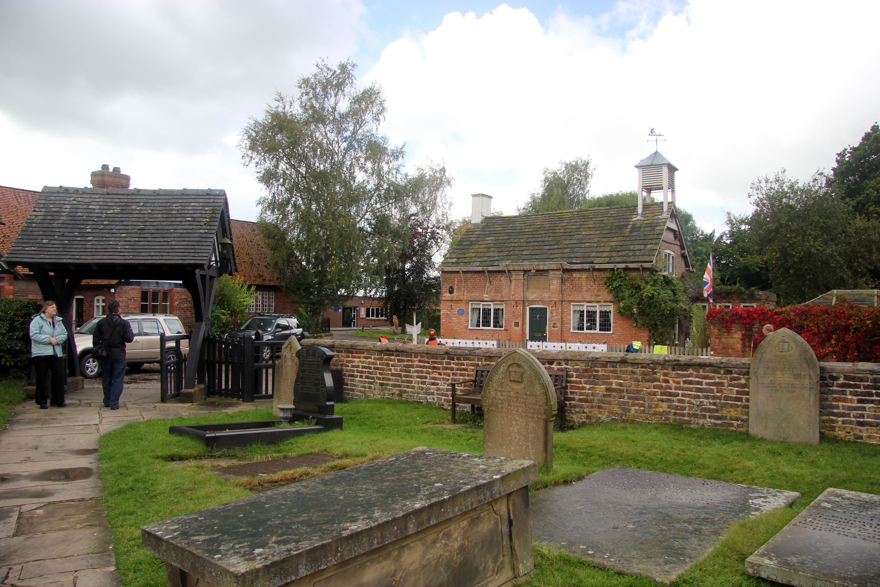
Peover Inferior is a civil parish in the Borough of Cheshire East and the ceremonial county of Cheshire, England. The village is known for its picturesque surrounding countryside and surprisingly convenient location. The name Peover is pronounced 'Peever' and derives from the Anglo-Saxon 'Peeffer' meaning 'a bright river', this 'bright river' being the River Peover which runs through the parish. The village and its neighbour Peover Superior lie on the river Peover, 'Inferior' here meaning downstream. The parish is situated on the B5081 roughly 25 km south south west of Manchester between Knutsford and Holmes Chapel and within five miles of junction 19 on the M6. Together with Nether Peover, it forms part of the village of Lower Peover, Lower Peover being the parish council. Peover Inferior is in Cheshire East, however Nether Peover is in Cheshire West, this often causes complications for the Lower Peover parish council. According to the 2011 census, it had a population of 220.
Adapted from Wikipedia, CC BY-SA 4.0.
Worth seeing in and around Peover Inferior
9 places within 25 km that the world writes about, in the order of how widely: the ones a visitor has heard of first, then the ones only a local would name.
- 01St Lawrence's Church, Over Peover
St Lawrence's Church, Over Peover is in the civil parish of Peover Superior. Close to Peover Hall and farm.
3.3 km · church in Cheshire East, Cheshire, England, UK · Wikipedia - 02St John the Evangelist's Church, Toft
St John the Evangelist's Church is in Toft Road, Toft, Cheshire, England. It is an active Anglican parish church in the deanery of Knutsford, the archdeaconry of Macclesfield, and the diocese of Chester.
3.5 km · grade II listed church in Toft, Cheshire East, Cheshire, England, UK · Wikipedia - 03Bexton Hall
Bexton Hall is a country house in the village of Bexton to the southwest of Knutsford, Cheshire, England. It is a square, symmetrical house of five bays, dating from the late 17th century.
3.3 km · Grade II* listed country house in Bexton, southwest of Knutsford, Cheshire, England, UK · Wikipedia - 04Peover Hall Stable Block
Peover Hall Stable Block is in the grounds of Peover Hall, Cheshire, England. It is recorded in the National Heritage List for England as a designated Grade I listed building.
3.4 km · Grade I listed building in Cheshire East, United Kingdom · Wikipedia - 05Holford Hall
Holford Hall is a country house west of the village of Plumley, Cheshire, England. It consists of a fragment of a much larger timber-framed house, built in 1601 for Mary Cholmondeley on a moated site.
3.5 km · Grade II* listed country house in Plumley, Cheshire, England, UK · Wikipedia - 06Hulme Hall
Hulme Hall is a house on a moated site in the parish of Allostock, Cheshire, England. It originated in the 15th century, with additions and alterations in the 17th and 19th centuries.
2 km · Grade II* listed house in Allostock, Cheshire, England, UK · Wikipedia - 07Peover Hall
Peover Hall is a country house in the civil parish of Peover Superior, commonly known as Over Peover, Cheshire, England. It is recorded in the National Heritage List for England as a designated Grade II* listed building.
3.3 km · country house in Peover Superior, Cheshire, England, UK · Wikipedia - 08St Oswald's Church
St Oswald's Church is in the village of Lower Peover, Cheshire, England. It is recorded in the National Heritage List for England as a designated Grade I listed building.
600 m · church in the village of Lower Peover, Cheshire, England, UK · Wikipedia - 09Toft Hall
Toft Hall is a 17th-century country house in Toft, Cheshire, England to which additions and alterations have been made during the following three centuries. It is constructed in brick, which has been rendered, with stone dressings and a slate roof.
2.9 km · country house in Toft, Cheshire, England, UK · Wikipedia
Ranked by the number of language editions of Wikipedia with an article on each, from Wikidata; the sentences are the openings of those articles, CC BY-SA 4.0.
Getting to Peover Inferior
- Airports
- Manchester (MAN), 12 km · Liverpool John Lennon (LPL), 32 km · Leeds Bradford (LBA), 83 km
- Stations
- Plumley railway station, 2.5 km
- Leeds, West Yorkshire → Peover Inferior81 km · quickest by road, 1h 55m · £10–13
- Nottingham, Leicestershire → Peover Inferior89 km · quickest by road, 2h 22m · £11–15
- Birmingham, West Midlands → Peover Inferior93 km · quickest by road, 1h 55m · £10–13
- Plan a tripFrom anywhereThe planner compares every way there from wherever you are.
Road and air are today’s quick answer; timetabled trains, buses and ferries load on the results page from the operators’ feeds.
No local-transport research exists yet for Peover Inferior
Our researched notes are written from a sourced entry: every shared taxi, boat and village bus with its operator, its rule, its fare and the year we saw it, and what could not be confirmed. Nobody has done that work for Peover Inferior. What is above is what we hold from open sources; nothing here pretends to be more.
- Get aroundThere is an off-road walk through The Dingle between the town centre and Lymm Dam.
From Wikivoyage: Lymm, CC BY-SA. Not yet checked by us; that article was last edited 2026-03.
- 01279 km
- 02296 km
- 03313 km
- 04349 km
- 05374 km
If you know how people move in Peover Inferior – the stand, the rule, the fare – tell us, and the note gets an entry.
Next door to Peover Inferior
Peover Inferior is 27 km from Manchester, the nearest large city, whose note carries the wider picture.
- Toftvillage and civil parish in Cheshire, UK3.2 km
- Allostockvillage and civil parish in Chester West and Cheshire, England, UK3 km
- Bextonvillage in Cheshire, England, UK3.1 km
- Plumleyvillage and civil parish in Cheshire East, UK2.8 km
- Lower Peovervillage in the civil parish of Nether Peover, Cheshire East in England900 m