Ossett
Ossett is a market and residential town in the Wakefield district, in the county of West Yorkshire, England.
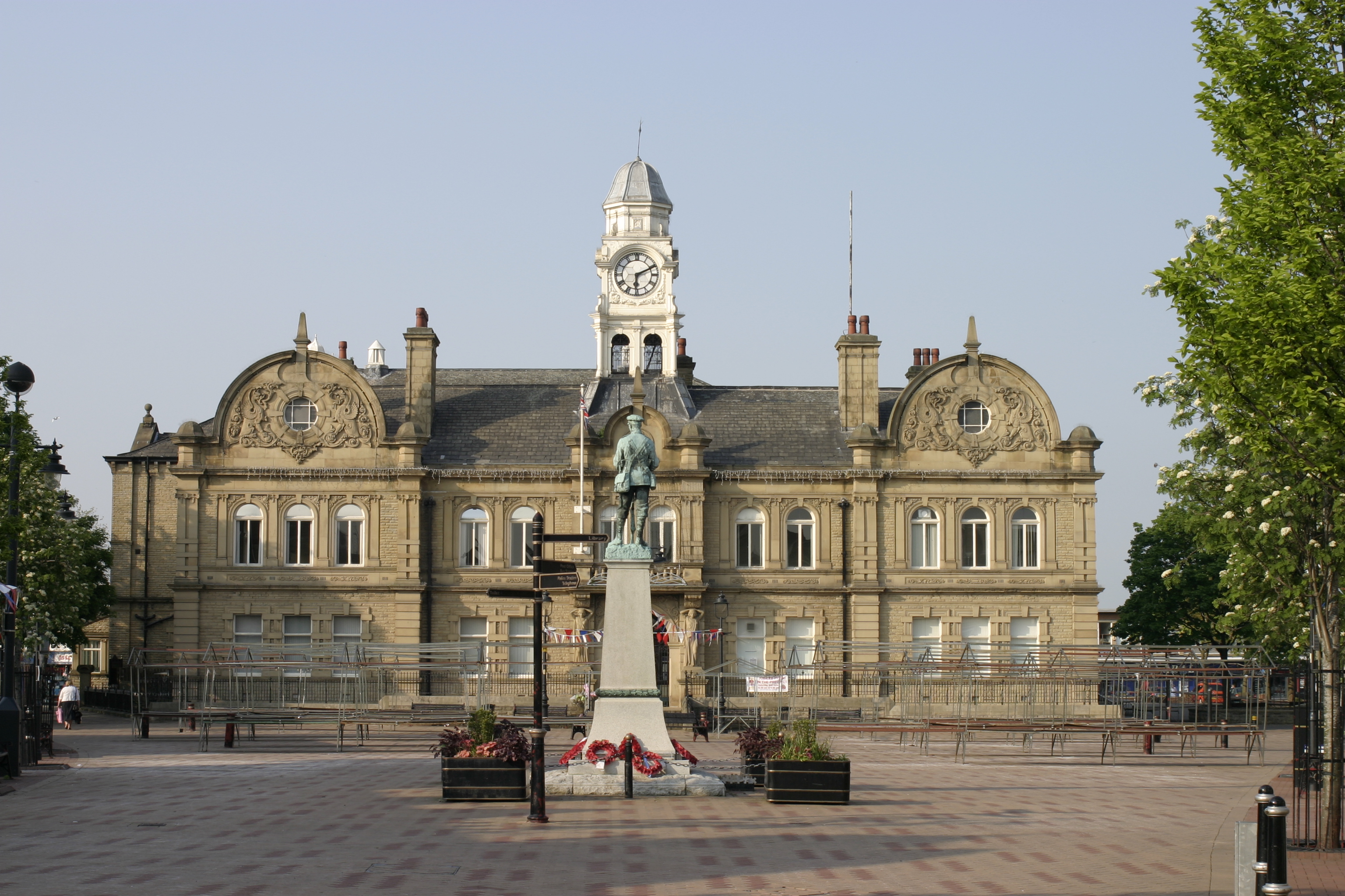
Ossett is a market and residential town in the Wakefield district, in the county of West Yorkshire, England. Historically part of the West Riding of Yorkshire, it is situated between Dewsbury, Horbury and Wakefield. At the 2021 census, the town had a population of 21,861. Ossett forms part of the Heavy Woollen District.
Adapted from Wikipedia, CC BY-SA 4.0.
Worth seeing in and around Ossett
10 places within 25 km that the world writes about, in the order of how widely: the ones a visitor has heard of first, then the ones only a local would name.
- 01Wakefield Cathedral
Wakefield Cathedral, or the Cathedral Church of All Saints in Wakefield, West Yorkshire, England, is a co-equal Anglican cathedral with Bradford and Ripon Cathedrals, in the Diocese of Leeds and a seat of the Bishop of Leeds. Originally the parish church, it has Anglo Saxon origins and, after enlargement and rebuilding, has the tallest spire in Yorkshire.
5.5 km · Grade I listed cathedral in Wakefield, United Kingdom · Wikipedia - 02Hepworth Wakefield
The Hepworth Wakefield is an art museum in Wakefield, West Yorkshire, England, which opened on 21 May 2011. The gallery is situated on the south side of the River Calder and takes its name from artist and sculptor Barbara Hepworth who was born and educated in the city.
5.9 km · art gallery in West Yorkshire, England, United Kingdom · Wikipedia - 03Markazi Mosque
The Markazi Masjid, also known as the Dewsbury Markaz or Dar ul Ulum, is a mosque in the Savile Town area of Dewsbury, West Yorkshire, England. With a maximum capacity of 4,000, it is one of the largest mosques in Europe.
3.2 km · Mosque in Dewsbury, West Yorkshire · Wikipedia - 04Crown Flatt
Crown Flatt, currently known as the FLAIR Stadium for sponsorship purposes, is a rugby league stadium on Owl Lane in Dewsbury, West Yorkshire, England. It is the home of the Dewsbury Rams, who play in the Championship, and the Huddersfield Giants who play in the Super League.
2.6 km · rugby league stadium · Wikipedia - 05National Coal Mining Museum for England
National Coal Mining Museum for England is based at the site of Caphouse Colliery in Overton, Wakefield, West Yorkshire, England. It opened in 1988 as the Yorkshire Mining Museum and was granted national status in 1995.
4.9 km · coal mining museum in Yorkshire, England, United Kingdom · Wikipedia - 06Pugneys Country Park
Pugneys Country Park is a 250-acre park located on the A636 between Wakefield, West Yorkshire, England and Junction 39 of the M1 motorway. It is a Local Nature Reserve.
5.7 km · country park in West Yorkshire, United Kingdom · Wikipedia - 07Fox's Biscuits Stadium
Mount Pleasant Stadium, officially known for sponsorship purposes as Fox's Biscuits Stadium, is a rugby league stadium in Batley, West Yorkshire, England. It is the home of the Batley Bulldogs and amateur club Batley ARLFC. The Mount Pleasant pitch is sloped and is on a hill overlooking Batley.
4.6 km · stadium · Wikipedia - 08Jaw Hill
Jaw Hill is a hill in the City of Leeds district of West Yorkshire, England. It is near Kirkhamgate in the City of Wakefield district.
3.2 km · hill in West Yorkshire, England, UK · Wikipedia - 09St Austin's Church, Wakefield
St Austin's Church is a Roman Catholic Church building in Wakefield, England. It is situated near where Northgate meets Marsh Way close to the city centre.
5.2 km · Catholic Church and grade II listed building in Wakefield, West Yorkshire, England, UK · Wikipedia - 10Dewsbury Minster
Dewsbury Minster, the Minster Church of All Saints is the parish church in Dewsbury, Kirklees, West Yorkshire, England. It dates from the 13th century and was rebuilt in 1895.
3.4 km · church in Dewsbury, West Yorkshire, England, UK · Wikipedia
Ranked by the number of language editions of Wikipedia with an article on each, from Wikidata; the sentences are the openings of those articles, CC BY-SA 4.0.
Getting to Ossett
- Airports
- Leeds Bradford (LBA), 21 km · Manchester (MAN), 59 km · Liverpool John Lennon (LPL), 92 km
- Stations
- Wakefield Westgate railway station, 4.9 km · Batley railway station, 4.4 km · Ravensthorpe railway station, 5 km · Dewsbury railway station, 3.7 km · Wakefield bus station, 5.5 km
- Manchester, Greater Manchester → Ossett49 km · quickest by road, 1h 28m · £6–8
- Liverpool → Ossett97 km · quickest by road, 2h 10m · £10–13
- Nottingham, Leicestershire → Ossett86 km · quickest by road, 1h 51m · £9–12
- Plan a tripFrom anywhereThe planner compares every way there from wherever you are.
Road and air are today’s quick answer; timetabled trains, buses and ferries load on the results page from the operators’ feeds.
No local-transport research exists yet for Ossett
Our researched notes are written from a sourced entry: every shared taxi, boat and village bus with its operator, its rule, its fare and the year we saw it, and what could not be confirmed. Nobody has done that work for Ossett. What is above is what we hold from open sources; nothing here pretends to be more.
- Go nextOther easy day trips include Bradford, Saltaire, Haworth and Sheffield.
From Wikivoyage: Wakefield (England), CC BY-SA. Not yet checked by us; that article was last edited 2026-09.
- 01311 km
- 02333 km
- 03345 km
- 04348 km
- 05373 km
If you know how people move in Ossett – the stand, the rule, the fare – tell us, and the note gets an entry.
Next door to Ossett
Ossett is 13 km from Leeds, the nearest large city, whose note carries the wider picture.
- Wakefieldcity in West Yorkshire, England5.4 km
- Dewsburytown in West Yorkshire, United Kingdom3.5 km
- Batleytown in West Yorkshire, England, UK5.5 km
- Crigglestonevillage in Wakefield, West Yorkshire, England, UK5.5 km
- Sitlingtoncivil parish in Wakefield, West Yorkshire, England3.9 km
- Horburylarge village in the City of Wakefield, West Yorkshire, England2.8 km