Ospringe
Ospringe is a village and area of Faversham in the English county of Kent.
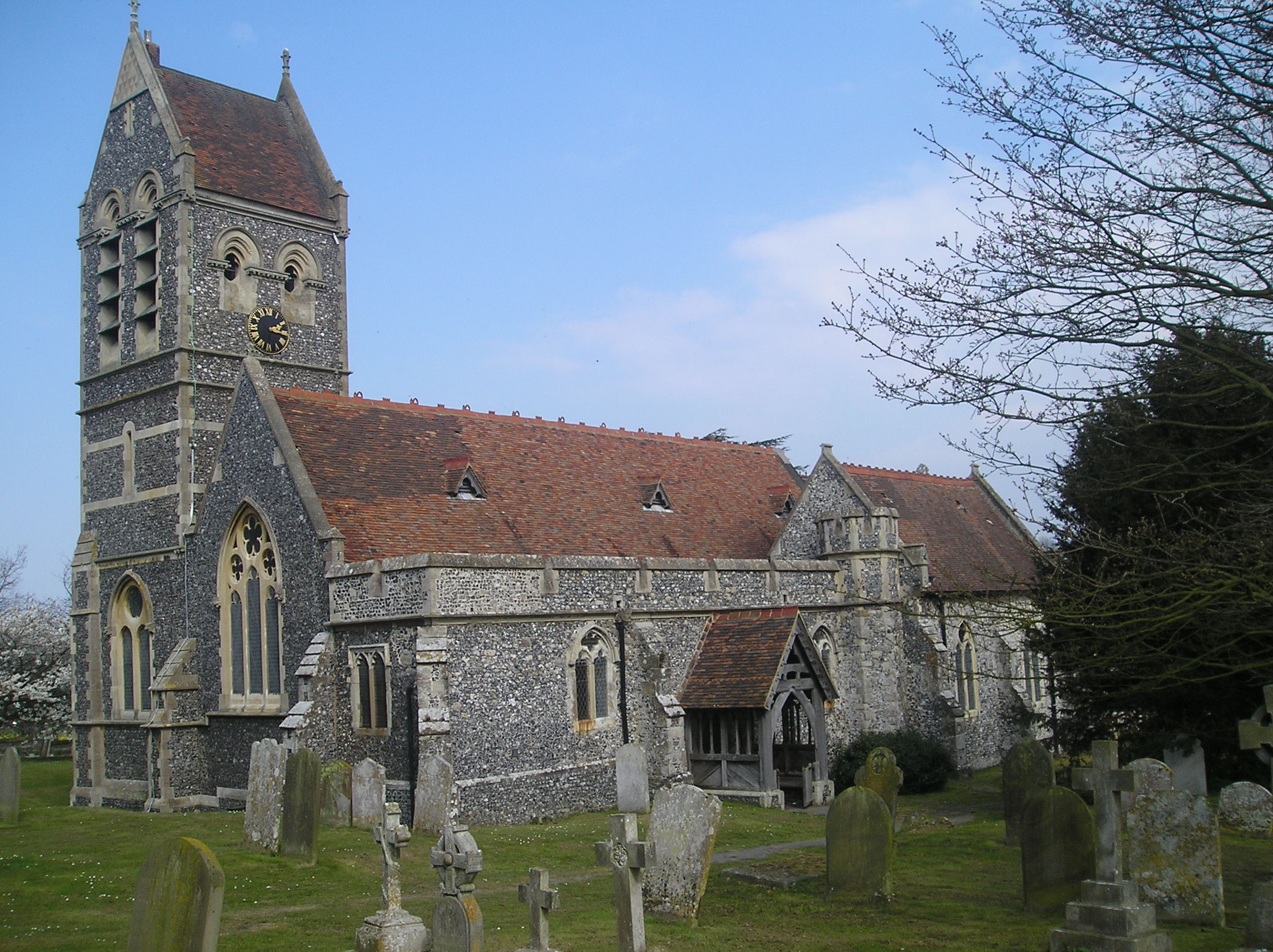
Ospringe is a village and area of Faversham in the English county of Kent. It is also the name of a civil parish, which since 1935 has not included the village of Ospringe.
Adapted from Wikipedia, CC BY-SA 4.0.
Worth seeing in and around Ospringe
10 places within 25 km that the world writes about, in the order of how widely: the ones a visitor has heard of first, then the ones only a local would name.
- 01Faversham Abbey
Faversham Abbey was a Cluniac style monastery immediately to the north-east of the town of Faversham, in north Kent, England.
1.7 km · Cluny style monastery in England · Wikipedia - 02National Fruit Collection
The United Kingdom's National Fruit Collection is one of the largest collections of fruit trees and plants in the world. Over 2,040 varieties of apple, 502 of pear, 350 of plum, 322 of cherry and smaller collections of bush fruits, nuts and grapes are grown, in 150 acres of orchards.
1.3 km · collection of heritage fruit varieties and cultivars, at Brogdale Farm, Kent, England · Wikipedia - 03St Mary's Church, Luddenham
St Mary's Church is a redundant Anglican church in the village of Luddenham, Kent, England. It is recorded in the National Heritage List for England as a designated Grade I listed building, and is under the care of the Churches Conservation Trust.
2.6 km · Grade I listed church in Luddenham, Swale, Kent, England, UK · Wikipedia - 04Faversham Parish Church
St Mary of Charity, Faversham Parish Church is the Church of England parish church of the town of Faversham in Kent, England. The church spire dominates the town's skyline and is visible from some distance.
1.7 km · church in Faversham, Swale, Kent, England, UK · Wikipedia - 05Provender
Provender is an English country house in Norton near Faversham in the English county of Kent. It is privately owned but open for tours on certain days, and is an event venue.
2.9 km · house in Norton, Buckland and Stone, Swale, Kent, England, UK · Wikipedia - 06Oare Meadow
Oare Meadow is a 2-hectare nature reserve in Oare, north of Faversham in Kent. It is managed by the Kent Wildlife Trust.
2.3 km · park in United Kingdom · Wikipedia - 07Oare Windmill
Oare Mill is a Grade II listed house converted tower mill in Oare, Kent, England that was built in the late eighteenth or early nineteenth century.
1.8 km · tower mill in Faversham, Swale, Kent, England, UK · Wikipedia - 08The Guildhall
Faversham Guildhall is a municipal building in the Market Place in Faversham, Kent, England. The structure, which was the meeting place of Faversham Borough Council, is a Grade II* listed building.
1.4 km · building in Faversham, Kent, England, UK · Wikipedia - 09Memorials to the victims of the 1916 Faversham Munitions Explosion
The memorial to the victims of the 1916 Faversham Munitions Explosion is a Grade II* listed building in Love Lane cemetery, in Faversham, Kent. Unveiled in 1917, it incorporates a granite Celtic cross and the granite structures surrounding a mass grave for 73 people killed by the Faversham explosion on 2 April 1916, and a nearby freestanding stone which records the names of another 35 who were buried elsewhere.
2.2 km · memorial in Faversham, Swale, Kent, England, UK · Wikipedia - 10National Shrine of Saint Jude
The National Shrine of Saint Jude, adjoining the Roman Catholic parish Church of Our Lady of Mount Carmel in Faversham, Kent, England, is a shrine to Saint Jude and a place of pilgrimage and prayer for Catholics and other Christians since it was officially opened in 1955. It comes under the Roman Catholic Archdiocese of Southwark.
900 m · Shrine in Faversham, United Kingdom · Wikipedia
Ranked by the number of language editions of Wikipedia with an article on each, from Wikidata; the sentences are the openings of those articles, CC BY-SA 4.0.
Getting to Ospringe
- Airports
- London Gatwick (LGW), 76 km · London Stansted (STN), 78 km · London Heathrow (LHR), 94 km
- Stations
- Faversham railway station, 1.3 km
- London → Ospringe72 km · quickest by road, 2h 2m · £8–10
- London, Essex → Ospringe72 km · quickest by road, 2h 2m · £8–10
- Luton, Luton → Ospringe109 km · quickest by road, 2h 37m · £13–18
- Plan a tripFrom anywhereThe planner compares every way there from wherever you are.
Road and air are today’s quick answer; timetabled trains, buses and ferries load on the results page from the operators’ feeds.
No local-transport research exists yet for Ospringe
Our researched notes are written from a sourced entry: every shared taxi, boat and village bus with its operator, its rule, its fare and the year we saw it, and what could not be confirmed. Nobody has done that work for Ospringe. What is above is what we hold from open sources; nothing here pretends to be more.
- Get aroundIt also gives advice on how best to see the city by bike, having put together several good guides to local rides, including on road, off road, and dedicated path routes.
From Wikivoyage: Canterbury (England), CC BY-SA. Not yet checked by us; that article was last edited 2026-09.
- 01167 km
- 02354 km
- 03386 km
- 04619 km
- 05654 km
If you know how people move in Ospringe – the stand, the rule, the fare – tell us, and the note gets an entry.
Next door to Ospringe
- Oarevillage and civil parish in Kent, UK2.1 km
- Luddenhamvillage and civil parish in Kent, United Kingdom2.6 km
- Norton, Buckland and Stonecivil parish in Kent, United Kingdom3.8 km
- Upleesvillage in Kent, England, UK3.6 km
- Brogdalehamlet in Kent, England, UK1.3 km
- Mockbeggarvillage in Swale, Kent, England, UK3.4 km