Orpington
Orpington is a town in Greater London, England, within the London Borough of Bromley.
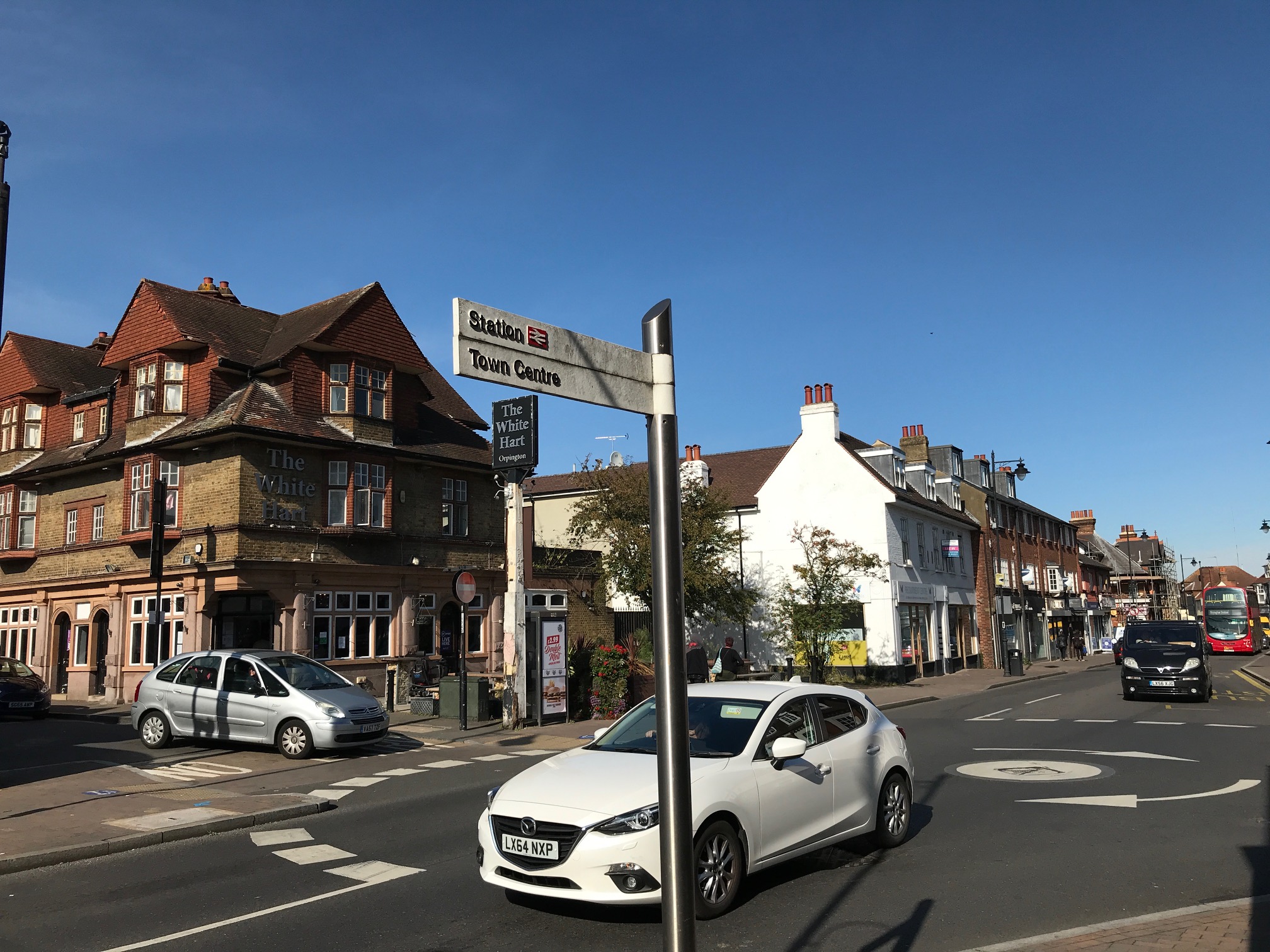
Orpington is a town in Greater London, England, within the London Borough of Bromley. It is 13.4 miles (21.6 km) southeast of Charing Cross, close to the border with Kent.
Adapted from Wikipedia, CC BY-SA 4.0.
Worth seeing in and around Orpington
9 places within 25 km that the world writes about, in the order of how widely: the ones a visitor has heard of first, then the ones only a local would name.
- 01Hayes Lane
Hayes Lane, currently known as the Copperjax Community Stadium for sponsorship reasons, is a football stadium in Bromley, Greater London, England. Located between Bromley town centre and Hayes, it is the home of Bromley Football Club and London City Lionesses.
5.7 km · association football stadium in England · Wikipedia - 02St Mary's Church, Downe
St Mary's Church in the village of Downe, Bromley is the Church of England Parish Church for the parish of Downe. It is a Grade II* listed building, which dates from the 13th century.
5.2 km · church in Downe, London (historically Kent) · Wikipedia - 03St Mary the Virgin, Hayes, Bromley
St Mary the Virgin is a Gothic church in South London, built in the 12th century but with notable Gothic Revival modifications and additions in the mid-Victorian period to the designs of Sir George Gilbert Scott and his son John Oldrid Scott. It is dedicated to St Mary the Virgin.
5.6 km · church in Hayes, London Borough of Bromley · Wikipedia - 04Norman Park
Norman Park is a recreation ground in Bromley, England. It has a playground and athletics track, and hosts events such as a music festivals, weekly organised Parkruns and yearly car shows.
5.3 km · recreation ground in the London Borough of Bromley, England · Wikipedia - 05London South East Colleges
Bromley College of Further and Higher Education, trading as London South East Colleges, is a large college of further education and higher education operating in south-east London, England. It is a partner college of six of the twelve schools of the University of Greenwich.
4.6 km · college in Bromley, UK · Wikipedia - 06Jubilee Country Park
Jubilee Country Park is a 62-acre public park in Petts Wood in the London Borough of Bromley. It is a Local Nature Reserve and a Site of Metropolitan Importance for Nature Conservation.
3.2 km · park in the United Kingdom · Wikipedia - 07High Elms Country Park
High Elms Country Park is an extensive 250-acre public park on the North Downs in Farnborough in the London Borough of Bromley. It is a Local Nature Reserve, and together with the neighbouring Downe Bank, a Site of Special Scientific Interest.
3 km · public park in Greater London · Wikipedia - 08Hewitt's Chalk Bank
Hewitt's Chalk Bank is a 4-hectare nature reserve north-east of Pratt's Bottom in the London Borough of Bromley. It is managed by the Kent Wildlife Trust.
3.6 km · park in United Kingdom · Wikipedia - 09Church of All Saints, Orpington
The Church of All Saints is a Grade II* listed church in Orpington, Bromley, London.
700 m · church in Orpington, London Borough of Bromley, England, UK · Wikipedia
Ranked by the number of language editions of Wikipedia with an article on each, from Wikidata; the sentences are the openings of those articles, CC BY-SA 4.0.
Getting to Orpington
- Airports
- London Gatwick (LGW), 32 km · London Heathrow (LHR), 40 km · London Stansted (STN), 58 km
- Stations
- Bickley railway station, 4.7 km · Orpington railway station, 700 m · Petts Wood railway station, 2.4 km · Chelsfield railway station, 2.1 km · St Mary Cray railway station, 2.3 km
- London → Orpington21 km · quickest by road, 1h 7m · £2.5–3
- London, Essex → Orpington21 km · quickest by road, 1h 7m · £2.5–3
- Luton, Luton → Orpington66 km · quickest by road, 1h 58m · £10–13
- Plan a tripFrom anywhereThe planner compares every way there from wherever you are.
Road and air are today’s quick answer; timetabled trains, buses and ferries load on the results page from the operators’ feeds.
No local-transport research exists yet for Orpington
Our researched notes are written from a sourced entry: every shared taxi, boat and village bus with its operator, its rule, its fare and the year we saw it, and what could not be confirmed. Nobody has done that work for Orpington. What is above is what we hold from open sources; nothing here pretends to be more.
- Get inWhile the runway is usable by aircraft up to Boeing 737/Airbus A320 size, it is prohibited for airline operators to sell tickets for flights in and out of the airport, thus there are no scheduled or holiday charter flights from the airport.
From Wikivoyage: London/South, CC BY-SA. Not yet checked by us; that article was last edited 2026-09.
- 01124 km
- 02332 km
- 03393 km
- 04581 km
- 05617 km
If you know how people move in Orpington – the stand, the rule, the fare – tell us, and the note gets an entry.
Next door to Orpington
Orpington is 22 km from London, the nearest large city, whose note carries the wider picture.
- Chislehurstdistrict in South East London, England4.7 km
- Downevillage in the London Borough of Bromley, England, UK5.3 km
- Sidcupsuburban district of south-east London, England, primarily in the London Borough of Bexley5.8 km
- Crockenhillvillage in Kent, England, UK4.5 km
- Farnborougharea of London, within London Borough of Bromley2.4 km
- Badgers Mountvillage in Kent, England, UK4.8 km