North Norfolk
North Norfolk is a local government district in Norfolk, England.
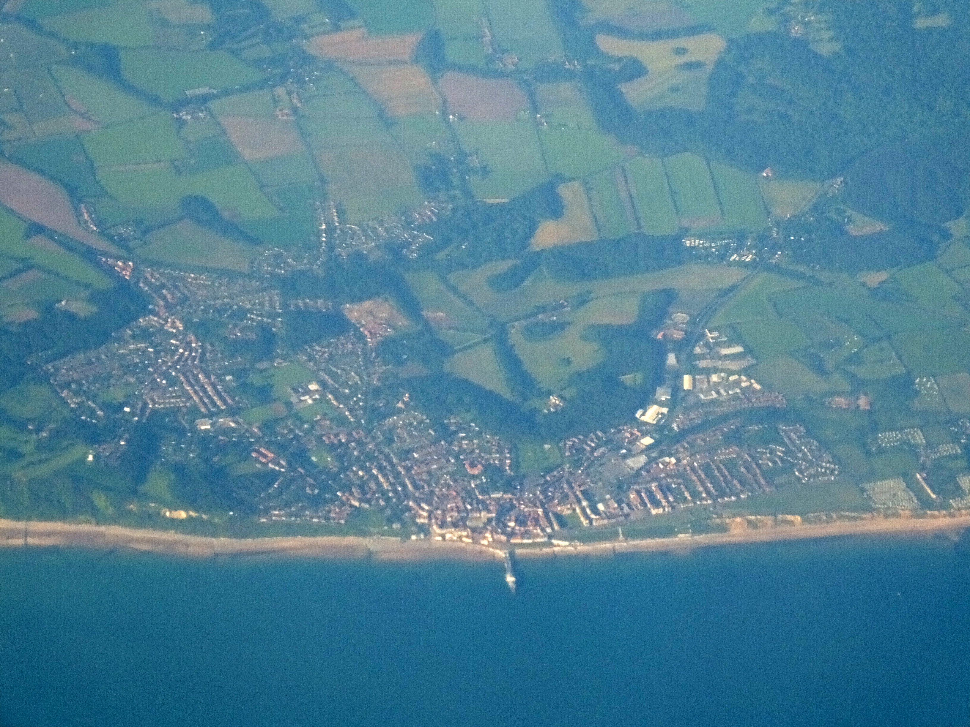
North Norfolk is a local government district in Norfolk, England. Its council is based in Cromer, and the largest town is North Walsham. The district also includes the towns of Fakenham, Holt, Sheringham, Stalham and Wells-next-the-Sea, along with numerous villages and surrounding rural areas.
Adapted from Wikipedia, CC BY-SA 4.0.
Worth seeing in and around North Norfolk
10 places within 25 km that the world writes about, in the order of how widely: the ones a visitor has heard of first, then the ones only a local would name.
- 01Cromer Lighthouse
Cromer Lighthouse is situated in the coastal town of Cromer, in the English county of Norfolk.
1.5 km · lighthouse in Cromer, North Norfolk, Norfolk, England, UK · Wikipedia - 02Felbrigg Hall
Felbrigg Hall is a 17th-century English country house near the village of that name in Norfolk. Part of a National Trust property, the unaltered 17th-century house is noted for its Jacobean architecture and fine Georgian interior.
4 km · Grade I listed house in Felbrigg, Norfolk, England, UK · Wikipedia - 03Beacon Hill
Beacon Hill is the highest point in the English county of Norfolk. The hill is located 0.75 miles south of the village of West Runton on the North Norfolk coast.
3.4 km · hill near Cromer, Norfolk, England, UK · Wikipedia - 04Cromer Hall
Cromer Hall is a country house located one mile south of Cromer on Holt Road, in the English county of Norfolk. The present house was built in 1829 by architect William Donthorne.
900 m · country house in Cromer, Norfolk, England, UK · Wikipedia - 05Cromer Pier
Cromer Pier is a Grade II listed seaside pier in the civil parish of Cromer on the north coast of the English county of Norfolk, 25 miles due north of the city of Norwich in the United Kingdom. The pier is the home of the Cromer Lifeboat Station and the Pavilion Theatre.
200 m · grade II listed building in Cromer, United Kingdom · Wikipedia - 06Sandcliff Hotel, Cromer
The Sandcliff Hotel is an AA 3 star hotel located on the seafront in the English town of Cromer, within the county of Norfolk, United Kingdom.
500 m · building in Norfolk, England · Wikipedia - 07Sea Marge Hotel, Overstrand
The Sea Marge Hotel is an AA 4-star hotel in the English seaside village of Overstrand in the county of Norfolk. The hotel also has 2 AA Rosettes for Food.
3.5 km · building in Norfolk, England, UK · Wikipedia - 08Overstrand Cliffs
Overstrand Cliffs is a 57.8-hectare biological and geological Site of Special Scientific Interest in Cromer in Norfolk, England. It is a Special Area of Conservation and part of it is a Geological Conservation Review site.
2 km · UK Site of Special Scientific Interest · Wikipedia - 09Overstrand Hall
Overstrand Hall is a country house in Overstrand, Norfolk, England, designed by Edwin Lutyens for Charles William Mills, 2nd Baron Hillingdon, a partner in Glyn, Mills & Co. Bank.
2.7 km · country house in Norfolk, England, UK · Wikipedia - 10Pavilion Theatre, Cromer Pier
The Pavilion Theatre is located on Cromer Pier in Cromer, Norfolk. Originally a bandstand when the pier opened, it was converted into an enclosed pavilion in 1905.
100 m · pier pavilion theatre in Cromer, Norfolk, England · Wikipedia
Ranked by the number of language editions of Wikipedia with an article on each, from Wikidata; the sentences are the openings of those articles, CC BY-SA 4.0.
What Wikivoyage says to see
The Norfolk Coast features a series of nationally and internationally significant landscapes, including areas reserved for wildlife. Many of these are publicly accessible with hides or viewpoints for visitors. Restrictions may apply in some areas to protect wildlife, particularly nesting birds during the summer months.
- 01RSPB Snettisham Reserve
Snettisham, Beach Road, King's Lynn, Norfolk, PE31 7RA, snettisham@rspb.org.uk.
- 02RSPB Titchwell Marsh
Titchwell Marsh, Main Road, King's Lynn, Norfolk, PE31 8BB, titchwell@rspb.org.uk.
- 03Holkham National Nature Reserve
Muddy creeks meet farmed plains, which meet pinewoods and sandy beaches.
- 04National Trust Blakeney Point
Home to England's largest seal colony, with around 4,500 pups born on the peninsula during the winter months.
- 05See the seals at Blakeney Point
See England's largest seal colony by boat.
From Wikivoyage: North Norfolk, CC BY-SA 4.0. Not yet checked by us.
Things to do
Birdwatching at Cley, Blakeney Point, Titchwell and Holme. Visit Seal Colony at Blakeney Point. Walking Walk along the Norfolk Coast Path long distance footpath (84 miles) from Hunstanton past Cromer to Sea Palling. Walk the Paston Way (22 miles) from Cromer closely following the coast to Bacton then inland to North Walsham. Walk the Weavers' Way long distance footpath (61 miles) from Cromer to Great Yarmouth.
From Wikivoyage: North Norfolk, CC BY-SA 4.0. Not yet checked by us.
Where to eat
Famous for locally caught seafood including Cromer Crabs.
From Wikivoyage: North Norfolk, CC BY-SA 4.0. Not yet checked by us.
Getting to North Norfolk
- Airports
- London Stansted (STN), 137 km · London Luton (LTN), 163 km · East Midlands (EMA), 177 km
- Stations
- Roughton Road railway station, 1.7 km · Cromer railway station, 600 m · West Runton railway station, 3.6 km · Overstrand railway station, 3.2 km
- London, Essex → North Norfolk171 km · quickest by road, 3h 30m · £18–24
- London → North Norfolk171 km · quickest by road, 3h 30m · £18–24
- Luton, Luton → North Norfolk149 km · quickest by road, 2h 59m · £16–22
- Plan a tripFrom anywhereThe planner compares every way there from wherever you are.
Road and air are today’s quick answer; timetabled trains, buses and ferries load on the results page from the operators’ feeds.
No local-transport research exists yet for North Norfolk
Our researched notes are written from a sourced entry: every shared taxi, boat and village bus with its operator, its rule, its fare and the year we saw it, and what could not be confirmed. Nobody has done that work for North Norfolk. What is above is what we hold from open sources; nothing here pretends to be more.
- 01249 km
- 02307 km
- 03452 km
- 04511 km
- 05542 km
If you know how people move in North Norfolk – the stand, the rule, the fare – tell us, and the note gets an entry.
Next door to North Norfolk
- Felbriggvillage in Norfolk, England, UK3 km
- West Runtonvillage in Norfolk, UK3.8 km
- Runtoncivil parish in Norfolk, England, UK3.4 km
- East Runtonvillage in Norfolk, UK2.2 km
- Cromer railway stationsVarious railway stations in the English town of Cromer, Norfolk600 m