Mongewell
Mongewell is a village in the civil parish of Crowmarsh in the South Oxfordshire district, in Oxfordshire, England, about 1 mile (1.6 km) south of Wallingford.
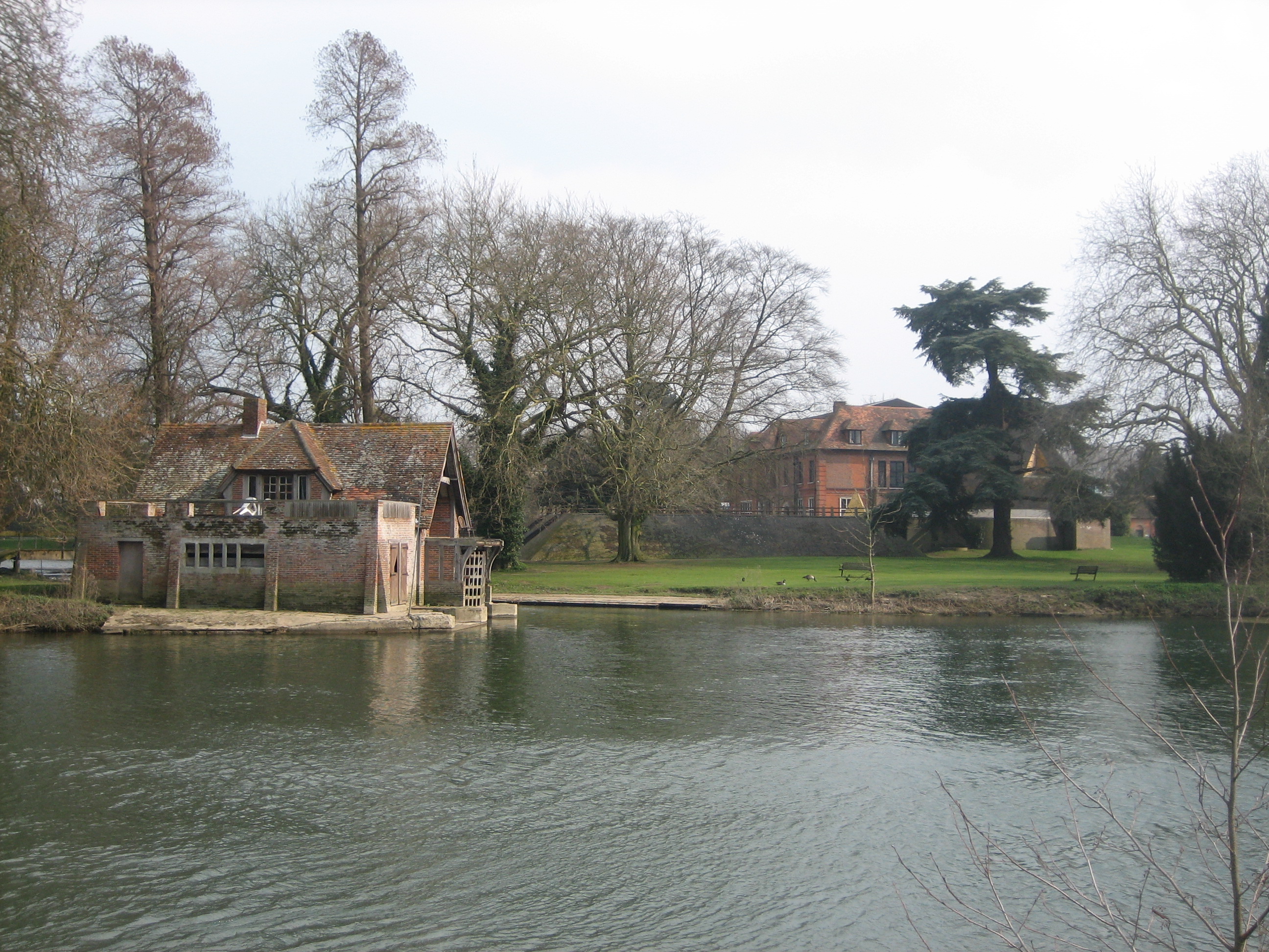
Mongewell is a village in the civil parish of Crowmarsh in the South Oxfordshire district, in Oxfordshire, England, about 1 mile (1.6 km) south of Wallingford. Mongewell is on the east bank of the Thames, linked with the west bank at Winterbrook by Winterbrook Bridge. The earthwork Grim's Ditch, now part of The Ridgeway long-distance footpath, passes through the northern part of it and is a scheduled ancient monument. It has a church called St John the Baptist's Church.
Adapted from Wikipedia, CC BY-SA 4.0.
Worth seeing in and around Mongewell
10 places within 25 km that the world writes about, in the order of how widely: the ones a visitor has heard of first, then the ones only a local would name.
- 01Wallingford Castle
Wallingford Castle is a medieval castle situated in Wallingford in the English county of Oxfordshire, adjacent to the River Thames. Established in the 11th century as a motte-and-bailey design within an Anglo-Saxon burgh, it grew to become what historian Nicholas Brooks has described as "one of the most powerful royal castles of the 12th and 13th centuries".
1.9 km · castle in Wallingford, Oxfordshire, England, UK · Wikipedia - 02St John the Baptist's Church, Mongewell
St John the Baptist's Church is a closed, redundant Anglican church, partly in ruins, in Mongewell, Oxfordshire, England. It is recorded in the National Heritage List for England as a designated Grade II listed building, and is under the care of the Churches Conservation Trust.
300 m · grade II listed church in Mongewell, Oxfordshire, England, UK · Wikipedia - 03St Mary's Church, Newnham Murren
St Mary's Church is a redundant Anglican church in the hamlet of Newnham Murren, Oxfordshire, England. It is recorded in the National Heritage List for England as a designated Grade II* listed building, and is under the care of the Churches Conservation Trust.
700 m · church in South Oxfordshire, England, UK · Wikipedia - 04Wallingford Museum
Wallingford Museum is a museum with collections of local interest in the town of Wallingford in the English county of Oxfordshire. The museum has an extensive collection relating to the town's history.
1.8 km · Local museum in Wallingford, England, United Kingdom · Wikipedia - 05Moulsford Railway Bridge
Moulsford Railway Bridge, also known locally as "Four Arches" bridge, is a pair of parallel bridges located a little to the north of Moulsford and South Stoke in Oxfordshire, UK. It carries the Great Western Main Line from Paddington, London to Wales and the West across the River Thames. The bridge lies between the stations at Goring & Streatley and Cholsey, and crosses the Thames at an oblique angle on the reach between Cleeve Lock and Benson Lock.
3.5 km · railway bridge in Oxfordshire, England, UK · Wikipedia - 06St Mary-le-More, Wallingford
St Mary-le-More is a Church of England parish church in Wallingford, Oxfordshire, England. The church is situated in the centre of The Marketplace, just behind the Town Hall.
1.6 km · church in Wallingford, South Oxfordshire, England, UK · Wikipedia - 07Winterbrook Bridge
Winterbrook Bridge, also known as Wallingford Bypass Bridge, was built in 1993 as part of a bypass around Wallingford, Oxfordshire, to relieve congestion on the single-lane Wallingford Bridge. It forms part of the A4130, connecting Winterbrook, at the north end of Cholsey, just south of Wallingford, on the west bank, to Mongewell on the east bank.
400 m · bridge in United Kingdom · Wikipedia - 08Kinecroft
Wallingford is a market town and civil parish on the River Thames in South Oxfordshire, England, 12 miles north of Reading, 13 miles south of Oxford and 11 miles north west of Henley-on-Thames. Although belonging to the historic county of Berkshire, it is within the ceremonial county of Oxfordshire for administrative purposes as a result of the Local Government Act 1972.
1.6 km · park in Wallingford, Oxfordshire, England, UK · Wikipedia - 09Howbery Park
Howbery Park is a 36-ha park located adjacent to the River Thames in Crowmarsh Gifford near Wallingford, UK. Its main feature is an English manor house built in about 1850 by Member of Parliament William Seymour Blackstone. Blackstone fell into debt, largely because of the building costs, which resulted in him spending time in the debtors' prison at Oxford and contributed to the end of his political career.
2.3 km · park in Oxfordshire, UK · Wikipedia - 10Wallingford Bridge
Wallingford Bridge is a medieval road bridge over the River Thames in England which connects Wallingford and Crowmarsh Gifford, Oxfordshire. It crosses the Thames on the reach between Cleeve Lock and Benson Lock.
1.6 km · bridge in Oxfordshire, England, UK · Wikipedia
Ranked by the number of language editions of Wikipedia with an article on each, from Wikidata; the sentences are the openings of those articles, CC BY-SA 4.0.
Getting to Mongewell
- Airports
- London Heathrow (LHR), 47 km · London Luton (LTN), 61 km · London Gatwick (LGW), 81 km
- Stations
- Cholsey railway station, 3.3 km · Chiltern Park Aerodrome, 3.9 km · Wallingford railway station, 1.7 km · Moulsford railway station, 3.3 km
- London → Mongewell69 km · quickest by road, 1h 57m · £7–9
- Luton, Luton → Mongewell58 km · quickest by road, 1h 54m · £9–12
- London, Essex → Mongewell69 km · quickest by road, 1h 57m · £7–9
- Plan a tripFrom anywhereThe planner compares every way there from wherever you are.
Road and air are today’s quick answer; timetabled trains, buses and ferries load on the results page from the operators’ feeds.
No local-transport research exists yet for Mongewell
Our researched notes are written from a sourced entry: every shared taxi, boat and village bus with its operator, its rule, its fare and the year we saw it, and what could not be confirmed. Nobody has done that work for Mongewell. What is above is what we hold from open sources; nothing here pretends to be more.
- 01101 km
- 02251 km
- 03454 km
- 04517 km
- 05553 km
If you know how people move in Mongewell – the stand, the rule, the fare – tell us, and the note gets an entry.
Next door to Mongewell
Mongewell is 18 km from Reading, the nearest large city, whose note carries the wider picture.
- Wallingfordtown and civil parish in South Oxfordshire, England1.5 km
- Cholseyvillage and civil parish in South Oxfordshire district, South Oxfordshire, England2.6 km
- Bensonvillage and civil parish in South Oxfordshire, England3.9 km
- Ipsdenvillage and civil parish in South Oxfordshire, England3.3 km
- Crowmarshcivil parish in South Oxfordshire, England1.5 km
- Crowmarsh Giffordvillage in Oxfordshire, England, UK1.5 km