Methley
Methley is a dispersed village in the City of Leeds metropolitan borough, south east of Leeds, in West Yorkshire, England.
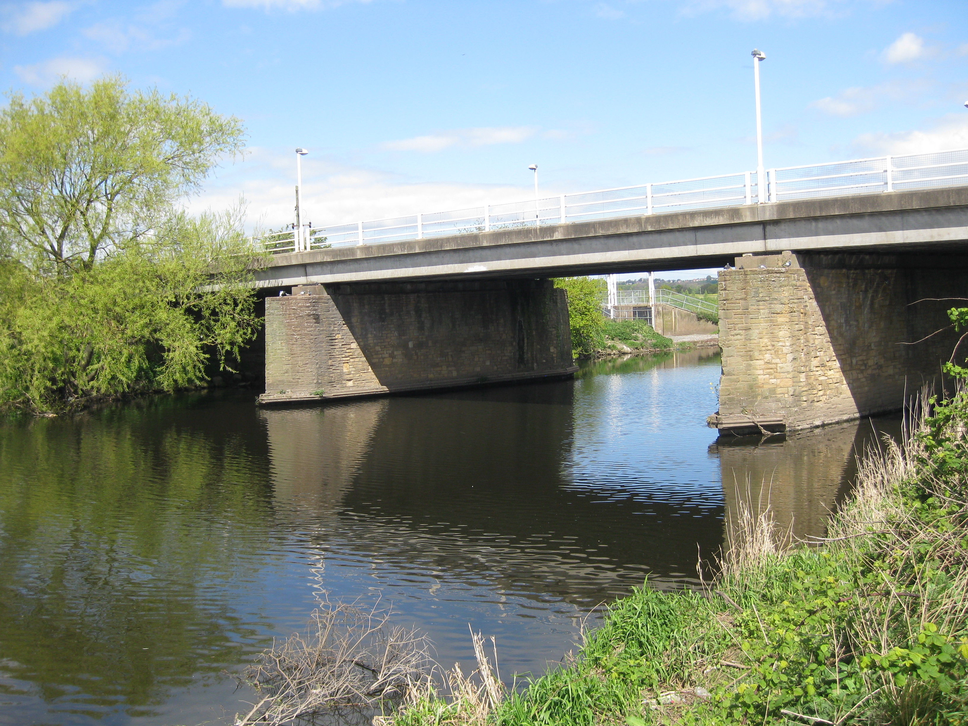
Methley is a dispersed village in the City of Leeds metropolitan borough, south east of Leeds, in West Yorkshire, England. It is located near Rothwell, Oulton, Woodlesford, Mickletown and Allerton Bywater. The Leeds City Ward is called Kippax and Methley. It is within the triangle formed by Leeds, Castleford and Wakefield, and between the confluence of the River Aire and River Calder. The latter is crossed by Methley Bridge, the A639 road, about a mile south-east of the village.
Adapted from Wikipedia, CC BY-SA 4.0.
Worth seeing in and around Methley
7 places within 25 km that the world writes about, in the order of how widely: the ones a visitor has heard of first, then the ones only a local would name.
- 01Trinity Methodist Church, Castleford
Trinity Methodist Church, Castleford, is in Castleford, Wakefield District, West Yorkshire, England. The church is part of the Aire and Calder Methodist Circuit in the Yorkshire West District.
3.7 km · church in West Yorkshire, England · Wikipedia - 02Lagentium
Lagentium or Legiolum was the Roman name for the fort and surrounding civilian settlement which was built around the year 74 by the Roman Empire. The English town of Castleford, West Yorkshire, is now built on what was the fort.
3.6 km · UK archaeological site · Wikipedia - 03Church of St John the Evangelist
St John the Evangelist's Church, Oulton, West Yorkshire, England is an active Anglican parish church in the archdeaconry of Leeds and the Diocese of Leeds.
3.5 km · church in Oulton, West Yorkshire, England, UK · Wikipedia - 04St Aidan's
St Aidan's is a 355-hectare nature park located between Leeds and Castleford in West Yorkshire, England. The land was formerly an opencast coal mining area that was flooded in 1988, after the riverbank collapsed.
1.6 km · country Park and RSPB reserve between Leeds and Castleford in West Yorkshire, England · Wikipedia - 05Church of All Saints
The Church of All Saints in Castleford, West Yorkshire, England is an active Anglican parish church in the archdeaconry of Leeds and the Diocese of Leeds. The church is Grade II listed.
3.5 km · church in Castleford, West Yorkshire, England, UK · Wikipedia - 06Oulton Hall
Oulton Hall in Oulton, West Yorkshire, is a Grade II listed building in England. It was once the home of the Blayds/Calverley family.
3.5 km · country house in Leeds, West Yorkshire, England, UK, now used as a hotel · Wikipedia - 07St. Mary's Church, Swillington
St Mary's Church is located on Church Lane next to Swillington Primary School, on Wakefield Road, Swillington, West Yorkshire, England. There has been a church at this location for at least 900 years.
3.9 km · church in Swillington, Leeds, West Yorkshire, England, UK · Wikipedia
Ranked by the number of language editions of Wikipedia with an article on each, from Wikidata; the sentences are the openings of those articles, CC BY-SA 4.0.
Getting to Methley
- Airports
- Leeds Bradford (LBA), 22 km · Manchester (MAN), 72 km · East Midlands (EMA), 101 km
- Stations
- Woodlesford railway station, 3.3 km · Castleford railway station, 3.7 km · Normanton railway station, 4 km · Methley South railway station, 1.1 km · Castleford bus station, 3.5 km
- Manchester, Greater Manchester → Methley62 km · quickest by road, 1h 31m · £7–9
- Nottingham, Leicestershire → Methley88 km · quickest by road, 2h 3m · £10–13
- Liverpool → Methley110 km · quickest by road, 2h 13m · £11–15
- Plan a tripFrom anywhereThe planner compares every way there from wherever you are.
Road and air are today’s quick answer; timetabled trains, buses and ferries load on the results page from the operators’ feeds.
No local-transport research exists yet for Methley
Our researched notes are written from a sourced entry: every shared taxi, boat and village bus with its operator, its rule, its fare and the year we saw it, and what could not be confirmed. Nobody has done that work for Methley. What is above is what we hold from open sources; nothing here pretends to be more.
- Go nextOther easy day trips include Bradford, Saltaire, Haworth and Sheffield.
From Wikivoyage: Wakefield (England), CC BY-SA. Not yet checked by us; that article was last edited 2026-09.
- 01315 km
- 02339 km
- 03349 km
- 04360 km
- 05377 km
If you know how people move in Methley – the stand, the rule, the fare – tell us, and the note gets an entry.
Next door to Methley
Methley is 11 km from Leeds, the nearest large city, whose note carries the wider picture.
- Allerton Bywatervillage in West Yorkshire, England, UK3.5 km
- Swillingtonvillage and civil parish in West Yorkshire, England3.8 km
- Great and Little Prestoncivil parish in Leeds, West Yorkshire, England, UK3.8 km
- Woodlesfordvillage in the City of Leeds, West Yorkshire, England3.2 km
- Mickletownsuburb in Methley, West Yorkshire, England, UK1 km
- Bottom Boatsettlement in Wakefield, West Yorkshire, England3.8 km