Marsh Baldon
Marsh Baldon is a village and civil parish about 5 miles (8 km) southeast of Oxford in Oxfordshire, England.
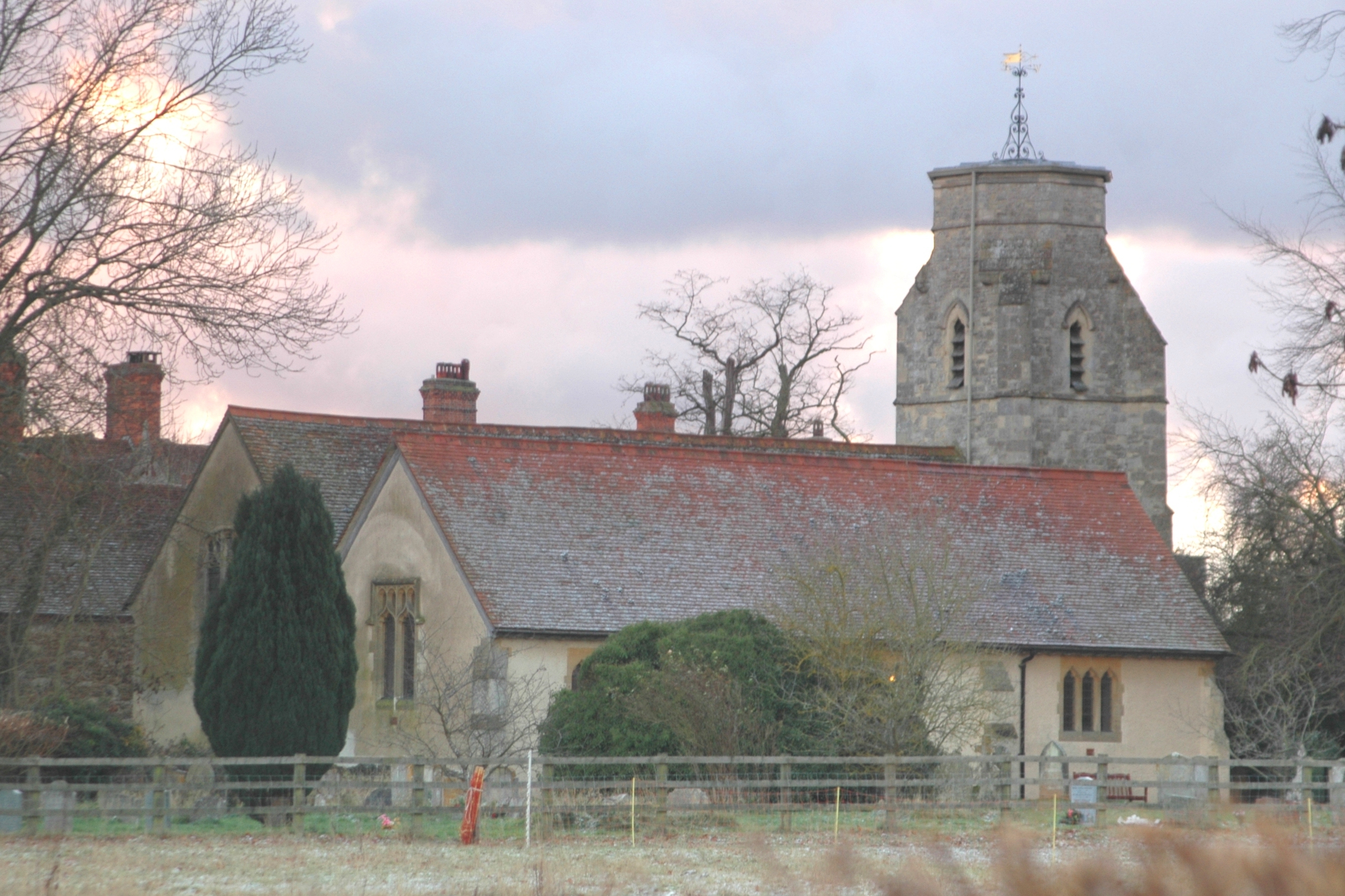
Marsh Baldon is a village and civil parish about 5 miles (8 km) southeast of Oxford in Oxfordshire, England. The parish also includes the hamlet of Little Baldon. At the 2021 census the parish had a population of 275. Marsh Baldon shares a grouped parish council with the neighbouring parish of Toot Baldon.
Adapted from Wikipedia, CC BY-SA 4.0.
Worth seeing in and around Marsh Baldon
6 places within 25 km that the world writes about, in the order of how widely: the ones a visitor has heard of first, then the ones only a local would name.
- 01Kassam Stadium
The Kassam Stadium is a football stadium in Oxford, England. It is the home of Oxford United Football Club, and is named after the ground's owner and former chairman of the football club, Firoz Kassam.
3.4 km · football stadium in Oxford, United Kingdom · Wikipedia - 02Garsington Manor
Garsington Manor, in the village of Garsington, near Oxford, England, is a country house, dating from the 17th century. Its fame derives principally from its owner in the early 20th century, the "legendary Ottoline Morrell, who held court from 1915 to 1924".
3.1 km · country house in Garsington, Oxfordshire, England, UK · Wikipedia - 03Old All Saints Church, Nuneham Courtenay
Old All Saints Church, or Harcourt Chapel, is a redundant Church of England church near the village of Nuneham Courtenay, Oxfordshire, England. It is recorded in the National Heritage List for England as a designated Grade II* listed building, and is under the care of the Churches Conservation Trust.
2.6 km · church in Nuneham Courtenay, Oxfordshire, England, UK · Wikipedia - 04Nuneham House
Nuneham House is an eighteenth century villa in the Palladian style, set in parkland at Nuneham Courtenay in Oxfordshire, England. It is currently owned by Oxford University and is used as a retreat centre by the Brahma Kumaris World Spiritual University.
2.8 km · country house in Nuneham Courtenay, Oxfordshire, England, UK · Wikipedia - 05Oxford Science Park
The Oxford Science Park is a science and technology park located on the southern edge of the city of Oxford, England. The 70 acre site was officially opened in 1991 and initially owned entirely by Magdalen College, Oxford, though a portion was sold in 2025 for the creation of the Ellison Institute of Technology.
3.7 km · research park in Oxfordshire, England · Wikipedia - 06Carfax Conduit
The Carfax Conduit was a water conduit that supplied the city of Oxford with water from 1610 until 1869. The conduit ran in an underground lead pipe from a spring on Hinksey Hill above the village of North Hinksey, beneath Seacourt Stream and the River Thames, to a building at Carfax in the centre of Oxford.
3.2 km · Grade I listed building in Nuneham Courtenay, Oxfordshire, England, UK · Wikipedia
Ranked by the number of language editions of Wikipedia with an article on each, from Wikidata; the sentences are the openings of those articles, CC BY-SA 4.0.
Getting to Marsh Baldon
- Airports
- London Heathrow (LHR), 56 km · London Luton (LTN), 60 km · London Gatwick (LGW), 92 km
- Stations
- Radley railway station, 3.9 km
- London → Marsh Baldon76 km · quickest by road, 2h 9m · £8–11
- Luton, Luton → Marsh Baldon57 km · quickest by road, 1h 55m · £7–9
- Birmingham, West Midlands → Marsh Baldon100 km · quickest by road, 2h 24m · £12–16
- Plan a tripFrom anywhereThe planner compares every way there from wherever you are.
Road and air are today’s quick answer; timetabled trains, buses and ferries load on the results page from the operators’ feeds.
No local-transport research exists yet for Marsh Baldon
Our researched notes are written from a sourced entry: every shared taxi, boat and village bus with its operator, its rule, its fare and the year we saw it, and what could not be confirmed. Nobody has done that work for Marsh Baldon. What is above is what we hold from open sources; nothing here pretends to be more.
- Get in() at Kidlington is used mainly for private and charter aircraft and has only intermittently had scheduled airline flights; it is useful only if you fly your own plane, or are able to charter a small aircraft.
- Get inBirmingham Airport has its own railway station called Birmingham International, which is connected to the airport terminal building via the free AirRail Link cable car shuttle, taking 1–2 min.
From Wikivoyage: Oxford, CC BY-SA. Not yet checked by us; that article was last edited 2026-09.
- 01112 km
- 02248 km
- 03453 km
- 04505 km
- 05541 km
If you know how people move in Marsh Baldon – the stand, the rule, the fare – tell us, and the note gets an entry.
Next door to Marsh Baldon
Marsh Baldon is 30 km from Reading, the nearest large city, whose note carries the wider picture.
- Radleyvillage and civil parish in Vale of White Horse district, Oxfordshire, England3.9 km
- Berinsfieldvillage and civil parish in South Oxfordshire, England3.2 km
- Stadhamptonvillage and civil parish in South Oxfordshire, England3.8 km
- Garsingtonvillage and civil parish in South Oxfordshire, England3.3 km
- Nuneham Courtenayvillage and civil parish in South Oxfordshire, England1.2 km
- Toot Baldonvillage and civil parish in South Oxfordshire, England1.5 km