Koolewong
Koolewong is a suburb of the Central Coast region of New South Wales, Australia between Gosford and Woy Woy, and is mostly on a hill overlooking Brisbane Water.
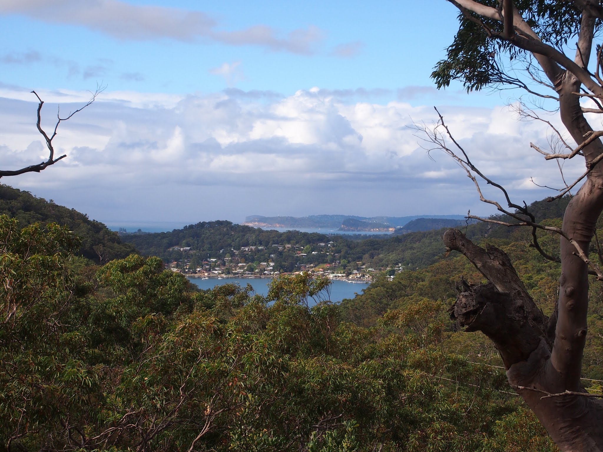
Koolewong is a suburb of the Central Coast region of New South Wales, Australia between Gosford and Woy Woy, and is mostly on a hill overlooking Brisbane Water. It is part of the Central Coast Council local government area.
Adapted from Wikipedia, CC BY-SA 4.0.
Worth seeing in and around Koolewong
4 places within 25 km that the world writes about, in the order of how widely: the ones a visitor has heard of first, then the ones only a local would name.
- 01Brisbane Water National Park
Brisbane Water National Park is a national park on the Central Coast of New South Wales, Australia. The national park is situated 70 kilometres north of Sydney and 12 kilometres southwest of Gosford.
1.7 km · National Park in New South Wales, Australia · Wikipedia - 02Mulholland's Farm
Mulholland's Farm is a heritage-listed residence at 9 Pixie Avenue, Green Point, Central Coast, New South Wales, Australia. It was built in 1907.
3.6 km · historic site in New South Wales, Australia · Wikipedia - 03Rosemount, Saratoga
Rosemount is a heritage-listed residence at 36 Village Road, Saratoga, Central Coast, New South Wales, Australia. It was built in 1917.
3.3 km · historic site in New South Wales, Australia · Wikipedia - 04Green Point Foreshore and Structures
Green Point Foreshore and Structures is a heritage-listed conservation site at 9 Pixie Avenue, Green Point, Central Coast, New South Wales, Australia. It includes the jetty, boatshed, well, and all foreshore land associated with Mulholland's Farm.
3.6 km · historic site in New South Wales, Australia · Wikipedia
Ranked by the number of language editions of Wikipedia with an article on each, from Wikidata; the sentences are the openings of those articles, CC BY-SA 4.0.
What Wikivoyage says to see
- 01Great North Road
It was built by convicts through rough terrain.
- 02Somersby Falls
Somersby Falls Rd, Somersby (8 km (5.0 mi) NW of Gosford, drive or taxi as there's no public transport available).
- 03Wondabyne
Famed for its remoteness, Wondabyne, surrounded by a river called Mullet Creek is the site of the only railway station in Australia that has inaccessible road access.
- 04Woy Woy
Woy Woy is a commuter town with an area of southern waterways, in reference to the Aboriginal name of a quantity of water.
- 05Tascott
Lends its name to a Scottish-born pioneer, who became the first person to grow sugarcane in Australia.
- 06Edogawa Commemorative Garden
A gift from Gosford's sister city Edogawa, the Japanese garden is a popular spot for people to relax and find their zen.
From Wikivoyage: Koolewong, CC BY-SA 4.0. Not yet checked by us.
Things to do
Watch an A-League match. The Central Coast Mariners are the sole professional sporting team in the Central Coast. Their men and women's teams play in the A-League Men and A-League Women respectively, the highest professional soccer leagues in Australia, with their home games being played at the Central Coast Stadium (also known by its sponsored name Industree Group Stadium).
- 01Pelican Feeding
The town named itself 'The Pelican Capital of Australia' in 1999, with a specially constructed platform with daily feeds.
- 02The Entrance Winter Blues & Jazz Festival
Memorial Park, The Entrance.
- 03Terrigal Beach
An unbroken beach that extends for 4 km (2.5 mi).
From Wikivoyage: Koolewong, CC BY-SA 4.0. Not yet checked by us.
Where to eat
GPK Erina, Erina Fair, Erina.
- 01Rhonda's Bar & Restaurant
3-5 Kurrawyba Ave, Terrigal, dine@rhondas.bar.
- 02The Grand Pavilion
46 Picnic Parade, Ettalong Beach, grandpavilionettalongbeachnswt@gmail.com.
From Wikivoyage: Koolewong, CC BY-SA 4.0. Not yet checked by us.
Getting to Koolewong
- Airports
- Sydney Kingsford Smith (SYD), 55 km · Newcastle (NTL), 89 km
- Stations
- Woy Woy railway station, 2.1 km · Koolewong railway station, 100 m · Point Clare railway station, 2.4 km · Tascott railway station, 1.7 km
- Sydney (Mascot) → Koolewong53 km · quickest by road, 2h 1m · A$10–14
- Williamtown → Koolewong87 km · quickest by road, 2h 16m · A$14–19
- Gold Coast → Koolewong640 km · quickest by air, 7h 11m · A$320–460
- Plan a tripFrom anywhereThe planner compares every way there from wherever you are.
Road and air are today’s quick answer; timetabled trains, buses and ferries load on the results page from the operators’ feeds.
No local-transport research exists yet for Koolewong
Our researched notes are written from a sourced entry: every shared taxi, boat and village bus with its operator, its rule, its fare and the year we saw it, and what could not be confirmed. Nobody has done that work for Koolewong. What is above is what we hold from open sources; nothing here pretends to be more.
- Get inFrom Palm Beach & Ettalong take the ferry to Wagstaffe.
- Get aroundSome of the trails are suitable for off road bicycles, but not all.
From Wikivoyage: Bouddi National Park, CC BY-SA. Not yet checked by us; that article was last edited 2024-04.
- 01935 km
- 021,148 km
- 031,311 km
- 041,893 km
- 054,243 km
If you know how people move in Koolewong – the stand, the rule, the fare – tell us, and the note gets an entry.
Next door to Koolewong
Koolewong is 6 km from Central Coast, the nearest large city, whose note carries the wider picture.
- Woy Woysuburb of Central Coast, New South Wales, Australia2.6 km
- Point Clarelocality in New South Wales, Australia3 km
- Woy Woy Baylocality in New South Wales, Australia2 km
- Green Pointsuburb of Central Coast, New South Wales, Australia3.8 km
- Saratogalocality in New South Wales, Australia3 km
- Tascottlocality in New South Wales, Australia1.4 km