Kebroyd
Kebroyd is a small hamlet in the civil parish of Ripponden, in the Calderdale district, in West Yorkshire, England, within the valley of the River Ryburn, between Sowerby Bridge and Ripponden.
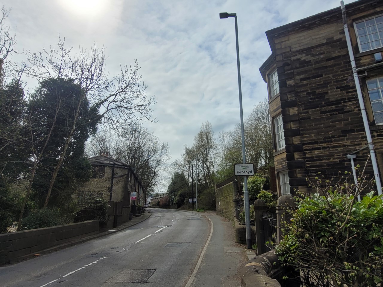
Kebroyd is a small hamlet in the civil parish of Ripponden, in the Calderdale district, in West Yorkshire, England, within the valley of the River Ryburn, between Sowerby Bridge and Ripponden. Kebroyd has an approximate population of 548 people as per the UK 2011 census.
Adapted from Wikipedia, CC BY-SA 4.0.
Worth seeing in and around Kebroyd
8 places within 25 km that the world writes about, in the order of how widely: the ones a visitor has heard of first, then the ones only a local would name.
- 01Sowerby Bridge
Sowerby Bridge is a market town in the Upper Calder Valley in Calderdale in West Yorkshire, England. The Calderdale Council ward population at the 2011 census was 11,703.
2.3 km · market town in the Upper Calder Valley in Calderdale in West Yorkshire, England · Wikipedia - 02Rochdale Canal
The Rochdale Canal is in Northern England, between Manchester and Sowerby Bridge, part of the connected system of the canals of Great Britain. Its name refers to the town of Rochdale through which it passes.
3.2 km · canal in the United Kingdom · Wikipedia - 03Tuel Lane Lock
Tuel Lane Lock is a canal lock, situated on the Rochdale Canal in Sowerby Bridge, England. It was built in 1996 as part of the canal's restoration, and replaces two previous locks, locks 3 and 4, from the original canal system.
3.2 km · canal lock on the Rochdale Canal in Sowerby Bridge, England · Wikipedia - 04Lloyds Bank
Sowerby Bridge Town Hall is a former municipal building in Town Hall Street in Sowerby Bridge, West Yorkshire, England. The building, which was initially used as the offices of the local board of health and as a public events venue, then as the home of the local Liberal Club and later as a bank branch, is a Grade II listed building.
3 km · bank building in Sowerby Bridge, West Yorkshire, England, UK · Wikipedia - 05Friendly
Friendly is a settlement near Sowerby Bridge in Calderdale, West Yorkshire, England, lying on the A646 road in the valley of the River Calder. It was described in John Bartholomew's 1887 Gazetteer of the British Isles as a village 3 miles west of Halifax.
3.3 km · area in Sowerby Bridge, West Yorkshire, England, United Kingdom · Wikipedia - 06Field House
Field House is a Grade II* listed privately owned historic house in Triangle, West Yorkshire, England.
1.6 km · Grade II* listed privately owned historic house in Sowerby, West Yorkshire, England, UK · Wikipedia - 07Ryburn Reservoir
Ryburn Reservoir is a supply reservoir operated by Yorkshire Water close to Ripponden in the Yorkshire Pennines, England. It lies in the valley of the River Ryburn and is the lower of two reservoirs built in the valley to supply Wakefield with water and was completed in 1933.
3.2 km · reservoir in West Yorkshire, England, UK · Wikipedia - 08Wood Lane Hall
Wood Lane Hall is a Grade I listed building near Sowerby, West Yorkshire, England.
2.6 km · Grade I listed house in Calderdale, West Yorkshire, England, UK · Wikipedia
Ranked by the number of language editions of Wikipedia with an article on each, from Wikidata; the sentences are the openings of those articles, CC BY-SA 4.0.
Getting to Kebroyd
- Airports
- Leeds Bradford (LBA), 27 km · Manchester (MAN), 44 km · Liverpool John Lennon (LPL), 72 km
- Stations
- Sowerby Bridge railway station, 3.1 km
- Manchester, Greater Manchester → Kebroyd30 km · quickest by road, 58 min · £3.5–4.5
- Liverpool → Kebroyd75 km · quickest by road, 1h 39m · £8–10
- Nottingham, Leicestershire → Kebroyd97 km · quickest by road, 2h 41m · £12–15
- Plan a tripFrom anywhereThe planner compares every way there from wherever you are.
Road and air are today’s quick answer; timetabled trains, buses and ferries load on the results page from the operators’ feeds.
No local-transport research exists yet for Kebroyd
Our researched notes are written from a sourced entry: every shared taxi, boat and village bus with its operator, its rule, its fare and the year we saw it, and what could not be confirmed. Nobody has done that work for Kebroyd. What is above is what we hold from open sources; nothing here pretends to be more.
- 01294 km
- 02329 km
- 03335 km
- 04336 km
- 05356 km
If you know how people move in Kebroyd – the stand, the rule, the fare – tell us, and the note gets an entry.
Next door to Kebroyd
Kebroyd is 17 km from Bradford, the nearest large city, whose note carries the wider picture.
- Rippondenvillage and civil parish in Calderdale, West Yorkshire, UK1.7 km
- Stainlandvillage in Calderdale, West Yorkshire, England3.9 km
- Barkislandvillage in West Yorkshire, United Kingdom1.5 km
- Luddenden Footvillage in West Yorkshire, England, UK3.5 km
- Norlandvillage in West Yorkshire, United Kingdom2.7 km
- Rishworthvillage in West Yorkshire, England2.8 km