Ifield, West Sussex
Ifield is a former village and now one of 14 neighbourhoods within the town of Crawley in West Sussex, England.
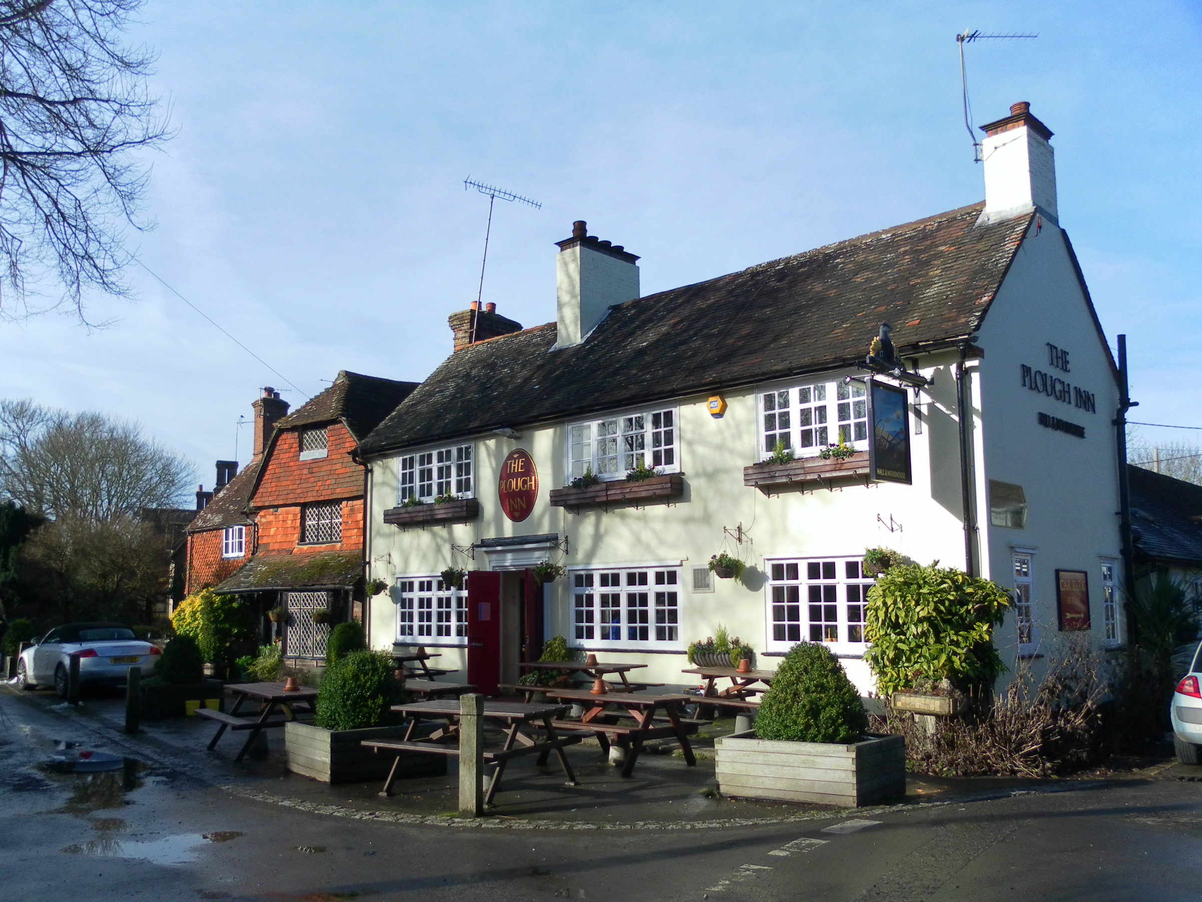
Ifield is a former village and now one of 14 neighbourhoods within the town of Crawley in West Sussex, England. Ifield is in the west of the town and is bordered by Ifield West, Horsham, Langley Green to the north east, West Green to the east across the ring road and Gossops Green and Bewbush to the south across the Arun Valley railway line.
Adapted from Wikipedia, CC BY-SA 4.0.
Worth seeing in and around Ifield, West Sussex
10 places within 25 km that the world writes about, in the order of how widely: the ones a visitor has heard of first, then the ones only a local would name.
- 01The Peoples Pension Stadium
The Broadfield Stadium is a multi-purpose stadium in Crawley, West Sussex, England. It is currently used mostly for football matches and is the home ground of Crawley Town F.C., Brighton & Hove Albion W.F.C. and the Sealand national football team.
2.8 km · football stadium in Crawley, West Sussex, England, UK · Wikipedia - 02Noor Mosque
Noor Mosque is a mosque in Crawley in the borough of West Sussex, England. The mosque was opened on 18 January 2014.
1.1 km · mosque in Crawley · Wikipedia - 03Friary Church of St Francis and St Anthony, Crawley
The Friary Church of St Francis and St Anthony is a Roman Catholic church in Crawley, a town and borough in West Sussex, England. The town's first permanent place of Roman Catholic worship was founded in 1861 next to a friary whose members, from the Order of Friars Minor Capuchin, had been invited to the area by a wealthy local family of Catholic converts.
1.8 km · church in Crawley, West Sussex, England, UK · Wikipedia - 04Providence Chapel, Charlwood
Providence Chapel is a former Nonconformist place of worship in the village of Charlwood in Surrey, England. Founded in 1816 on the outskirts of the ancient village, it was associated with Independent Calvinists and Strict Baptists throughout nearly two centuries of religious use.
3.8 km · church in Mole Valley, UK · Wikipedia - 05St Michael and All Angels Church, Lowfield Heath
St Michael and All Angels Church is a church in Lowfield Heath, a depopulated former village in the Borough of Crawley, West Sussex, England. Built by the Gothic Revival architect William Burges in 1867 to serve the village, it declined in importance as Lowfield Heath was gradually appropriated for the expansion of London Gatwick Airport and of its related development.
3.1 km · church in Lowfield Heath, West Sussex, England · Wikipedia - 06Ifield Friends Meeting House
The Ifield Friends Meeting House is a Friends meeting house in the Ifield neighbourhood of Crawley, a town and borough in West Sussex, England. Built in 1676 and used continuously since then by the Quaker community for worship, it is one of the oldest purpose-built Friends meeting houses in the world.
500 m · Grade I listed friends meeting house in Crawley, West Sussex, England, UK · Wikipedia - 07House Copse
House Copse is a 12.5-hectare biological Site of Special Scientific Interest west of Crawley in West Sussex. This ancient wood was formerly managed as hornbeam and small-leaved lime coppice with oak standards.
3.4 km · site of special scientific interest in West Sussex, England · Wikipedia - 08Buchan Hill Ponds
Buchan Hill Ponds is a 19.5-hectare biological Site of Special Scientific Interest on the south-west outskirts of Crawley in West Sussex. This site consists of two ponds and adjacent wet woodland.
3.5 km · biological Site · Wikipedia - 09Target Hill Park
Target Hill Park is a 9-hectare Local Nature Reserve in Crawley in West Sussex. It is owned by Crawley Borough Council and managed by the council and Gatwick Greenspace Partnership.
3 km · park · Wikipedia - 10St Margaret's Church, Ifield
St Margaret's Church is an Anglican church in the Ifield neighbourhood of Crawley, a town and borough in West Sussex, England. It is the ancient parish church of the village of Ifield; the medieval settlement was expanded to form one of the New Town of Crawley's 13 neighbourhoods, and the church's modern parish now serves several other neighbourhoods as well.
800 m · Grade I listed church in Ifield, West Sussex, England, UK · Wikipedia
Ranked by the number of language editions of Wikipedia with an article on each, from Wikidata; the sentences are the openings of those articles, CC BY-SA 4.0.
Getting to Ifield, West Sussex
- Airports
- London Gatwick (LGW), 3 km · London Heathrow (LHR), 42 km · London Luton (LTN), 84 km
- Stations
- London Gatwick Airport, 2.9 km · Crawley railway station, 1.9 km · Three Bridges railway station, 3.3 km · Ifield railway station, 1 km
- London → Ifield, West Sussex44 km · quickest by road, 1h 43m · £5–6
- Luton, Luton → Ifield, West Sussex86 km · quickest by road, 2h 7m · £11–15
- London, Essex → Ifield, West Sussex44 km · quickest by road, 1h 43m · £5–6
- Plan a tripFrom anywhereThe planner compares every way there from wherever you are.
Road and air are today’s quick answer; timetabled trains, buses and ferries load on the results page from the operators’ feeds.
No local-transport research exists yet for Ifield, West Sussex
Our researched notes are written from a sourced entry: every shared taxi, boat and village bus with its operator, its rule, its fare and the year we saw it, and what could not be confirmed. Nobody has done that work for Ifield, West Sussex. What is above is what we hold from open sources; nothing here pretends to be more.
- Go nextThere are many possible day trips from Horsham, here are some suggestions: Leith Hill and the Surrey Hills, 20 minutes north-northwest via the A24 and B2126, one of the most beautiful stretches of the North Downs, with the highest point in south east England.
From Wikivoyage: Horsham (West Sussex), CC BY-SA. Not yet checked by us; that article was last edited 2026-05.
- 0191 km
- 02311 km
- 03427 km
- 04593 km
- 05629 km
If you know how people move in Ifield, West Sussex – the stand, the rule, the fare – tell us, and the note gets an entry.
Next door to Ifield, West Sussex
Ifield, West Sussex is 43 km from London, the nearest large city, whose note carries the wider picture.
- Crawleytown in West Sussex, England, United Kingdom1.3 km
- Charlwoodvillage and civil parish in Mole Valley, Surrey, England, UK3.9 km
- Bewbushsuburb of Crawley, West Sussex, England, UK2.2 km
- Gossops Greensuburb in Crawley, West Sussex, England, UK1.1 km
- Three Bridgessuburb in Crawley, West Sussex, England, UK3.3 km
- Southgatesuburb of Crawley, West Sussex, England, UK2 km