Horspath
Horspath is a village and civil parish in South Oxfordshire about 3+1⁄2 miles (5.6 km) east of the centre of Oxford, England.
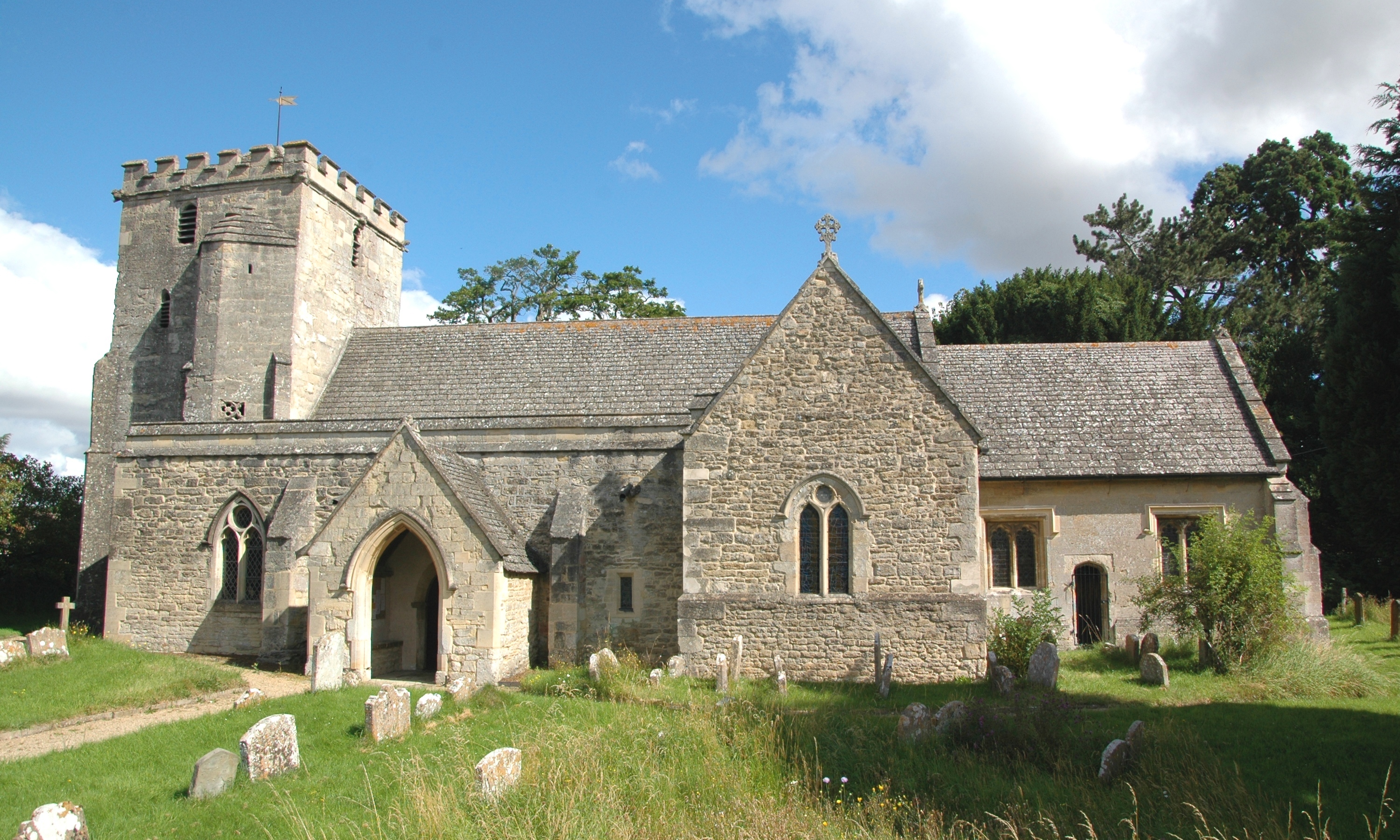
Horspath is a village and civil parish in South Oxfordshire about 3+1⁄2 miles (5.6 km) east of the centre of Oxford, England. The 2011 census recorded the parish's population as 1,378.
Adapted from Wikipedia, CC BY-SA 4.0.
Worth seeing in and around Horspath
10 places within 25 km that the world writes about, in the order of how widely: the ones a visitor has heard of first, then the ones only a local would name.
- 01Oxford Brookes University
Oxford Brookes University is a public research university in Oxford, England. It is a new university, having received university status through the Further and Higher Education Act 1992.
3.8 km · university in Oxford, England · Wikipedia - 02Kassam Stadium
The Kassam Stadium is a football stadium in Oxford, England. It is the home of Oxford United Football Club, and is named after the ground's owner and former chairman of the football club, Firoz Kassam.
3.4 km · football stadium in Oxford, United Kingdom · Wikipedia - 03Headington Shark
Untitled 1986, commonly known as the Headington Shark, is a rooftop sculpture located at 2 New High Street, Headington, Oxford, England, depicting a large shark embedded head-first in the roof of a house. It was protest art, put up without permission, to be symbolic of bombs crashing into buildings.
3.6 km · sculpture in Oxford, England, UK · Wikipedia - 04Garsington Manor
Garsington Manor, in the village of Garsington, near Oxford, England, is a country house, dating from the 17th century. Its fame derives principally from its owner in the early 20th century, the "legendary Ottoline Morrell, who held court from 1915 to 1924".
2.9 km · country house in Garsington, Oxfordshire, England, UK · Wikipedia - 05Church of All Saints, Cuddesdon
The Church of All Saints is a Church of England parish church in Cuddesdon, Oxfordshire. The church is a grade I listed building and it dates from the 12th century.
3.4 km · church in South Oxfordshire, England, UK · Wikipedia - 06Big Data Institute
The Big Data Institute, part of the Li Ka Shing Centre for Health Information and Discovery, is an interdisciplinary research institute at the University of Oxford. The institute brings together researchers from both the Nuffield Department of Population Health and the Nuffield Department of Medicine.
3.3 km · research institute · Wikipedia - 07The Kilns
The Kilns, also known as C. S. Lewis House, is the house in Risinghurst, Oxford, England, where the author C. S. Lewis wrote all of his Narnia books and other classics. The house itself was featured in the Narnia books.
2.4 km · private house in England · Wikipedia - 08Oxford Science Park
The Oxford Science Park is a science and technology park located on the southern edge of the city of Oxford, England. The 70 acre site was officially opened in 1991 and initially owned entirely by Magdalen College, Oxford, though a portion was sold in 2025 for the creation of the Ellison Institute of Technology.
3.9 km · research park in Oxfordshire, England · Wikipedia - 09St Bartholomew's Chapel, Oxford
St Bartholomew's Chapel, or Bartlemas Chapel, is a small, early-14th-century chapel, built as part of a leper hospital in Oxford, England. Founded in the early 12th century by Henry I, for twelve sick persons and a chaplain, it was granted to Oriel College by Edward III in 1328.
3.7 km · church in Oxford, UK · Wikipedia - 10Templars Square
Templars Square is a shopping centre located in Between Towns Road, Cowley, Oxford, England. It was opened in 1965 and was known as Cowley Centre until 1989.
3 km · shopping mall in Cowley, Oxfordshire · Wikipedia
Ranked by the number of language editions of Wikipedia with an article on each, from Wikidata; the sentences are the openings of those articles, CC BY-SA 4.0.
Getting to Horspath
- Airports
- London Luton (LTN), 57 km · London Heathrow (LHR), 58 km · Birmingham (BHX), 89 km
- London → Horspath77 km · quickest by road, 1h 57m · £8–10
- Luton, Luton → Horspath54 km · quickest by road, 1h 44m · £6–8
- Birmingham, West Midlands → Horspath96 km · quickest by road, 2h 20m · £12–16
- Plan a tripFrom anywhereThe planner compares every way there from wherever you are.
Road and air are today’s quick answer; timetabled trains, buses and ferries load on the results page from the operators’ feeds.
No local-transport research exists yet for Horspath
Our researched notes are written from a sourced entry: every shared taxi, boat and village bus with its operator, its rule, its fare and the year we saw it, and what could not be confirmed. Nobody has done that work for Horspath. What is above is what we hold from open sources; nothing here pretends to be more.
- Get in() at Kidlington is used mainly for private and charter aircraft and has only intermittently had scheduled airline flights; it is useful only if you fly your own plane, or are able to charter a small aircraft.
- Get inBirmingham Airport has its own railway station called Birmingham International, which is connected to the airport terminal building via the free AirRail Link cable car shuttle, taking 1–2 min.
From Wikivoyage: Oxford, CC BY-SA. Not yet checked by us; that article was last edited 2026-09.
- 01117 km
- 02250 km
- 03450 km
- 04500 km
- 05536 km
If you know how people move in Horspath – the stand, the rule, the fare – tell us, and the note gets an entry.
Next door to Horspath
Horspath is 34 km from Reading, the nearest large city, whose note carries the wider picture.
- Wheatleyvillage and civil parish in South Oxfordshire, England2.6 km
- Holtonvillage and civil parish in South Oxfordshire, England3.2 km
- Garsingtonvillage and civil parish in South Oxfordshire, England2.6 km
- Toot Baldonvillage and civil parish in South Oxfordshire, England3.9 km
- Headingtonsuburb of Oxford, Oxfordshire, England, UK4 km
- Cowleysuburb in Oxford, Oxfordshire, England2.9 km