Furness Vale
Furness Vale is a village in the High Peak district of Derbyshire, England, between New Mills and Whaley Bridge.
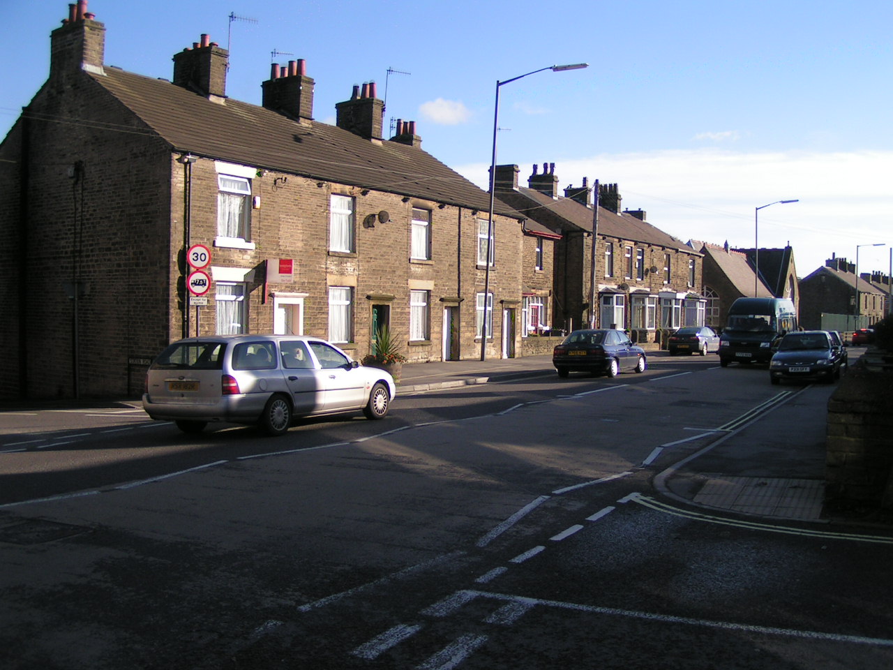
Furness Vale is a village in the High Peak district of Derbyshire, England, between New Mills and Whaley Bridge. It is bisected by the A6 road and the Peak Forest Canal, whose towpath is followed by the Goyt Way, part of the 230-mile (370 km) Midshires Way. It comes under the administration of Whaley Bridge town council and has a population of approximately 1,500.
Adapted from Wikipedia, CC BY-SA 4.0.
Worth seeing in and around Furness Vale
9 places within 25 km that the world writes about, in the order of how widely: the ones a visitor has heard of first, then the ones only a local would name.
- 01Taxal
Whaley Bridge is a town and civil parish in the High Peak district of Derbyshire, England. It is situated on the River Goyt, 16 miles south-east of Manchester, 7 miles north of Buxton, 9 miles north-east of Macclesfield and 28 miles west of Sheffield.
3.7 km · village in Whaley Bridge, High Peak, Derbyshire, England · Wikipedia - 02Toddbrook Reservoir
Toddbrook Reservoir, a feeder for the Peak Forest Canal, opened in 1838. It is above the town of Whaley Bridge in the High Peak area of Derbyshire, England.
2.7 km · reservoir in Derbyshire, England, UK · Wikipedia - 03New Mills Town Hall
New Mills Town Hall is a municipal building on Spring Bank, New Mills, Derbyshire, England. Constructed of local gritstone, it was opened in 1871 as a public hall for the Mechanics Institute, and became a town hall in 1895 upon the creation of New Mills Urban District Council, which used it as administrative headquarters until its 1974 abolition.
2.3 km · town hall in Derbyshire, England · Wikipedia - 04Bollinhurst Reservoir
The Bollinhurst Reservoir was constructed in Lyme Park in 1872 for the Stockport District Waterworks Company. At the time of the First World War, it had a capacity of 84.46 million gallons.
3.2 km · reservoir in Cheshire, England, UK · Wikipedia - 05Railway Bridge
Buxton Road Bridge is a railway bridge over the A5004 road in Whaley Bridge, in the High Peak district, in the county of Derbyshire, England. It carries the Buxton line.
2.4 km · Grade II listed railway bridge in Whaley Bridge, High Peak, Derbyshire, England, UK · Wikipedia - 06Church of St James
St. James' Church, Buxworth is a 19th-century Church of England church in the village of Buxworth, Derbyshire.
2 km · church building in Chinley, Buxworth and Brownside, High Peak, Derbyshire, England, UK · Wikipedia - 07St Mary's Church, Disley
St Mary's Church is an Anglican parish church in the diocese of Chester, the archdeaconry of Macclesfield and the deanery of Chadkirk. It is on a hill overlooking the village of Disley, Cheshire, England.
3.4 km · church in Disley, Cheshire, England, UK · Wikipedia - 08Bugsworth Basin
Bugsworth Basin is a canal basin at the terminus of the Peak Forest Canal at Buxworth in the valley of the Black Brook, close to Whaley Bridge. It was once a busy interchange with the Peak Forest Tramway, for the transport of limestone and burnt lime.
2.1 km · canal basin in the UK · Wikipedia - 09Eccles Pike
Eccles Pike is an isolated hill three miles west of Chapel en le Frith in the Derbyshire Peak District, England. It consists of gritstone, pink in colour at the summit.
3.6 km · hill in Derbyshire, United Kingdom · Wikipedia
Ranked by the number of language editions of Wikipedia with an article on each, from Wikidata; the sentences are the openings of those articles, CC BY-SA 4.0.
Getting to Furness Vale
- Airports
- Manchester (MAN), 19 km · Liverpool John Lennon (LPL), 57 km · Leeds Bradford (LBA), 61 km
- Stations
- Chinley railway station, 3.2 km · Disley railway station, 3.6 km · New Mills Central railway station, 2.1 km · Whaley Bridge railway station, 2.1 km · New Mills Newtown railway station, 1.8 km
- Liverpool → Furness Vale66 km · quickest by road, 1h 41m · £7–9
- Leeds, West Yorkshire → Furness Vale58 km · quickest by road, 1h 52m · £8–11
- Nottingham, Leicestershire → Furness Vale71 km · quickest by road, 1h 59m · £8–10
- Plan a tripFrom anywhereThe planner compares every way there from wherever you are.
Road and air are today’s quick answer; timetabled trains, buses and ferries load on the results page from the operators’ feeds.
No local-transport research exists yet for Furness Vale
Our researched notes are written from a sourced entry: every shared taxi, boat and village bus with its operator, its rule, its fare and the year we saw it, and what could not be confirmed. Nobody has done that work for Furness Vale. What is above is what we hold from open sources; nothing here pretends to be more.
- 01300 km
- 02303 km
- 03320 km
- 04356 km
- 05382 km
If you know how people move in Furness Vale – the stand, the rule, the fare – tell us, and the note gets an entry.
Next door to Furness Vale
Furness Vale is 22 km from Manchester, the nearest large city, whose note carries the wider picture.
- New Millstown and civil parish in Derbyshire, England2.3 km
- Whaley Bridgetown and civil parish in Derbyshire, England2.1 km
- Disleyvillage in Cheshire East, Cheshire, England, UK3.6 km
- Birch Valevillage in Derbyshire, England3.6 km
- Newtownsuburb of New Mills, Derbyshire, England, UK1.7 km
- Buxworthvillage in Derbyshire, UK1.9 km