East Ryde
East Ryde is a suburb of Sydney in the state of New South Wales, Australia.
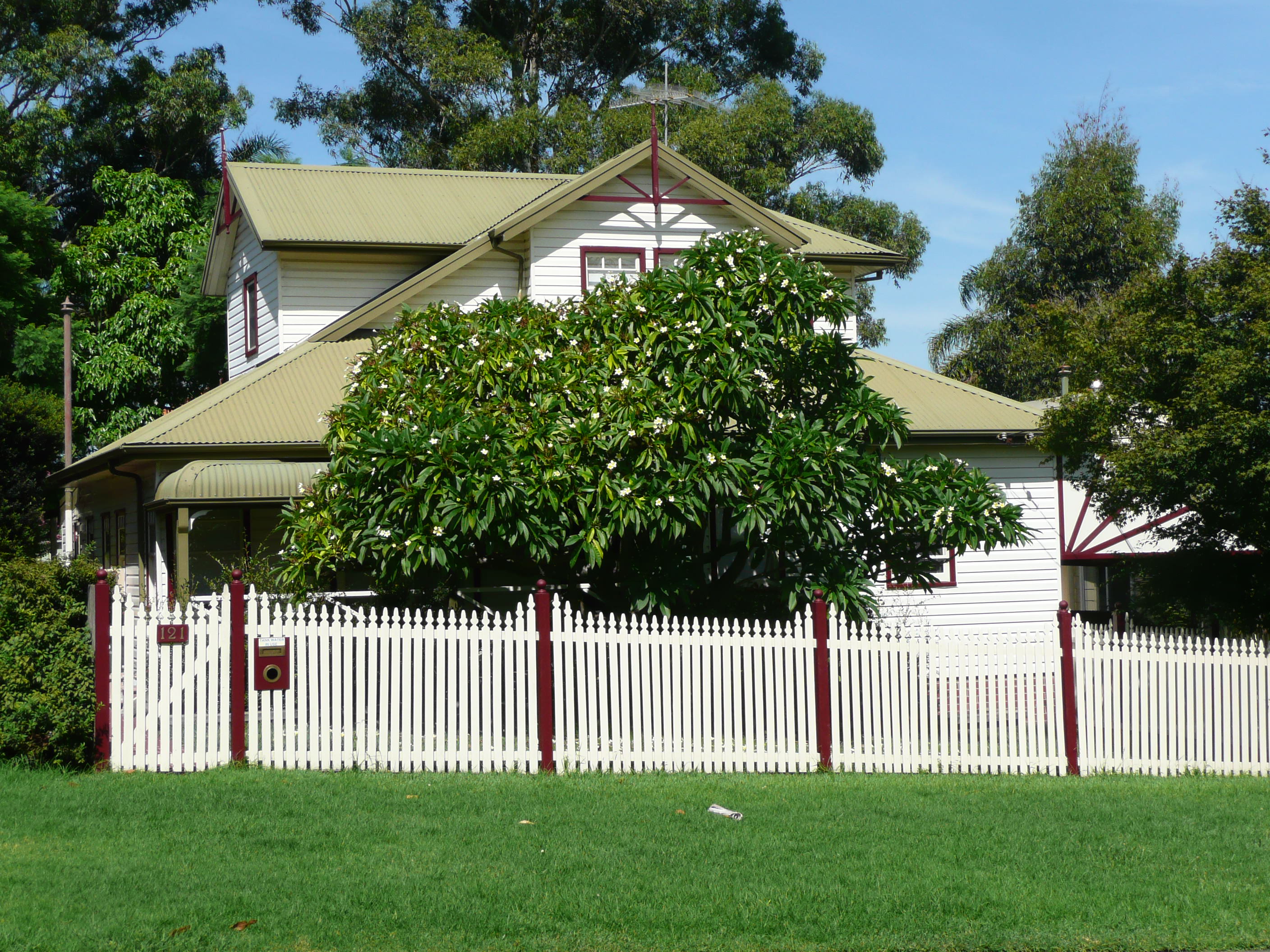
East Ryde is a suburb of Sydney in the state of New South Wales, Australia. It is in the Northern Sydney region and is located 12 kilometers north-west of the Sydney central business district, in the local government area of the City of Ryde. East Ryde sits on the western bank of the Lane Cove River. East Ryde shares the postcode of 2113 with the adjacent suburb of North Ryde, though it does not have a post office of its own.
Adapted from Wikipedia, CC BY-SA 4.0.
Worth seeing in and around East Ryde
10 places within 25 km that the world writes about, in the order of how widely: the ones a visitor has heard of first, then the ones only a local would name.
- 01Lane Cove National Park
The Lane Cove National Park is a protected national park that is located within metropolitan Sydney, in New South Wales, Australia. The 670-hectare national park is situated about 10 kilometres north-west of the Sydney central business district and features various vegetation types, such as, wet and dry sclerophyll forest, heathland, mangroves and tidal flats.
3 km · National Park in New South Wales, Australia · Wikipedia - 02Gladesville Bridge
Gladesville Bridge is a heritage-listed concrete arch road bridge that carries Victoria Road over the Parramatta River, linking the Sydney suburbs of Drummoyne and Huntleys Point, in the local government areas of Canada Bay and Hunter's Hill respectively, in New South Wales, Australia. Despite its name, the bridge is not in Gladesville.
3.8 km · bridge in Sydney, Australia · Wikipedia - 03Macquarie Centre
Macquarie Centre is a shopping centre in the suburb of Macquarie Park in the Northern Sydney region of Sydney and is located opposite the main campus of Macquarie University.
3.9 km · shopping mall in New South Wales, Australia · Wikipedia - 04Boronia Park
The Boronia Park, or the Boronia Park Reserve, is a waterfront parkland and nature reserve wholly within the suburb of Hunters Hill, in the Municipality of Hunter's Hill, New South Wales, Australia. The park dates back to pre-colonial New South Wales, with original and widely diverse flora and fauna:...Boronia Park is the best place to gain an idea of Hunter's Hill's pre-European landscape, as it has the largest intact stretch of bushland.
1.8 km · protected area in Hunters Hill, Sydney, New South Wales, Australia · Wikipedia - 05Vienna, Hunters Hill
Vienna is a heritage-listed former house and now museum at 38–40 Alexandra Street, Hunters Hill in the Municipality of Hunter's Hill local government area of New South Wales, Australia. It was built in 1871 and is known as Curan Curan, Carrum Carrum, Subiaco and Vienna Cottage.
3.3 km · historic site in New South Wales, Australia · Wikipedia - 06St Joseph's College
St Joseph's College is an independent Catholic secondary day and boarding school for boys, conducted in the Marist Brothers tradition, in Hunters Hill, a suburb on the Lower North Shore of Sydney, New South Wales, Australia. Founded by the Marist Brothers in 1881, Joeys has approximately 1,100 students from Year 7 to Year 12, including over 550 boarders, making it the largest all boys' boarding school in Australia, and one of the largest in the Southern Hemisphere.
2.4 km · boys secondary school in Hunters Hill, Sydney, New South Wales, Australia · Wikipedia - 07Tarban Creek Bridge
The Tarban Creek Bridge is a prestressed concrete arch bridge that carries the Burns Bay Road across the Tarban Creek, located west of the Sydney central business district in New South Wales, Australia. The bridge is situated between the Gladesville Bridge and the Fig Tree Bridge, being immediately to the north of Gladesville Bridge.
3.2 km · bridge in New South Wales, Australia · Wikipedia - 08NSW Schoolhouse Museum
The NSW Schoolhouse Museum, also known as the New South Wales Schoolhouse Museum of Public Education, is located within the school grounds of North Ryde Public School in North Ryde, a suburb of Sydney, New South Wales, Australia. The museum includes a replica of an 1870s classroom to be found in the original 1877 school building.
2.1 km · education museum in Sydney, Australia · Wikipedia - 09Fig Tree Bridge
The Fig Tree Bridge is a road bridge which carries Burns Bay Road across the Lane Cove River, and connects the suburbs of Hunters Hill in the south and Linley Point in the north, located approximately seven kilometres northwest of the Sydney central business district in New South Wales, Australia. The concrete girder bridge carries motor vehicles, and a grade-separated footpath and cycleway.
2.4 km · bridge in Australia · Wikipedia - 10Carisbrook, Lane Cove
Carisbrook is a heritage-listed former private residence and now house and local history museum at 334 Burns Bay Road, Lane Cove, Sydney, Australia. It was built during 1884.
2 km · historic site in New South Wales, Australia · Wikipedia
Ranked by the number of language editions of Wikipedia with an article on each, from Wikidata; the sentences are the openings of those articles, CC BY-SA 4.0.
Getting to East Ryde
- Airports
- Sydney Kingsford Smith (SYD), 16 km · Newcastle (NTL), 130 km
- Williamtown → East Ryde129 km · quickest by road, 2h 41m · A$20–26
- Gold Coast → East Ryde682 km · quickest by air, 5h 22m · A$240–350
- Toowoomba → East Ryde699 km · quickest by air, 5h 10m · A$230–350
- Plan a tripFrom anywhereThe planner compares every way there from wherever you are.
Road and air are today’s quick answer; timetabled trains, buses and ferries load on the results page from the operators’ feeds.
No local-transport research exists yet for East Ryde
Our researched notes are written from a sourced entry: every shared taxi, boat and village bus with its operator, its rule, its fare and the year we saw it, and what could not be confirmed. Nobody has done that work for East Ryde. What is above is what we hold from open sources; nothing here pretends to be more.
- Get inThe region is well serviced by public transport with trains, buses and ferries servicing the area.
- Get inThere are regular ferries from Sydney and it makes a great way to get to places near the Parramatta and Lane Cove Rivers.
- Go nextTake the ferry from Woolwich Wharf to historic Cockatoo Island.
From Wikivoyage: Sydney/Macquarie Park, CC BY-SA. Not yet checked by us; that article was last edited 2026-09.
- 01975 km
- 021,107 km
- 031,285 km
- 041,878 km
- 054,256 km
If you know how people move in East Ryde – the stand, the rule, the fare – tell us, and the note gets an entry.
Next door to East Ryde
East Ryde is 9 km from Sydney, the nearest large city, whose note carries the wider picture.
- Longuevillesuburb of Sydney, New South Wales, Australia3.8 km
- Gladesvillesuburb of Sydney, New South Wales, Australia2.1 km
- Macquarie Parksuburb of Sydney, New South Wales, Australia3.8 km
- Hunters Hillsuburb of Sydney, New South Wales, Australia3.7 km
- Lane Covesuburb of Sydney, New South Wales, Australia3.2 km
- North Rydesuburb of Sydney, New South Wales, Australia2 km