Earlswood
Earlswood is a suburb of Redhill in Surrey, England, which lies on the A23 between Redhill and Horley.
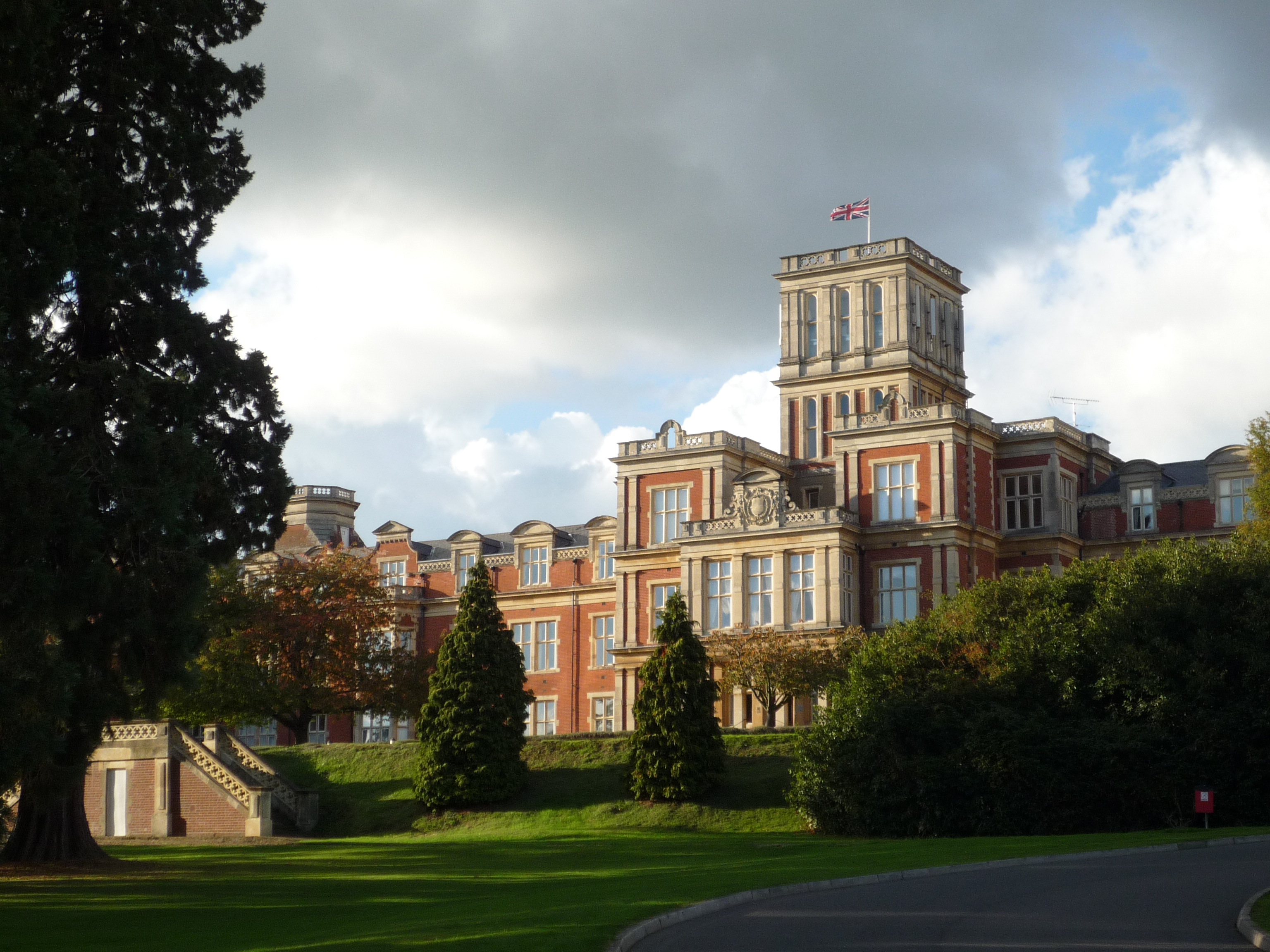
Earlswood is a suburb of Redhill in Surrey, England, which lies on the A23 between Redhill and Horley. Earlswood Common is a local nature reserve that separates the suburb from the southern outskirts of Reigate and has two lakes and picnic areas. Earlswood station is on the Brighton Main Line. To the east of the line are Royal Earlswood Park, the East Surrey Hospital and Whitebushes.
Adapted from Wikipedia, CC BY-SA 4.0.
Worth seeing in and around Earlswood
9 places within 25 km that the world writes about, in the order of how widely: the ones a visitor has heard of first, then the ones only a local would name.
- 01East Surrey College
East Surrey College is a general further education college in the north of the town of Redhill, Surrey, England. As of 2014, the college has over 2,500 classroom-based students and 1,000 community learners.
2.9 km · Further education college in Redhill, Surrey, England · Wikipedia - 02St Andrew's Church
The Church of St Andrew, Gatton is a Church of England church in Gatton, near Reigate in Surrey, England. It is a Grade I listed.
3.7 km · church in Gatton, Surrey, England, UK · Wikipedia - 03Mercers Lake
Mercers Lake is a body of water in Mercers Park, Merstham, near Redhill, Surrey. It is a former quarry that has been adapted for water sports, such as sailing, kayaking, and paddle boarding.
3.4 km · lake in Surrey, England, UK · Wikipedia - 04Nutfield Marshes
Nutfield Marshes is a 62-hectare nature reserve near Nutfield in Surrey. It is managed by the Surrey Wildlife Trust.
2.4 km · park · Wikipedia - 05Reigate Town Hall
Reigate Town Hall is a municipal building in Castlefield Road, Reigate, Surrey, England. The town hall, which is the meeting place of Reigate and Banstead Borough Council, is a Grade II listed building.
2.7 km · town hall in Reigate and Banstead, Surrey, England, UK · Wikipedia - 06Reigate Castle
Reigate Castle is a former castle in the town of Reigate in the county of Surrey, England. None of the castle buildings survive today, but a cave below the site, considered to be part of the castle, still exists.
2.8 km · castle in Reigate, Surrey, England, UK · Wikipedia - 07Reigate Priory
Reigate Priory is a Grade I listed building in Reigate, Surrey, England. It was founded in the first half of the 13th century as an Augustinian priory.
2.6 km · Grade I listed house in Reigate and Banstead, Surrey, England, UK · Wikipedia - 08Earlswood Common
Earlswood Common is an 89.1-hectare Local Nature Reserve in Redhill in Surrey. It is owned and managed by Reigate and Banstead Borough Council.
900 m · park · Wikipedia - 09St John's, Redhill
St John's is a hamlet on the fringes of Redhill, Surrey, England. The small elevated residential community occupies a conservation area encircled by Earlswood and the wooded Redhill Common, which is connected along two low to mid rise streets with typically woodland-style gardens to Reigate.
400 m · church in Redhill, Surrey, England, UK · Wikipedia
Ranked by the number of language editions of Wikipedia with an article on each, from Wikidata; the sentences are the openings of those articles, CC BY-SA 4.0.
Getting to Earlswood
- Airports
- London Gatwick (LGW), 9 km · London Heathrow (LHR), 34 km · London Luton (LTN), 73 km
- Stations
- Redhill Aerodrome, 2.8 km · Redhill railway station, 1.4 km · Nutfield railway station, 2.6 km · Reigate railway station, 2.8 km · Salfords railway station, 3 km
- Luton, Luton → Earlswood74 km · quickest by road, 1h 52m · £9–12
- London, Essex → Earlswood31 km · quickest by road, 1h 31m · £3–4
- Birmingham, West Midlands → Earlswood14 km · quickest by road, 49 min · £1.5–2
- Plan a tripFrom anywhereThe planner compares every way there from wherever you are.
Road and air are today’s quick answer; timetabled trains, buses and ferries load on the results page from the operators’ feeds.
No local-transport research exists yet for Earlswood
Our researched notes are written from a sourced entry: every shared taxi, boat and village bus with its operator, its rule, its fare and the year we saw it, and what could not be confirmed. Nobody has done that work for Earlswood. What is above is what we hold from open sources; nothing here pretends to be more.
- 01100 km
- 02314 km
- 03418 km
- 04585 km
- 05620 km
If you know how people move in Earlswood – the stand, the rule, the fare – tell us, and the note gets an entry.
Next door to Earlswood
Earlswood is 31 km from London, the nearest large city, whose note carries the wider picture.
- Reigatetown in Reigate and Banstead, Surrey, England2.7 km
- Redhilltown in Reigate and Banstead, Surrey, England1.3 km
- Reigate and Bansteadlocal government district with borough status in Surrey, England2.5 km
- Nutfieldvillage and civil parish in Surrey, United Kingdom2.9 km
- Salfordsvillage in Surrey, UK3 km
- Salfords and Sidlowcivil parish in Surrey, UK3.3 km