Dhanbad
DhanbadHindi pronunciation: [dʱənˌbɐːd̪] is the second-most populated city in the Indian state of Jharkhand after Jamshedpur and a major financial hub of Jharkhand.
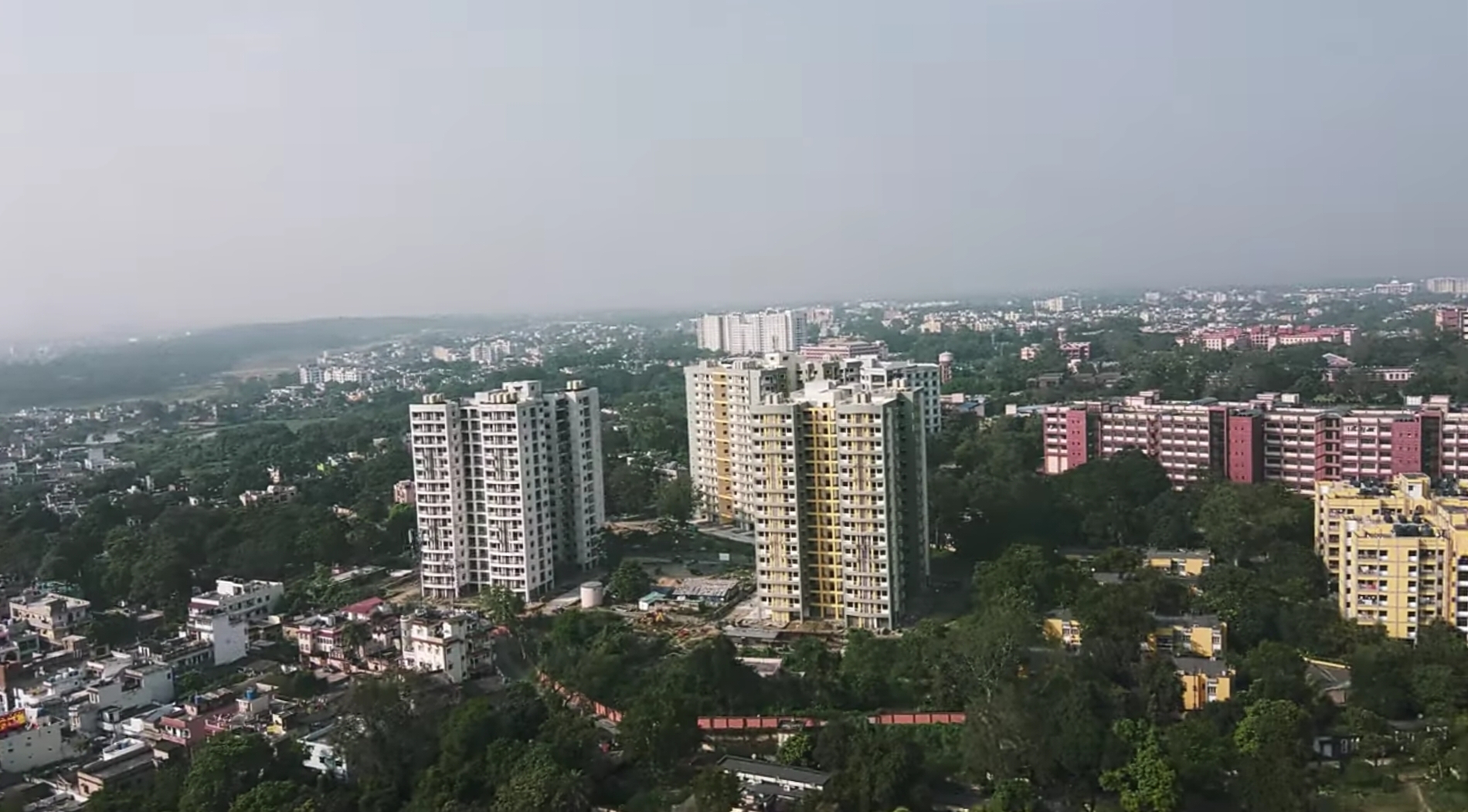
DhanbadHindi pronunciation: [dʱənˌbɐːd̪] is the second-most populated city in the Indian state of Jharkhand after Jamshedpur and a major financial hub of Jharkhand. In terms of economy, Dhanbad has the largest economy in the state of and is often referred to as the 'economic capital of Jharkhand'. Dhanbad is also an emerging center for manufacturing industries. The Dhanbad district is known for its cultural heritage and has few tourist attractions, making it a well-rounded destination. Dhanbad ranks as the 39th largest city in India and is the 33rd largest million-plus urban agglomeration in India. The Dhanbad railway division generates the highest revenue in India. Dhanbad shares its land borders with the Paschim Bardhaman district and the Purulia district of West Bengal and Bokaro, and the Giridih and Jamtara districts of Jharkhand. The city is called the 'Coal Capital of India' for housing one of the largest coal mines in the country. The prestigious institute Indian School of Mines is situated in Dhanbad. Apart from coal, it has also grown in information technology.
Adapted from Wikipedia, CC BY-SA 4.0.
Worth seeing in and around Dhanbad
5 places within 25 km that the world writes about, in the order of how widely: the ones a visitor has heard of first, then the ones only a local would name.
- 01IIT (ISM) Dhanbad
The Indian Institute of Technology Dhanbad is one of India's oldest technical universities. It is located in the mineral-rich region of eastern India, in Dhanbad, Jharkhand.
1.9 km · Public Engineering and Research Institute · Wikipedia - 02Shaheed Nirmal Mahto Medical College and Hospital, Dhanbad
Shaheed Nirmal Mahto Medical College, established in 1969, is a full-fledged tertiary government medical college and hospital.
3.4 km · Medical College in Jharkhand, India · Wikipedia - 03Raja Talab
Raja Talab is a large man-made lake located at Jharia Jharkhand, India.
6.3 km · man-made lake in Jharia Jharkhand, India · Wikipedia - 04Binod Bihari Mahto Koylanchal University
Binod Bihari Mahto Koyalanchal University is a state university located in Dhanbad, Jharkhand, India. It oversees colleges across Dhanbad and Bokaro districts, including 13 constituent and 23 affiliated colleges, as well as institutions offering B.Ed., law, nursing, medical and pharmacy programs.
1.4 km · state public university in Dhanbad, Jharkhand, India · Wikipedia - 05Railway Stadium, Dhanbad
Railway Stadium is a multi-purpose ground in Dhanbad, Jharkhand. The ground has hosted Five first-class and T20 matches for Jharkhand cricket team till 2014.
800 m · multi-propose ground in Dhanbad, Jharkhand, India · Wikipedia
Ranked by the number of language editions of Wikipedia with an article on each, from Wikidata; the sentences are the openings of those articles, CC BY-SA 4.0.
What Wikivoyage says to see
- 01Bhatinda Fall
- 02Indian Institute of Technology
It was established in 1926, and has one of the most beautiful engineering campuses in the country.
- 03Chati Gobindpur
The village is in Govindpur development block, contains two ancient pillars which are locally associated with Emperor Asoka and the Afghan Chief Sher Shah.
- 04Lilori Sthan
- 05Maithon Dam
Maithon Dam is the biggest Dam of Damodar Valley Corporation.
- 06Panchet Dam
This is the longest dam of Damodar Valley Corporation.
From Wikivoyage: Dhanbad, CC BY-SA 4.0. Not yet checked by us.
Things to do
Carnivals are arranged by Lions Club, Rotary Club and other clubs, mostly in winter and these are open to visitors also. Dhanbad is surrounded by beautiful picnic spots. People are very helpful and friendly and love visitors. Charak Pathar is a popular picnic spot. This is a village, which falls under the development block of Govindpur in the district of Dhanbad.
From Wikivoyage: Dhanbad, CC BY-SA 4.0. Not yet checked by us.
Where to eat
Hotel Skylark - Flavours Restaurant, Bank More, Dhanbad (near Railway Station),. 09:00-23:00. Multicuisine restaurant, vegetarian food, non-vegetarian food, Jain food Madhulika, Bank More, 9-Shanti Bhawan, Bank More, Dhanbad,. Take Home, Saraidhela (1.5 km from Indian school of mines main gate). till 23:00. Veg and non-veg. Try Hyderabad Chicken Biryani(₹80).
From Wikivoyage: Dhanbad, CC BY-SA 4.0. Not yet checked by us.
Getting to Dhanbad
- Airports
- Netaji Subhash Chandra Bose (CCU), 242 km
- Stations
- Dhanbad Airport, 3.8 km
- Kolkata → Dhanbad241 km · quickest by road, 4h 45m · ₹1,920–2,410
- Siliguri → Dhanbad381 km · quickest by road, 8h 42m · ₹3,720–4,650
- Bhubaneswar → Dhanbad397 km · quickest by road, 7h 28m · ₹3,260–4,070
- Plan a tripFrom anywhereThe planner compares every way there from wherever you are.
Road and air are today’s quick answer; timetabled trains, buses and ferries load on the results page from the operators’ feeds.
No local-transport research exists yet for Dhanbad
Our researched notes are written from a sourced entry: every shared taxi, boat and village bus with its operator, its rule, its fare and the year we saw it, and what could not be confirmed. Nobody has done that work for Dhanbad. What is above is what we hold from open sources; nothing here pretends to be more.
- Get inAuto rickshaws are popular transport links with neighbouring towns and in the coalfields, but these are generally overcrowded.
- Get aroundAuto rickshaws are also available till late at night.
- Get aroundThis is also a cheap mode of transport as rickshaw wallahs demand more.
From Wikivoyage: Dhanbad, CC BY-SA. Not yet checked by us; that article was last edited 2026-03.
- 01292 km
- 02560 km
- 03572 km
- 04586 km
- 05688 km
If you know how people move in Dhanbad – the stand, the rule, the fare – tell us, and the note gets an entry.
Next door to Dhanbad
Dhanbad is 32 km from Bokāro, the nearest large city, whose note carries the wider picture.
- Dhanbad districtDistrict of Jharkhand, India5.7 km
- Gobindpurhuman settlement9.8 km
- Jhariahuman settlement in India5.5 km
- Jamadobahuman settlement in Dhanbad district, North Chotanagpur division, Jharkhand, India9.4 km
- Babua Kalanhuman settlement6.8 km
- Kenduadihhuman settlement in Dhanbad district, North Chotanagpur division, Jharkhand, India5.6 km