Coombes
Coombes is a small village and civil parish in the Adur District of West Sussex, England.
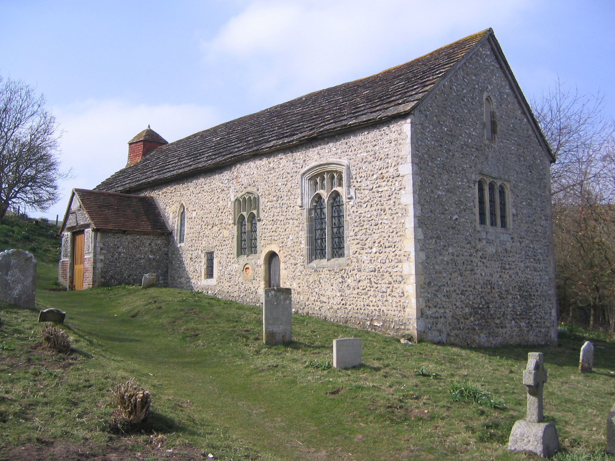
Coombes is a small village and civil parish in the Adur District of West Sussex, England. The village is in the Adur Valley 2 miles (3.2 km) northwest of Shoreham-by-Sea.
Adapted from Wikipedia, CC BY-SA 4.0.
Worth seeing in and around Coombes
10 places within 25 km that the world writes about, in the order of how widely: the ones a visitor has heard of first, then the ones only a local would name.
- 01Bramber Castle
Bramber Castle is the ruins of a Norman motte-and-bailey castle, formerly the caput of the large feudal barony of Bramber long held by the Braose family. It is situated in the village of Bramber, West Sussex, near the town of Steyning, overlooking the River Adur.
2.5 km · Norman castle in Bamber, West Sussex, England, UK · Wikipedia - 02Lancing Ring
Lancing Ring is a 29.4-hectare Local Nature Reserve in Lancing in West Sussex. It is owned and managed by Adur District Council.
2.1 km · hill in West Sussex, England, UK · Wikipedia - 03St James the Less Church, Lancing
St James the Less Church is the Anglican parish church of Lancing with Coombes, an ancient village which has been absorbed into the modern town of Lancing in the district of Adur, one of seven local government districts in the English county of West Sussex. It was founded in the 12th century in the most northerly of the three settlements in Lancing parish, which has Saxon origins.
2.8 km · church in Adur, UK · Wikipedia - 04St Mary de Haura Church, Shoreham-by-Sea
St Mary de Haura Church is an Anglican church in the ancient "New Shoreham" area of Shoreham-by-Sea in the district of Adur, one of seven local government districts in the English county of West Sussex. It was founded at the end of the 11th century as a large cruciform church which, due to its original scale, has been described as a collegiate church—a reflection of the port of Shoreham's importance at the time.
4 km · church in Shoreham-by-Sea, West Sussex, England, UK · Wikipedia - 05Jarvis Hall, Steyning
Jarvis Hall is a former Nonconformist chapel in the village of Steyning, in the Horsham district of the English county of West Sussex. Since its construction in 1835, the Classical-style building has been used by four different Nonconformist Christian denominations: the Countess of Huntingdon's Connexion, Wesleyan Methodists, the Salvation Army and Plymouth Brethren.
3.1 km · church in Steyning, Horsham, West Sussex, England, UK · Wikipedia - 06Coombes Church
Coombes Church is a Church of England parish church in the rural hamlet of Coombes in the Adur District of West Sussex, England. It has served the rural parish, northwest of Shoreham-by-Sea and next to the River Adur, since the 11th century.
200 m · church in Adur, UK · Wikipedia - 07St Nicolas' Church, Shoreham-by-Sea
St Nicolas Church is an Anglican church in Old Shoreham, an ancient inland settlement that is now part of the town of Shoreham-by-Sea in the district of Adur, one of seven local government districts in the English county of West Sussex. It was founded on a riverside site by Anglo-Saxons at the start of the 10th century, possibly on the site of a 5th-century predecessor.
2.8 km · church in Shoreham-by-Sea, West Sussex, England, UK · Wikipedia - 08Shoreham Town Hall
Shoreham Town Hall is a municipal building in the High Street, Shoreham-by-Sea, West Sussex, England. The town hall, which was the headquarters of Shoreham-by-Sea Urban District Council, is a Grade II listed building.
4 km · town hall in Adur, West Sussex, England, UK · Wikipedia - 09Marlipins Museum
Marlipins Museum, is a 12th to early-13th-century Grade II* listed building on the High Street in Shoreham-by-Sea, a town in Adur district in West Sussex, England. It is distinguished by the chequerboard pattern of limestone and flint on its front façade.
4 km · museum in West Sussex, England, United Kingdom · Wikipedia - 10Chantry House
The Chantry House is a house at 34 Church Street in Steyning, West Sussex, England. It is a Grade II* listed building, built in the 18th century.
3.4 km · house in Steyning, West Sussex, England, UK · Wikipedia
Ranked by the number of language editions of Wikipedia with an article on each, from Wikidata; the sentences are the openings of those articles, CC BY-SA 4.0.
Getting to Coombes
- Airports
- London Gatwick (LGW), 33 km · London Heathrow (LHR), 69 km · London Luton (LTN), 113 km
- Stations
- Brighton City Airport, 3 km · Shoreham-by-Sea railway station, 4 km · Steyning railway station, 3.2 km · Bramber railway station, 2.2 km
- London → Coombes73 km · quickest by road, 2h 27m · £9–11
- Luton, Luton → Coombes114 km · quickest by road, 2h 50m · £13–18
- London, Essex → Coombes73 km · quickest by road, 2h 27m · £9–11
- Plan a tripFrom anywhereThe planner compares every way there from wherever you are.
Road and air are today’s quick answer; timetabled trains, buses and ferries load on the results page from the operators’ feeds.
No local-transport research exists yet for Coombes
Our researched notes are written from a sourced entry: every shared taxi, boat and village bus with its operator, its rule, its fare and the year we saw it, and what could not be confirmed. Nobody has done that work for Coombes. What is above is what we hold from open sources; nothing here pretends to be more.
- Go nextDieppe, France – by ferry from Newhaven Harbour, about east of Brighton.
From Wikivoyage: Brighton, CC BY-SA. Not yet checked by us; that article was last edited 2026-09.
- 0173 km
- 02307 km
- 03450 km
- 04615 km
- 05651 km
If you know how people move in Coombes – the stand, the rule, the fare – tell us, and the note gets an entry.
Next door to Coombes
- Steyningtown and civil parish in West Sussex in England, United Kingdom3.1 km
- Lancingvillage and civil parish in West Sussex, England3.4 km
- Brambervillage in West Sussex, England, UK2.4 km
- Upper Beedingvillage in West Sussex, England, UK2.3 km
- Botolphsvillage in West Sussex, England, UK1 km