Compstall
Compstall is a village in the Metropolitan Borough of Stockport, Greater Manchester, England, between Marple Bridge and Romiley.
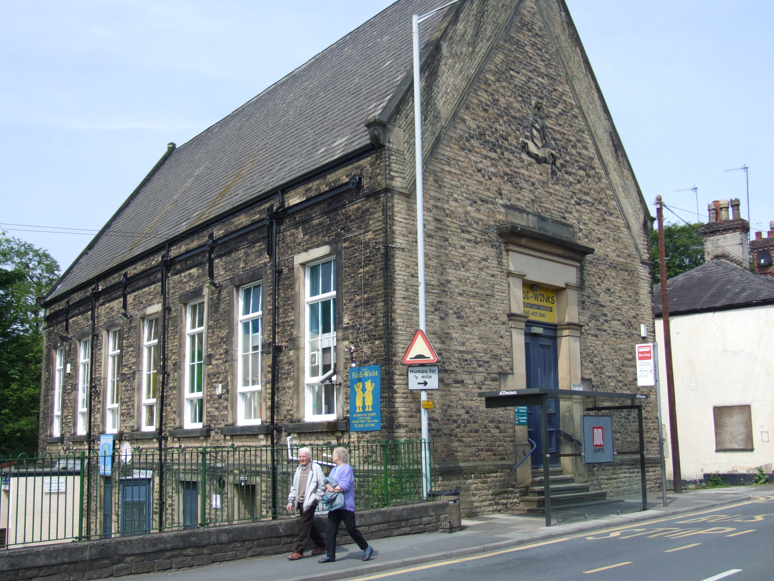
Compstall is a village in the Metropolitan Borough of Stockport, Greater Manchester, England, between Marple Bridge and Romiley. Historically part of Cheshire, it was formerly a mill village built by George Andrew in the 1820s to house his 800 workers; most of the original mill cottages and other structures remain unchanged.
Adapted from Wikipedia, CC BY-SA 4.0.
Worth seeing in and around Compstall
10 places within 25 km that the world writes about, in the order of how widely: the ones a visitor has heard of first, then the ones only a local would name.
- 01Church of St Martin, Marple
The Church of St Martin is a 19th-century church on Brabyns Brow in Marple, a town within the Metropolitan Borough of Stockport, Greater Manchester, England. It was designed by J. D. Sedding for Maria Anne Hudson, who lived in nearby Brabyns Hall, and was built between 1869 and 1870.
1.5 km · Grade II* listed church in Marple, Stockport, UK · Wikipedia - 02Marple Aqueduct
Marple Aqueduct at Marple, Greater Manchester, England, was built to carry the lower level of the Peak Forest Canal across the River Goyt. It is the highest aqueduct in England.
1.2 km · aqueduct in Greater Manchester, England · Wikipedia - 03All Saints Church, Marple
All Saints Church is in Church Lane, Marple, Greater Manchester, England. It is recorded in the National Heritage List for England as a designated Grade II listed building.
2.9 km · church in Marple, Greater Manchester, England, UK · Wikipedia - 04St George's Church, Hyde
St George's Church is on Church Street, Hyde, Greater Manchester, England. It is an active Anglican parish church in the deanery of Mottram, the archdeaconry of Macclesfield, and the diocese of Chester.
4 km · church in Hyde, Greater Manchester, England, UK · Wikipedia - 05Werneth Low
Werneth Low is a hill in Greater Manchester, England, and a part of the Pennines. It is located on the border of Stockport and Tameside, rising to a height of 279 metres.
2.2 km · hill in Tameside, Greater Manchester, UK · Wikipedia - 06Brabyns Park
Brabyns Park is a public park in Marple Bridge, Stockport, Greater Manchester, England.
900 m · park in England · Wikipedia - 07Marple Lock Flight
Marple Lock Flight is a flight of sixteen canal locks, situated on the Peak Forest Canal in Marple, a suburb of Stockport.
1.3 km · flight of sixteen canal locks, situated on the Peak Forest Canal in Marple, near Stockport · Wikipedia - 08Mellor hill fort
Mellor hill fort is a prehistoric site in North West England dating from the British Iron Age – about 800 BC to 100 AD. Situated on a hill in Mellor, Greater Manchester, on the western edge of the Peak District, the hill fort overlooks the Cheshire Plain. Although the settlement was founded during the Iron Age, evidence exists of activity on the site as far back as 8,000 BC; during the Bronze Age the hill may have been an area where funerary practices were performed.
2.5 km · prehistoric site in North West England · Wikipedia - 09St. Thomas' Church, Mellor
St. Thomas' Church is at the top of a lane overlooking the village of Mellor, Greater Manchester, England, with views over Manchester, Cheshire and beyond.
2.5 km · church in Mellor, Greater Manchester, England, UK · Wikipedia - 10Norfolk Arms And National Westminster Bank, Marple Bridge Branch
The Norfolk Arms is a Grade II listed public house on Town Street in Marple Bridge, a district of Marple within the Metropolitan Borough of Stockport, Greater Manchester, England. Dating from the early 19th century, it appears on late 19th and early 20th‑century Ordnance Survey maps as an unnamed pub.
1.4 km · building in Stockport, Greater Manchester, England, UK · Wikipedia
Ranked by the number of language editions of Wikipedia with an article on each, from Wikidata; the sentences are the openings of those articles, CC BY-SA 4.0.
Getting to Compstall
- Airports
- Manchester (MAN), 17 km · Liverpool John Lennon (LPL), 54 km · Leeds Bradford (LBA), 57 km
- Stations
- Romiley railway station, 2.3 km · Marple railway station, 1.5 km · Broadbottom railway station, 3.9 km · Rose Hill Marple railway station, 2.5 km · Bredbury railway station, 3.9 km
- Liverpool → Compstall61 km · quickest by road, 1h 27m · £7–9
- Leeds, West Yorkshire → Compstall54 km · quickest by road, 1h 30m · £7–9
- Nottingham, Leicestershire → Compstall79 km · quickest by road, 2h 22m · £9–12
- Plan a tripFrom anywhereThe planner compares every way there from wherever you are.
Road and air are today’s quick answer; timetabled trains, buses and ferries load on the results page from the operators’ feeds.
No local-transport research exists yet for Compstall
Our researched notes are written from a sourced entry: every shared taxi, boat and village bus with its operator, its rule, its fare and the year we saw it, and what could not be confirmed. Nobody has done that work for Compstall. What is above is what we hold from open sources; nothing here pretends to be more.
- Get inThe Manchester Ship Canal can only be used on the Mersey Ferry cruise from Salford to Eastham between April and October.
From Wikivoyage: Manchester, CC BY-SA. Not yet checked by us; that article was last edited 2026-09.
- 01306 km
- 02307 km
- 03312 km
- 04347 km
- 05374 km
If you know how people move in Compstall – the stand, the rule, the fare – tell us, and the note gets an entry.
Next door to Compstall
Compstall is 14 km from Manchester, the nearest large city, whose note carries the wider picture.
- Marpletown in Stockport, Greater Manchester, England1.9 km
- Chisworthvillage and civil parish in Derbyshire, England2.9 km
- Mellorvillage in Greater Manchester, UK2.5 km
- Broadbottomvillage in Tameside, Greater Manchester, England3.3 km
- Romileyarea of the Metropolitan Borough of Stockport, Greater Manchester, England2 km
- Marple Bridgevillage in the Borough of Stockport, Greater Manchester1.7 km