Belgrave South
Belgrave South is a suburb of Greater Melbourne mainly beyond the Melbourne metropolitan area Urban Growth Boundary, 37 km south-east from Melbourne's central business district, located within the Shire of Yarra Ranges local government area.
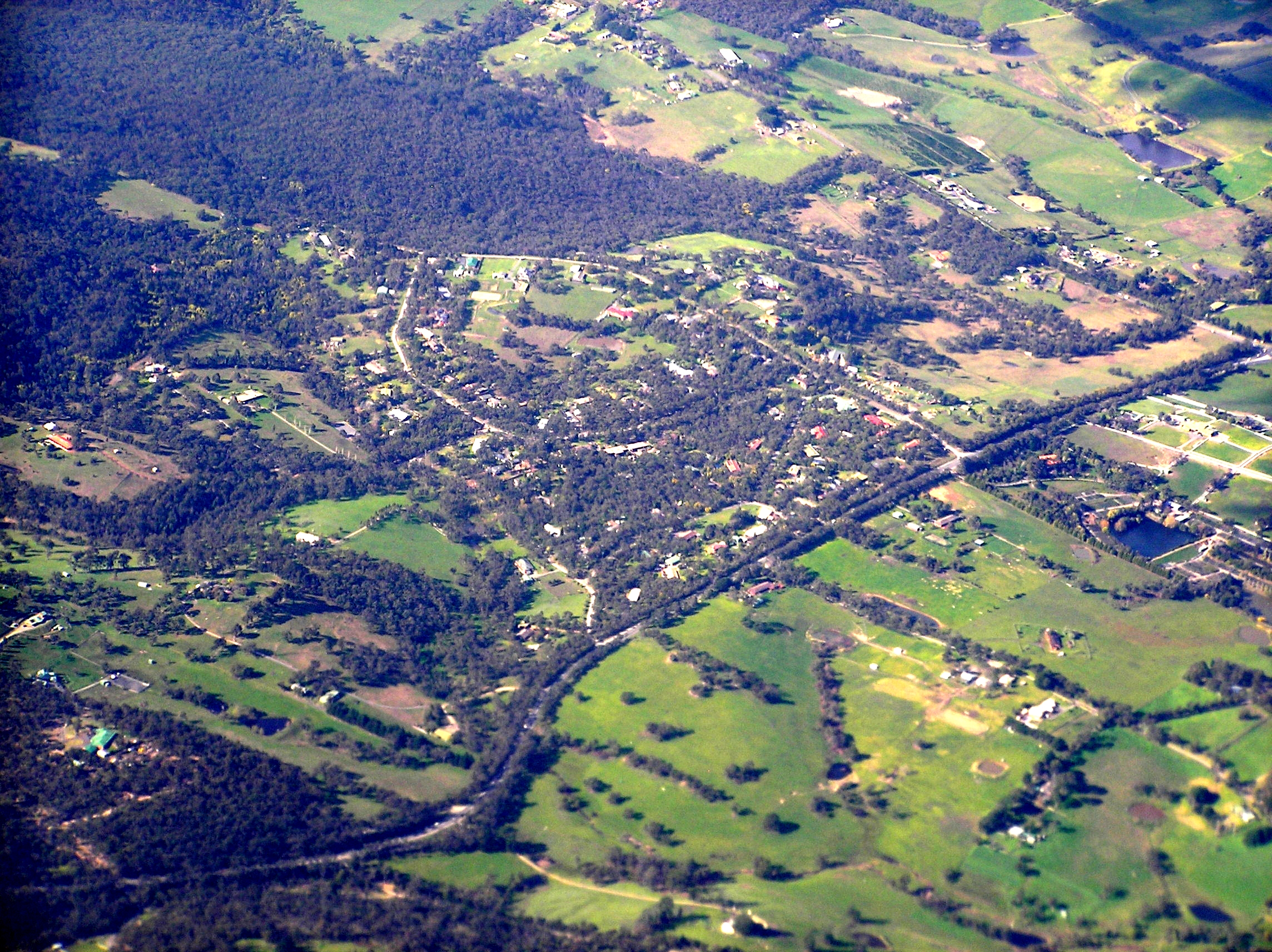
Belgrave South is a suburb of Greater Melbourne mainly beyond the Melbourne metropolitan area Urban Growth Boundary, 37 km south-east from Melbourne's central business district, located within the Shire of Yarra Ranges local government area. Belgrave South recorded a population of 1,670 at the 2021 census.
Adapted from Wikipedia, CC BY-SA 4.0.
Worth seeing in and around Belgrave South
2 places within 25 km that the world writes about, in the order of how widely: the ones a visitor has heard of first, then the ones only a local would name.
- 01Puffing Billy Railway
Puffing Billy Railway is a 2 ft 6 in narrow gauge heritage railway in the southern foothills of the Dandenong Ranges in Melbourne, Australia. The railway was one of the five narrow gauge lines of the Victorian Railways which opened around the beginning of the 20th century.
3.6 km · heritage rail service in metropolitan Melbourne, Victoria, Australia · Wikipedia - 02Monbulk Creek Trestle Bridge
The Monbulk Creek Rail Bridge, also known as the Monbulk Creek Trestle Bridge, the Puffing Billy Trestle Bridge, and the Horseshoe Bridge, is a railway trestle bridge that carries the Puffing Billy tourist train across the Monbulk Creek and over the Belgrave-Gembrook Road, located between Belgrave and Selby, in the Yarra Ranges, in the north eastern suburbs of Melbourne, in Victoria, Australia. Built in 1899 on the traditional lands of the Wurundjeri people, the bridge was added to the Victorian Heritage Register on 20 August 1982 in recognition of its historical, social, and architectural significance; and was also added to non-statutory lists by the Victorian branch of the National Trust on 18 September 1975 and the now defunct Register of the National Estate on 21 March 1978.
3.6 km · heritage-listed railway bridge in the Yarra Ranges, Melbourne, Victoria, Australia · Wikipedia
Ranked by the number of language editions of Wikipedia with an article on each, from Wikidata; the sentences are the openings of those articles, CC BY-SA 4.0.
Getting to Belgrave South
- Airports
- Melbourne (MEL), 54 km · Melbourne Avalon (AVV), 79 km
- Stations
- Belgrave (Puffing Billy) railway station, 3.6 km · Selby railway station, Melbourne, 3.1 km
- Melbourne → Belgrave South35 km · quickest by road, 59 min · A$5–7
- Geelong/Melbourne → Belgrave South30 km · quickest by road, 51 min · A$4–6
- Hobart (Cambridge) → Belgrave South575 km · quickest by air, 6h 14m · A$260–380
- Plan a tripFrom anywhereThe planner compares every way there from wherever you are.
Road and air are today’s quick answer; timetabled trains, buses and ferries load on the results page from the operators’ feeds.
No local-transport research exists yet for Belgrave South
Our researched notes are written from a sourced entry: every shared taxi, boat and village bus with its operator, its rule, its fare and the year we saw it, and what could not be confirmed. Nobody has done that work for Belgrave South. What is above is what we hold from open sources; nothing here pretends to be more.
- 01618 km
- 02761 km
- 031,594 km
- 042,020 km
- 054,244 km
If you know how people move in Belgrave South – the stand, the rule, the fare – tell us, and the note gets an entry.
Next door to Belgrave South
Belgrave South is 37 km from Melbourne, the nearest large city, whose note carries the wider picture.
- Belgravesuburb of Melbourne, Victoria, Australia3.1 km
- Tecomasuburb of Melbourne, Victoria, Australia3.9 km
- Selbylocality in Victoria, Australia3.1 km
- Belgrave Heightssuburb of Melbourne, Victoria, Australia2.4 km
- Menzies Creeklocality in Victoria, Australia3.8 km
- Narre Warren Eastlocality in Victoria, Australia2.7 km