Beitunia
Beitunia, also Bitunya, is a Palestinian city located 3 kilometers (1.9 mi) west of Ramallah and 14 kilometers (8.7 mi) north of Jerusalem, in the Ramallah and al-Bireh Governorate of Palestine, in the central West Bank.
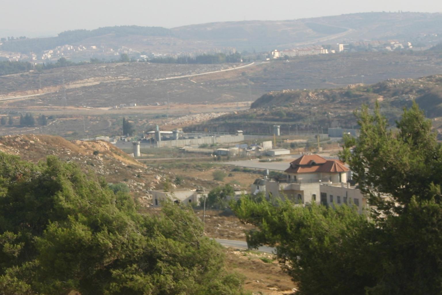
Beitunia, also Bitunya, is a Palestinian city located 3 kilometers (1.9 mi) west of Ramallah and 14 kilometers (8.7 mi) north of Jerusalem, in the Ramallah and al-Bireh Governorate of Palestine, in the central West Bank. According to the Palestinian Central Bureau of Statistics, the city had a population of 26,604 in 2017, making it the third largest locality in its governorate after al-Bireh and Ramallah.
Adapted from Wikipedia, CC BY-SA 4.0.
Worth seeing in and around Beitunia
9 places within 25 km that the world writes about, in the order of how widely: the ones a visitor has heard of first, then the ones only a local would name.
- 01Beth Horon
Bethoron, also Beth-Horon, were two neighboring towns in ancient Israel, situated on the Gibeon–Aijalon road. They served as strategic points along the road, guarding the "ascent of Bethoron".
3.9 km · Biblical site and Jewish settlement until the Talmud period · Wikipedia - 02Orthodox Church of Ramallah
The Greek Orthodox Church of Transfiguration is a church in Ramallah, West Bank, Palestine. It was inaugurated in 1852.
3.2 km · church in Ramallah, West Bank, Palestine · Wikipedia - 03Holy Family Church, Ramallah
The Holy Family Church is a Catholic Church in Ramallah, West Bank, Palestine.
3.5 km · church in Ramallah, Palestine · Wikipedia - 04Al-Manara Square
Al-Manara Square is a town square located in Ramallah, West Bank, Palestine.
3.9 km · public square in Ramallah, Palestine · Wikipedia - 05Mövenpick Hotel Ramallah
The Millennium Palestine Ramallah Hotel is a five-star hotel located in Ramallah, West Bank, Palestine. It cost $42.5 million to build.
3.6 km · building in Ramallah, Palestine · Wikipedia - 06Khirbet Beit Sila
Khirbet Beit Sila is an archaeological site located south of Beitunia, in the central West Bank. It is situated in the historical Benjamin Hills area, above Nahal Modi'im and beside a secondary route that led from the Shephelah up to Jerusalem.
1.6 km · archaeological site · Wikipedia - 07Khirbat el-Lathain
Khirbat el-Latatin is a ruin in the West Bank located about 300 meters north of the Israeli settlement of Givat Ze'ev, north west of Jerusalem, on a hill 760 meters above sea level covering an area of about four dunams.
2.2 km · archaeological site in Israel · Wikipedia - 08Byzantine West Church of Khirbet et-Tireh
The Byzantine Church of Khirbet et-Tireh is the archaeological site of a ruined church located 2 kilometres west of the city of Ramallah in Palestine. The church was established in the 4th or 5th century, continued in use through the Umayyad period, and fell out of use after the mid-8th century.
3.1 km · church in Palestine · Wikipedia - 09Bir ed-Duwali
Bir ed-Duwali, Kh. Bir ed-Dawali or Kh.
500 m · archaeological site in the central West Bank · Wikipedia
Ranked by the number of language editions of Wikipedia with an article on each, from Wikidata; the sentences are the openings of those articles, CC BY-SA 4.0.
Getting to Beitunia
- Airports
- Ben Gurion (TLV), 30 km · Marka International (Amman Civil) (ADJ), 78 km · Queen Alia (AMM), 80 km
- Eilat → Beitunia260 km · quickest by road, 5h 59m · ₪115–155
- Amman → Beitunia74 km · quickest by road, 2h 29m · JD4.5–6
- El Arish → Beitunia155 km · quickest by road, 4h 52m · E£375–500
- Plan a tripFrom anywhereThe planner compares every way there from wherever you are.
Road and air are today’s quick answer; timetabled trains, buses and ferries load on the results page from the operators’ feeds.
No local-transport research exists yet for Beitunia
Our researched notes are written from a sourced entry: every shared taxi, boat and village bus with its operator, its rule, its fare and the year we saw it, and what could not be confirmed. Nobody has done that work for Beitunia. What is above is what we hold from open sources; nothing here pretends to be more.
- Get aroundYou are almost always advised to use Shared Taxis which will be quicker although marginally more expensive.
- Get aroundBuses, like shared taxis will also tend to wait until full before departing.
- Get aroundMost shared taxis have fixed bus-stations, often car-parks near the centre of towns or cities.
- Get aroundLarger minivans carry 7 passengers and inner-city shared taxis carry 4.
- Get aroundShared taxis are often distinguished with black stripes on front and back at the sides, particularly the normal-sized cars serving inner-city routes.
From Wikivoyage: Palestinian territories, CC BY-SA. Not yet checked by us; that article was last edited 2026-09.
- 01176 km
- 02259 km
- 03382 km
- 04699 km
- 051,058 km
If you know how people move in Beitunia – the stand, the rule, the fare – tell us, and the note gets an entry.
Next door to Beitunia
Beitunia is 13 km from West Jerusalem, the nearest large city, whose note carries the wider picture.
- Ramallahcity in the State of Palestine3.3 km
- Giv'at Ze'evIsraeli town in the West Bank2.8 km
- Beit HoronIsraeli settlement in the West Bank3.9 km
- Ein 'Arikvillage council in Ramallah and al-Bireh Governorate, Palestine3 km
- Rafatvillage council in Jerusalem Governorate3.1 km
- Al-MasyounNeighborhood in Ramallah, Palestine3.1 km