Barrow Hill, Derbyshire
Barrow Hill is a village in Derbyshire, England, north-east of Chesterfield in the civil parish of Staveley.
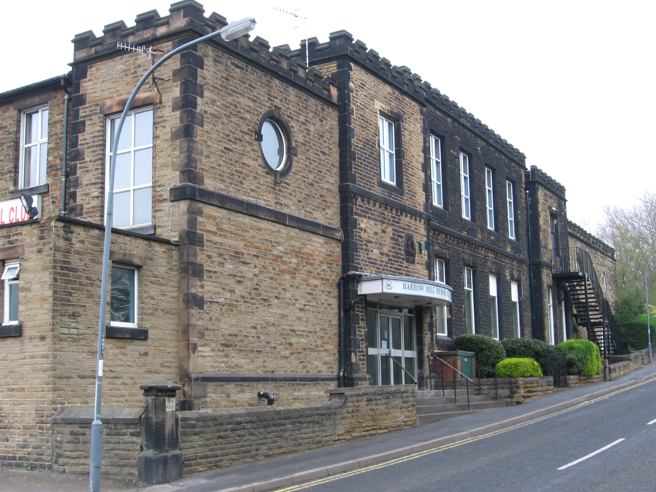
Barrow Hill is a village in Derbyshire, England, north-east of Chesterfield in the civil parish of Staveley. It was formerly the site of Barrow Hill railway station, and now Barrow Hill Engine Shed.
Adapted from Wikipedia, CC BY-SA 4.0.
Worth seeing in and around Barrow Hill, Derbyshire
10 places within 25 km that the world writes about, in the order of how widely: the ones a visitor has heard of first, then the ones only a local would name.
- 01Chesterfield
Chesterfield is a market and industrial town in the county of Derbyshire, England. It is 24 miles north of Derby and 11 miles south of Sheffield at the confluence of the Rivers Rother and Hipper.
5.4 km · market town and unparished area in Derbyshire, England · Wikipedia - 02Proact Stadium
SMH Group Stadium is an all-seater football stadium in Whittington Moor, Chesterfield, Derbyshire, on the site of the former Dema Glassworks. It is the home of Chesterfield Football Club, replacing Saltergate as the club's stadium from the start of the 2010–11 season.
4 km · football stadium · Wikipedia - 03Church of St Mary and All Saints, Chesterfield
Chesterfield Parish Church is an Anglican church dedicated to Saint Mary and All Saints, in Chesterfield, Derbyshire, England. Building of the church began in 1234 AD, though the present church dates predominantly from the 14th century.
5.3 km · church with crooked spire in Chesterfield · Wikipedia - 04Renishaw Hall
Renishaw Hall is a country house in Renishaw in the parish of Eckington in Derbyshire, England. It is a Grade I listed building and has been the home of the Sitwell family for nearly 400 years.
3.7 km · Grade I listed historic house museum in North East Derbyshire, England, UK · Wikipedia - 05The Parish Church of St Peter and St Paul
St Peter and St Paul's Church, Eckington is a Grade I listed parish church in the Church of England in Eckington, Derbyshire.
4.6 km · church in Eckington, North East Derbyshire, England, UK · Wikipedia - 06Eckington Cemetery
Eckington Cemetery is a cemetery in Eckington, Derbyshire, England. The cemetery serves Eckington itself, as well as nearby villages such as Renishaw, Ridgeway, Spinkhill, Troway and Marsh Lane, Derbyshire.
5.2 km · cemetery in England · Wikipedia - 07Church of the Immaculate Conception, Spinkhill
Immaculate Conception Church is a Roman Catholic Parish church in Spinkhill, Derbyshire, England. It was built in 1846 and designed by Joseph Hansom.
5 km · Catholic church in Derbyshire, England, UK · Wikipedia - 08Holy Trinity Church, Chesterfield
Holy Trinity Church, Chesterfield is a Grade II listed parish church in the Church of England in Chesterfield, Derbyshire.
5.1 km · grade II listed church in Derbyshire, England, UK · Wikipedia - 09Chesterfield Canal
The Chesterfield Canal is a narrow canal in the East Midlands of England and it is known locally as 'Cuckoo Dyke'. It was one of the last of the canals designed by James Brindley, who died while it was being constructed.
4.8 km · Canal in the East Midlands of England · Wikipedia - 10Tapton House
Tapton House, in Tapton, Derbyshire, England, was once the home of engineer George Stephenson, who built the first public railway line in the world to use steam locomotives. Tapton has been a gentleman's residence, a ladies' boarding school and a co-educational school.
4 km · country house in Derbyshire, England, UK · Wikipedia
Ranked by the number of language editions of Wikipedia with an article on each, from Wikidata; the sentences are the openings of those articles, CC BY-SA 4.0.
Getting to Barrow Hill, Derbyshire
- Airports
- East Midlands (EMA), 49 km · Manchester (MAN), 61 km · Leeds Bradford (LBA), 68 km
- Stations
- Chesterfield railway station, 4.9 km · Coal Aston Airfield, 4.9 km · Chesterfield coach station, 5.6 km
- Nottingham, Leicestershire → Barrow Hill, Derbyshire39 km · quickest by road, 59 min · £4–6
- Manchester, Greater Manchester → Barrow Hill, Derbyshire62 km · quickest by road, 2h 3m · £7–9
- Leeds, West Yorkshire → Barrow Hill, Derbyshire59 km · quickest by road, 1h 26m · £7–9
- Plan a tripFrom anywhereThe planner compares every way there from wherever you are.
Road and air are today’s quick answer; timetabled trains, buses and ferries load on the results page from the operators’ feeds.
No local-transport research exists yet for Barrow Hill, Derbyshire
Our researched notes are written from a sourced entry: every shared taxi, boat and village bus with its operator, its rule, its fare and the year we saw it, and what could not be confirmed. Nobody has done that work for Barrow Hill, Derbyshire. What is above is what we hold from open sources; nothing here pretends to be more.
- Go nextFor a day trip by public transport, the most accessible is along the Hope Valley railway line through Grindleford, Hathersage, Hope and Edale.
From Wikivoyage: Sheffield, CC BY-SA. Not yet checked by us; that article was last edited 2026-09.
- 01288 km
- 02323 km
- 03353 km
- 04388 km
- 05415 km
If you know how people move in Barrow Hill, Derbyshire – the stand, the rule, the fare – tell us, and the note gets an entry.
Next door to Barrow Hill, Derbyshire
Barrow Hill, Derbyshire is 13 km from Sheffield, the nearest large city, whose note carries the wider picture.
- Staveleytown in Derbyshire, England, United Kingdom2 km
- Eckingtontown and civil parish in North East Derbyshire, England3.9 km
- Unstonevillage and civil parish in North East Derbyshire, England4.2 km
- Brimingtonvillage and civil parish in Chesterfield, Derbyshire, England2 km
- Calowvillage and civil parish in North East Derbyshire, England, UK4.3 km
- Sutton cum Duckmantoncivil parish in North East Derbyshire, Derbyshire, England4.5 km