Barnoldswick
Barnoldswick is a market town and civil parish in the Borough of Pendle, Lancashire, England.
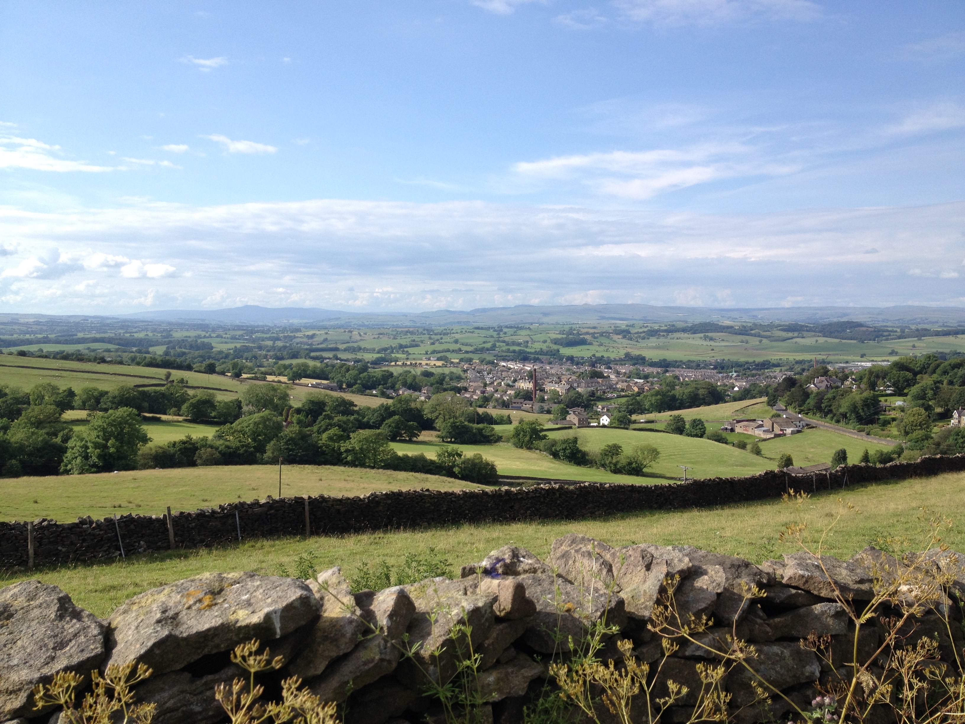
Barnoldswick is a market town and civil parish in the Borough of Pendle, Lancashire, England. It lies within the boundaries of the historic West Riding of Yorkshire. It is situated 30 miles (48 km) from Leeds and 40 miles (64 km) from Lancaster; nearby towns include Skipton to the east, Clitheroe to the west, Burnley to the south and Keighley to the east-south-east. The civil parish has a population of 10,752.
Adapted from Wikipedia, CC BY-SA 4.0.
Worth seeing in and around Barnoldswick
10 places within 25 km that the world writes about, in the order of how widely: the ones a visitor has heard of first, then the ones only a local would name.
- 01Noyna Hill
Noyna Hill is a hill in the Pennine range in Pendle, Lancashire, England. It is a mile east of Foulridge and it is possible to see other local towns such as Colne, Nelson, Trawden, Barnoldswick and Earby.
4.7 km · hill in Lancashire, United Kingdom · Wikipedia - 02Church of St Mary le Ghyll, Barnoldswick
The Church of St Mary le Ghyll is in Ghyll Lane, Barnoldswick, Lancashire, England. It is an active Anglican parish church in the deanery of Skipton, the archdeaconry of Craven, and the Diocese of Leeds.
2.2 km · church in Barnoldswick, Lancashire, England, UK · Wikipedia - 03Weets Hill
Weets Hill is a hill in the West Craven area of Pendle, Lancashire, England. It is 2+1⁄2 miles south-west of the town of Barnoldswick and is 4 miles north-east of Pendle Hill.
2.5 km · hill in Lancashire, England, UK · Wikipedia - 04Bancroft Shed
Bancroft Shed was a weaving shed in Barnoldswick, Lancashire, England, situated on the road to Skipton. Construction was started in 1914 and the shed was commissioned in 1920 for James Nutter & Sons Limited.
400 m · mill museum in Barnoldswick, Pendle, Lancashire, England, UK · Wikipedia - 05St Michael's Church, Bracewell
St Michael's Church is in Bracewell Lane, Bracewell, Lancashire, England. It is an active Anglican parish church in the deanery of Skipton, the archdeaconry of Craven, and the Diocese of Leeds.
2.3 km · Grade I listed church in Bracewell and Brogden, Pendle, Lancashire, England, UK · Wikipedia - 06Elslack Hall Cottage with garden wall adjoining to north of Elslack Hall Farmhouse
Elslack Hall is a historic building in Elslack, a village in North Yorkshire, in England. Today it has been subdivided into a farm house and cottage.
5.8 km · Grade II* listed building in Elslack, North Yorkshire, England, UK · Wikipedia - 07Cross Keys Public House
The Cross Keys is a closed pub in East Marton, a village in North Yorkshire, in England. The pub was probably built in the second half of the 18th century, on what is now the A59 road.
5.4 km · Grade II listed public house in East Marton, Craven, North Yorkshire, BD23 · Wikipedia - 08Gledstone Hall
Gledstone Hall is a 20th-century country house in West Marton, near Skipton, North Yorkshire, England. Designed by Edwin Lutyens it stands in a 12-hectare estate.
4.9 km · grade II* listed house in West Marton, North Yorkshire, England, UK · Wikipedia - 09Ingthorpe Grange
Ingthorpe Grange is a historic building near West Marton, a village in North Yorkshire, in England. In the late Mediaeval period, there was a grange of Bolton Abbey on the site.
5.7 km · building in Martons Both, Craven, England, UK · Wikipedia - 10Church of St Peter
St Peter's Church is the parish church of East Marton, a village in North Yorkshire, in England. The church was built in the 12th century, from which period the tower survives.
5.2 km · church in East Marton, North Yorkshire, England, UK · Wikipedia
Ranked by the number of language editions of Wikipedia with an article on each, from Wikidata; the sentences are the openings of those articles, CC BY-SA 4.0.
Getting to Barnoldswick
- Airports
- Leeds Bradford (LBA), 35 km · Manchester (MAN), 63 km · Liverpool John Lennon (LPL), 78 km
- Stations
- Barnoldswick railway station, 300 m
- Manchester, Greater Manchester → Barnoldswick49 km · quickest by road, 1h 21m · £5–7
- Liverpool → Barnoldswick77 km · quickest by road, 2h · £9–12
- Newcastle upon Tyne, Tyne and Wear → Barnoldswick123 km · quickest by road, 2h 42m · £15–20
- Plan a tripFrom anywhereThe planner compares every way there from wherever you are.
Road and air are today’s quick answer; timetabled trains, buses and ferries load on the results page from the operators’ feeds.
No local-transport research exists yet for Barnoldswick
Our researched notes are written from a sourced entry: every shared taxi, boat and village bus with its operator, its rule, its fare and the year we saw it, and what could not be confirmed. Nobody has done that work for Barnoldswick. What is above is what we hold from open sources; nothing here pretends to be more.
- 01264 km
- 02299 km
- 03326 km
- 04347 km
- 05364 km
If you know how people move in Barnoldswick – the stand, the rule, the fare – tell us, and the note gets an entry.
Next door to Barnoldswick
Barnoldswick is 32 km from Bradford, the nearest large city, whose note carries the wider picture.
- Pendlelocal government district with borough status in Lancashire, England, UK5.5 km
- Earbytown and civil parish in Pendle, Lancashire, UK2.9 km
- Gisburnvillage in Lancashire, England, UK5.3 km
- Middophamlet and civil parish in Lancashire, United Kingdom3.9 km
- Newsholmevillage and civil parish in Lancashire, England, UK5.8 km
- Elslackvillage and civil parish in North Yorkshire, UK5.2 km