Astley Abbotts
Astley Abbotts is a village and civil parish in the postal district of Bridgnorth, Shropshire, England, located immediately north of Bridgnorth, and straddling the B4373 Bridgnorth to Broseley road.
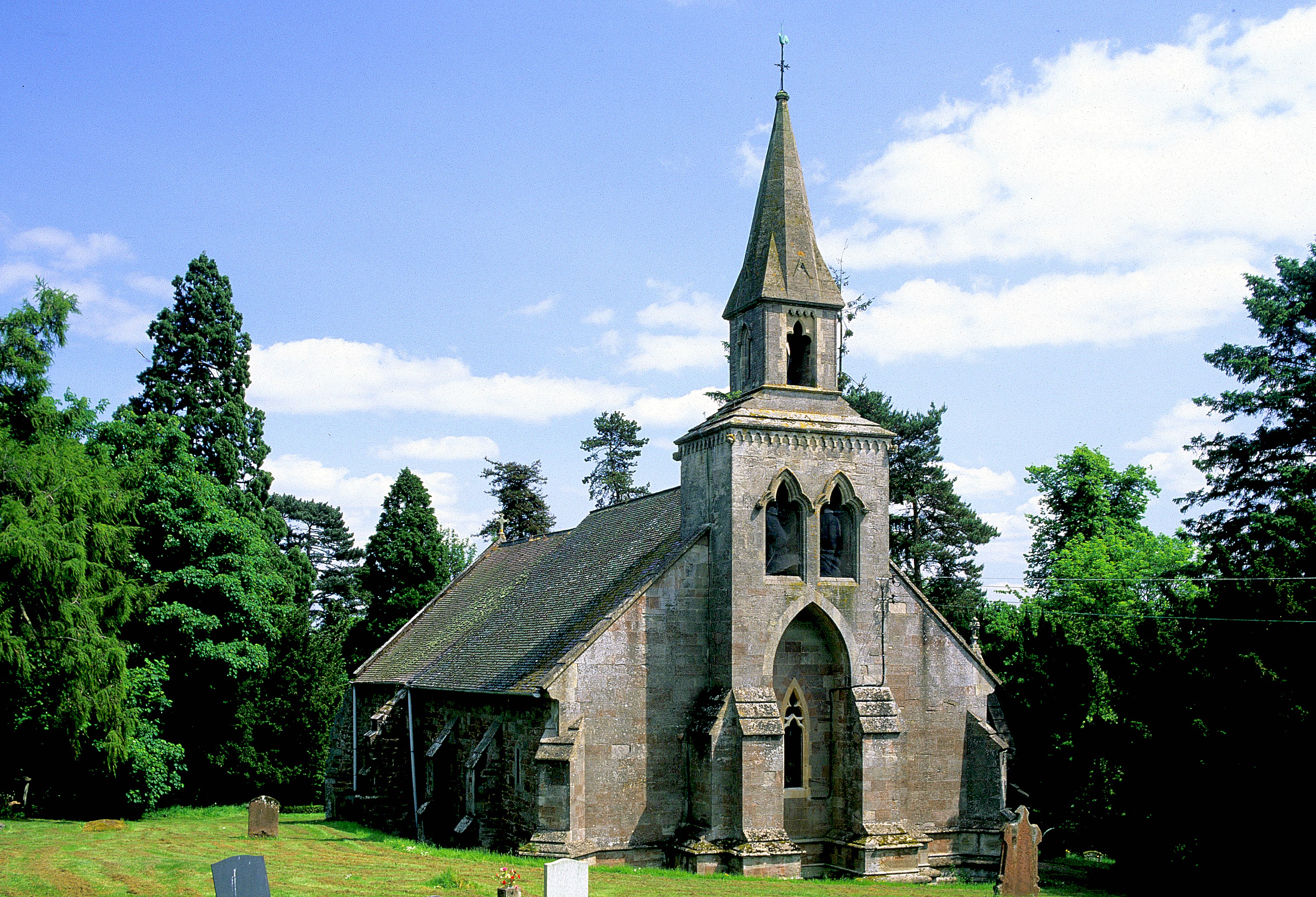
Astley Abbotts is a village and civil parish in the postal district of Bridgnorth, Shropshire, England, located immediately north of Bridgnorth, and straddling the B4373 Bridgnorth to Broseley road. According to the 2001 census the parish had a population of 396.
Adapted from Wikipedia, CC BY-SA 4.0.
Worth seeing in and around Astley Abbotts
8 places within 25 km that the world writes about, in the order of how widely: the ones a visitor has heard of first, then the ones only a local would name.
- 01Bridgnorth Castle
Bridgnorth Castle is a castle in the town of Bridgnorth, Shropshire. It is a scheduled monument, first listed in 1928.
3.6 km · castle in Bridgnorth, Shropshire, England, UK · Wikipedia - 02St Leonard's Church, Linley
St Leonard's Church is in the hamlet of Linley, Shropshire, England. It is a redundant church under the care of the Churches Conservation Trust.
3.1 km · church in Shropshire, England, UK · Wikipedia - 03Aldenham Park
Aldenham Park, also known as Aldenham Hall, is a late 17th-century country house in Morville, near Bridgnorth, Shropshire, England which stands in 12 hectares of parkland. It is a Grade II* listed building.
3.9 km · country house in Morville, Shropshire, England, UK · Wikipedia - 04St Leonard's Church, Bridgnorth
St Leonard's Church is a redundant Anglican church in Bridgnorth, Shropshire, England. It is recorded in the National Heritage List for England as a designated Grade II* listed building, and is under the care of the Churches Conservation Trust.
3.1 km · church in Shropshire, England, UK · Wikipedia - 05The New Market Hall
The New Market Hall, also known as the New Market Buildings, is a building in Bridgnorth, Shropshire, United Kingdom, built between 1855 and 1859. It is a Grade II listed building.
3.4 km · building in Bridgnorth, Shropshire, England, UK · Wikipedia - 06Apley Hall
Apley Hall is an English Gothic Revival house located in the parish of Stockton near Bridgnorth, Shropshire. The building was completed in 1811 with adjoining property of 180 acres of private parkland beside the River Severn.
1.9 km · Grade II* listed country house in Shropshire, England, UK · Wikipedia - 07Stanley Hall, Shropshire
Stanley Hall, near Astley Abbotts in Shropshire, England, is a Grade II–listed building that first gained its protected status in 1970. It probably dates to the early 17th century.
1 km · English country house · Wikipedia - 08Church of St. Mary Magdalene, Bridgnorth
The Church of St. Mary Magdalene, Bridgnorth, is a parish Church in the Church of England, standing in East Castle Street, Bridgnorth, Shropshire, England.
3.6 km · church in Bridgnorth, Shropshire, England, UK · Wikipedia
Ranked by the number of language editions of Wikipedia with an article on each, from Wikidata; the sentences are the openings of those articles, CC BY-SA 4.0.
Getting to Astley Abbotts
- Airports
- Birmingham (BHX), 48 km · East Midlands (EMA), 80 km · Manchester (MAN), 88 km
- Stations
- Bridgnorth railway station, 3.8 km
- Birmingham, West Midlands → Astley Abbotts37 km · quickest by road, 1h 20m · £4.5–6
- Nottingham, Leicestershire → Astley Abbotts97 km · quickest by road, 2h 36m · £12–16
- Manchester, Greater Manchester → Astley Abbotts103 km · quickest by road, 2h 56m · £12–16
- Plan a tripFrom anywhereThe planner compares every way there from wherever you are.
Road and air are today’s quick answer; timetabled trains, buses and ferries load on the results page from the operators’ feeds.
No local-transport research exists yet for Astley Abbotts
Our researched notes are written from a sourced entry: every shared taxi, boat and village bus with its operator, its rule, its fare and the year we saw it, and what could not be confirmed. Nobody has done that work for Astley Abbotts. What is above is what we hold from open sources; nothing here pretends to be more.
- Get inHolyhead's ferry port ensures that the north of Wales is well connected with the whole West Midlands.
From Wikivoyage: West Midlands (region), CC BY-SA. Not yet checked by us; that article was last edited 2026-09.
- 01218 km
- 02223 km
- 03379 km
- 04415 km
- 05438 km
If you know how people move in Astley Abbotts – the stand, the rule, the fare – tell us, and the note gets an entry.
Next door to Astley Abbotts
Astley Abbotts is 37 km from Birmingham, the nearest large city, whose note carries the wider picture.
- Bridgnorthtown and civil parish in Shropshire, England, UK3.3 km
- Tasleyvillage and civil parish in Shropshire, England3 km
- Apley Forgevillage in Shropshire, England, UK900 m
- Burcotehamlet in Shropshire, England, UK3.8 km