Arverne
Arverne is a neighborhood in the New York City borough of Queens, on the Rockaway Peninsula.
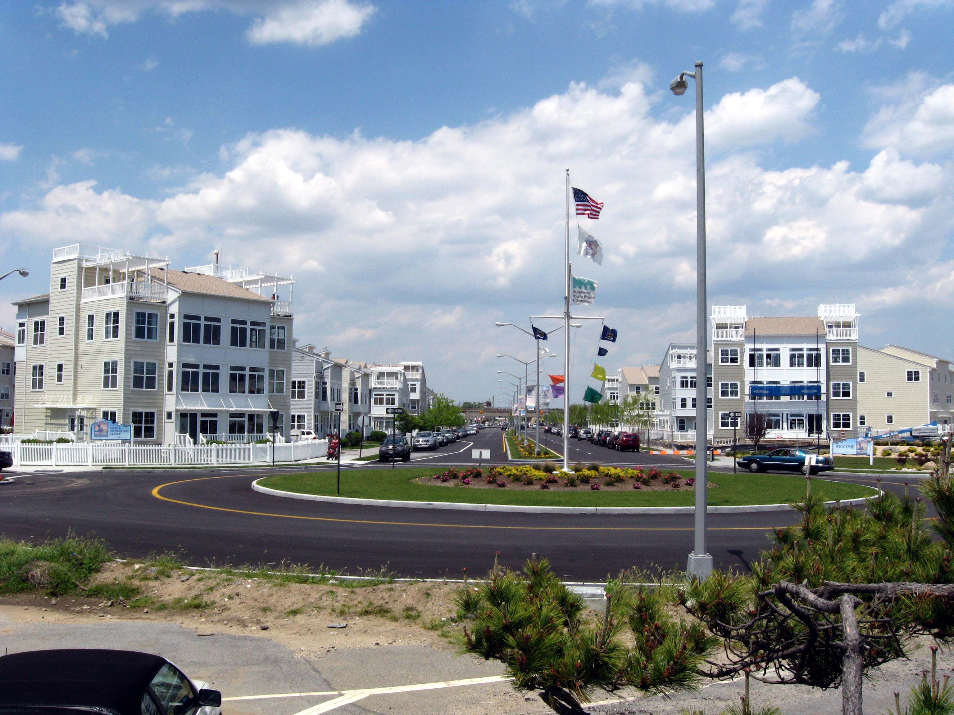
Arverne is a neighborhood in the New York City borough of Queens, on the Rockaway Peninsula. It was initially developed by Remington Vernam, whose signature "R. Vernam" inspired the name of the neighborhood. Arverne extends from Beach 54th Street to Beach 79th Street, along its main thoroughfare Beach Channel Drive, alternatively known as Rev. Joseph H. May Drive.
Adapted from Wikipedia, CC BY-SA 4.0.
Worth seeing in and around Arverne
7 places within 25 km that the world writes about, in the order of how widely: the ones a visitor has heard of first, then the ones only a local would name.
- 01TWA Flight Center
The TWA Flight Center is a building at John F. Kennedy International Airport in Queens, New York, United States. Designed by Eero Saarinen and Associates for Trans World Airlines, the building was completed in 1962 and operated as an airport terminal for four decades.
6.4 km · building in New York City · Wikipedia - 02Jacob Riis Park
Jacob Riis Park, also called Jacob A. Riis Park and Riis Park, is a seaside park on the southwestern portion of the Rockaway Peninsula in the New York City borough of Queens. It lies at the foot of the Marine Parkway–Gil Hodges Memorial Bridge, east of Fort Tilden, and west of Neponsit and Rockaway Beach.
7.2 km · beachfront park in New York City · Wikipedia - 03New York's 5th congressional district
New York's 5th congressional district is a congressional district for the United States House of Representatives, represented by Democrat Gregory Meeks. The district is located in Queens.
2.5 km · U.S. House district for New York · Wikipedia - 04Marine Parkway-Gil Hodges Memorial Bridge
The Marine Parkway–Gil Hodges Memorial Bridge is a vertical-lift bridge in New York City, New York, that crosses Rockaway Inlet. The bridge, which opened on July 3, 1937, connects the Rockaway Peninsula in Queens, with Flatbush Avenue, in turn providing access to Floyd Bennett Field, Belt Parkway, and the Marine Park neighborhood in Brooklyn.
7.8 km · bridge in New York · Wikipedia - 05Cross Bay Veterans Memorial Bridge
The Cross Bay Veterans Memorial Bridge is a toll bridge that carries Cross Bay Boulevard across Jamaica Bay in Queens, New York City, between Broad Channel and the Rockaway Peninsula.
2.1 km · bridge in Queens, New York · Wikipedia - 06Fort Tilden
Fort Tilden, also known as Fort Tilden Historic District, is a former United States Army installation on the coast in the New York City borough of Queens. Fort Tilden now forms part of the Gateway National Recreation Area, and is administered by the National Park Service.
9.1 km · park and historic military installation in New York City · Wikipedia - 07Joseph P. Addabbo Memorial Bridge
The Joseph P. Addabbo Memorial Bridge is a bridge that carries Cross Bay Boulevard across Jamaica Bay in Queens, New York City, between Howard Beach and Broad Channel. The fixed bridge, carrying six lanes of Cross Bay Boulevard, is named for the late Joseph P. Addabbo, who represented the area in the United States House of Representatives from 1961 to 1986.
6.7 km · bridge in Queens, New York · Wikipedia
Ranked by the number of language editions of Wikipedia with an article on each, from Wikidata; the sentences are the openings of those articles, CC BY-SA 4.0.
Getting to Arverne
- Airports
- John F. Kennedy (JFK), 6 km · LaGuardia (LGA), 22 km · Newark Liberty (EWR), 34 km
- Stations
- John F. Kennedy International Airport, 5.7 km · Floyd Bennett Field, 8.1 km · Rockaway Park–Beach 116th Street station, 3.6 km · Far Rockaway – Mott Avenue, 3.7 km · Broad Channel, 2.7 km
- Philadelphia → Arverne136 km · quickest by road, 3h 1m · $13–18
- Hartford → Arverne160 km · quickest by road, 3h 36m · $15–21
- Providence/Warwick → Arverne230 km · quickest by road, 5h 1m · $23–31
- Plan a tripFrom anywhereThe planner compares every way there from wherever you are.
Road and air are today’s quick answer; timetabled trains, buses and ferries load on the results page from the operators’ feeds.
No local-transport research exists yet for Arverne
Our researched notes are written from a sourced entry: every shared taxi, boat and village bus with its operator, its rule, its fare and the year we saw it, and what could not be confirmed. Nobody has done that work for Arverne. What is above is what we hold from open sources; nothing here pretends to be more.
- Get inNYC Ferry runs a ferry from the Financial District in Manhattan via Southwest Brooklyn in Brooklyn.
From Wikivoyage: Queens/The Rockaways, CC BY-SA. Not yet checked by us; that article was last edited 2025-09.
- 0155 km
- 02560 km
- 032,616 km
- 042,622 km
- 052,746 km
If you know how people move in Arverne – the stand, the rule, the fare – tell us, and the note gets an entry.
Next door to Arverne
Arverne is 11 km from Queens, the nearest large city, whose note carries the wider picture.
- Rockawayneighborhoods of Queens in New York City1.8 km
- Far Rockawayneighborhood in borough of Queens, New York City, United States3.4 km
- Jamaica Bay Wildlife RefugeWildlife refuge in New York City4.1 km
- Rockaway Beachneighborhood in borough of Queens, New York City, New York, United States1.4 km
- Ozone Parkneighborhood in Queens, New York City, United States9.6 km
- Rockaway Parkneighborhood in Queens, New York, United States of America4.1 km