Abinger Hammer
Abinger Hammer is a village in the Mole Valley district of Surrey, England.
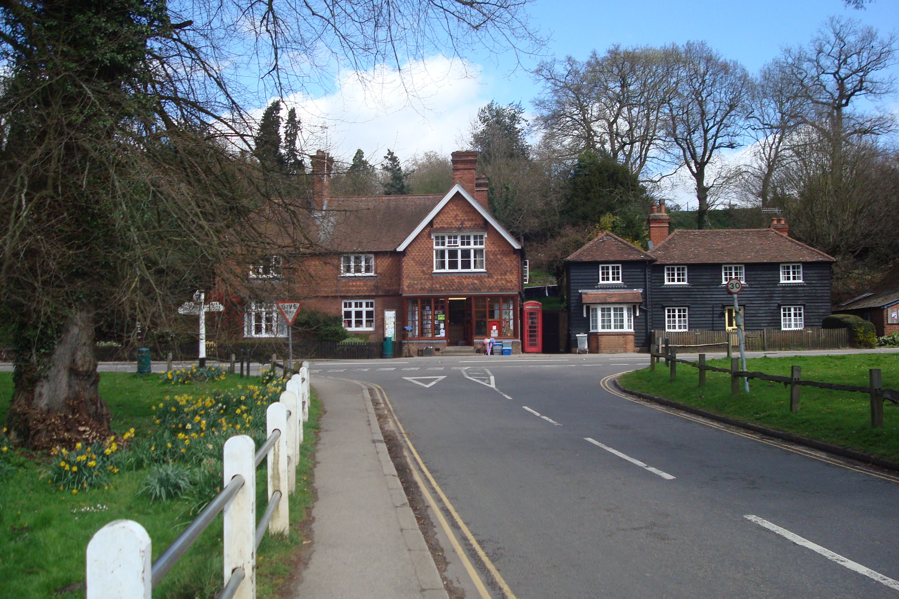
Abinger Hammer is a village in the Mole Valley district of Surrey, England. It lies in the Vale of Holmesdale in the Surrey Hills National Landscape and is located on the A25 about 6 miles (9.7 km) east of Guildford and 4+1⁄2 miles (7.2 km) west of Dorking. The village is named after its water-powered iron forge.
Adapted from Wikipedia, CC BY-SA 4.0.
Worth seeing in and around Abinger Hammer
10 places within 25 km that the world writes about, in the order of how widely: the ones a visitor has heard of first, then the ones only a local would name.
- 01Abinger Castle
Abinger Castle is an earthwork motte and bailey that was topped with a small wooden fortress. It is located in Abinger Common, between Guildford and Dorking in Surrey, England.
2.4 km · castle in Surrey, England, UK · Wikipedia - 02Silent Pool
Silent Pool is a spring-fed lake at the foot of the North Downs, about 4 miles east of Guildford in Surrey. The outflow from Silent Pool runs into a second, adjacent, lake, Sherbourne Pond, created in the mid-seventeenth century.
3.6 km · lake in the United Kingdom · Wikipedia - 03Old St Peter and St Paul's Church, Albury
Old St Peter and St Paul's Church is a former Anglican church near the village of Albury, Surrey, England in the care of The Churches Conservation Trust. It is recorded in the National Heritage List for England as a designated Grade I listed building.
3.2 km · Grade I listed church in Albury, Surrey, England, UK · Wikipedia - 04Wotton House
Wotton House is a hotel, wedding venue, conference centre and former country house in Wotton near Dorking, Surrey, England. Originally the centre of the Wotton Estate and the seat of the Evelyn family, it was the birthplace in 1620 of diarist and landscape gardener John Evelyn, who built the first Italian garden in England there.
2.7 km · country house hotel in Wotton, Surrey, England, UK · Wikipedia - 05Church of St James, Abinger
St James's Church stands on Abinger Lane in Abinger Common, a small village within the civil parish of Abinger in Surrey, south-eastern England. The church was built in the early 12th century and then rebuilt around 1220, and is today a grade II* listed building.
2.5 km · church in Abinger, Surrey, England, UK · Wikipedia - 06Abinger Common War Memorial
Abinger Common War Memorial is a First World War memorial in the village of Abinger Common in Surrey, south-eastern England. The memorial was destroyed by a German bomb during the Second World War and rebuilt in the late 1940s.
2.5 km · war memorial in Abinger, Mole Valley, Surrey, England, UK · Wikipedia - 07Albury Park
Albury Park is a country park and Grade II* listed historic country house in Surrey, England. It covers over 150 acres; within this area is the old village of Albury, which consists of three or four houses and a church.
3.2 km · country house in Surrey, England, UK · Wikipedia - 08Goddards
Goddards is a Grade II*-listed house in Abinger Common, Surrey, England, completed in 1900. It was designed by Edwin Lutyens in the ideals of the Arts and Crafts movement and the west-facing courtyard garden was designed by Gertrude Jekyll.
3.3 km · country house in Surrey, England, UK · Wikipedia - 09Hackhurst and White Downs
Hackhurst and White Downs is a 185.1-hectare biological Site of Special Scientific Interest west of Dorking in Surrey. White Downs is a Nature Conservation Review site, Grade 2, and part of it is in the 200-hectare White Downs nature reserve, which is owned by the Wotton Estate and managed by the Surrey Wildlife Trust.
2.6 km · Site of Special Scientific Interest in Surrey, England, UK · Wikipedia - 10Colekitchen Down
Colekitchen Down is a 3-hectare nature reserve north of Gomshall in Surrey. It is managed by the Surrey Wildlife Trust.
1.6 km · park · Wikipedia
Ranked by the number of language editions of Wikipedia with an article on each, from Wikidata; the sentences are the openings of those articles, CC BY-SA 4.0.
Getting to Abinger Hammer
- Airports
- London Gatwick (LGW), 19 km · London Heathrow (LHR), 28 km · London Luton (LTN), 73 km
- Stations
- Gomshall railway station, 700 m
- Luton, Luton → Abinger Hammer74 km · quickest by road, 1h 48m · £8–11
- London, Essex → Abinger Hammer39 km · quickest by road, 1h 37m · £5–7
- Bristol → Abinger Hammer153 km · quickest by road, 2h 57m · £16–21
- Plan a tripFrom anywhereThe planner compares every way there from wherever you are.
Road and air are today’s quick answer; timetabled trains, buses and ferries load on the results page from the operators’ feeds.
No local-transport research exists yet for Abinger Hammer
Our researched notes are written from a sourced entry: every shared taxi, boat and village bus with its operator, its rule, its fare and the year we saw it, and what could not be confirmed. Nobody has done that work for Abinger Hammer. What is above is what we hold from open sources; nothing here pretends to be more.
- Go nextRoad/rail links to Oxford (with organised day trips to Blenheim Palace or Henley on Thames) and Salisbury (with organised day trips to the Stonehenge museum) are good.
From Wikivoyage: Surrey, CC BY-SA. Not yet checked by us; that article was last edited 2026-09.
- 0185 km
- 02295 km
- 03434 km
- 04576 km
- 05612 km
If you know how people move in Abinger Hammer – the stand, the rule, the fare – tell us, and the note gets an entry.
Next door to Abinger Hammer
Abinger Hammer is 38 km from Brent, the nearest large city, whose note carries the wider picture.
- Sherevillage and civil parish in Surrey, England2.5 km
- Abingervillage and civil parish in Mole Valley, Surrey, England2 km
- Wottonvillage and civil parish in Surrey, England, UK3.2 km
- Gomshallvillage in Surrey, UK1.2 km
- Holmbury St Maryvillage in Surrey, England, UK2.7 km
- Peaslakevillage in Surrey, England, UK1.4 km