Nuevo Laredo
Nuevo Laredo is a city in the Municipality of Nuevo Laredo in the Mexican state of Tamaulipas.
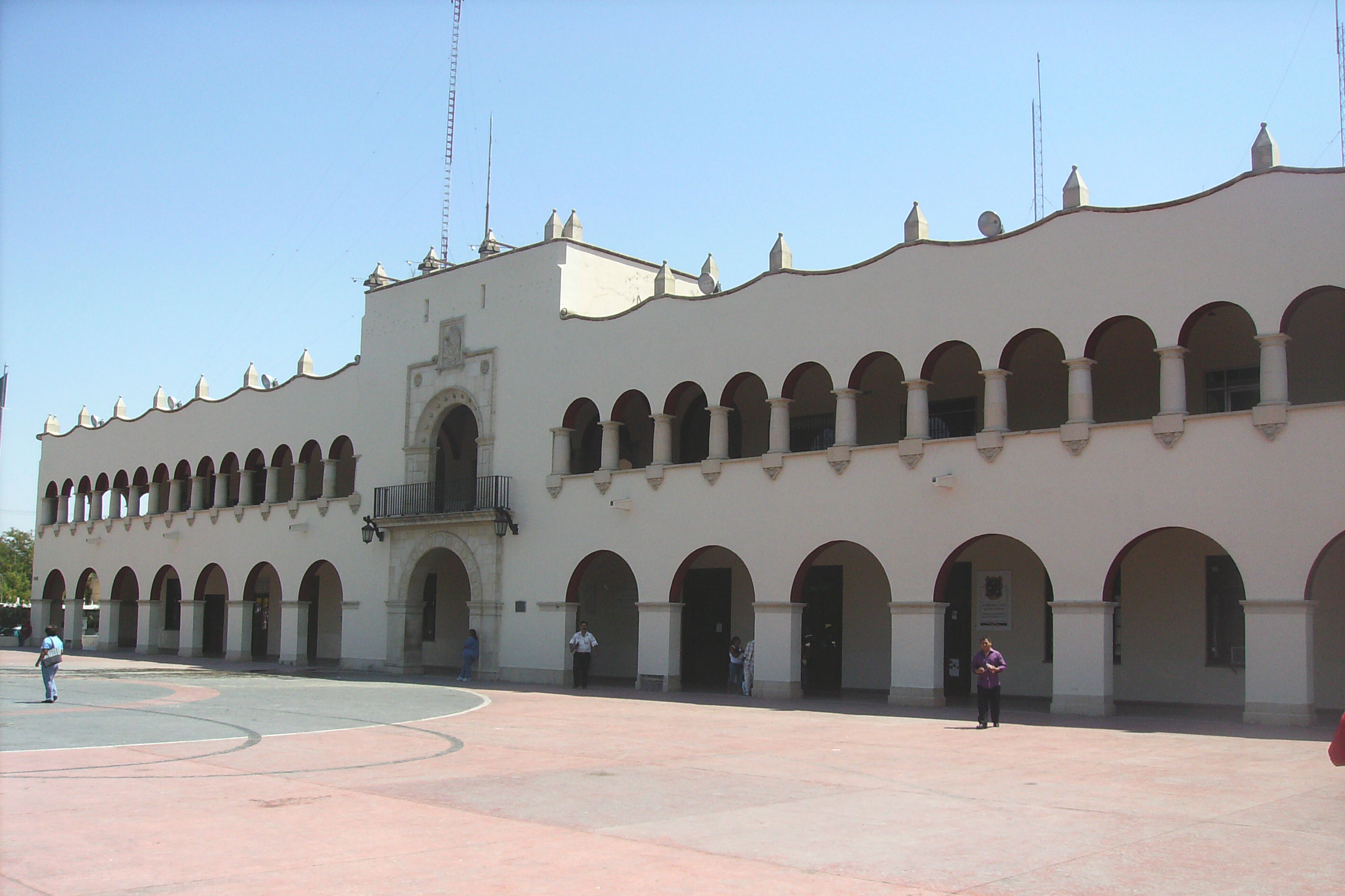
Nuevo Laredo is a city in the Municipality of Nuevo Laredo in the Mexican state of Tamaulipas. The city lies on the banks of the Rio Grande, across from Laredo, Texas, United States. The 2010 census population of the city was 373,725. Nuevo Laredo is part of the Laredo-Nuevo Laredo Metropolitan Area with a population of 636,516. The municipality has an area of 1,334.02 km2 (515.07 sq mi). Nuevo Laredo is considered the “customs capital of Latin America” because of its high volume of international trade operations in the region, and number 1 in importance for US inland commercial traffic. Both the city and the municipality rank as the third largest in the state.
Adapted from Wikipedia, CC BY-SA 4.0.
Worth seeing in and around Nuevo Laredo
10 places within 25 km that the world writes about, in the order of how widely: the ones a visitor has heard of first, then the ones only a local would name.
- 01Roman Catholic Diocese of Nuevo Laredo
The Diocese of Nuevo Laredo is a Latin Church ecclesiastical territory or diocese of the Catholic Church in Nuevo Laredo, Tamaulipas, Mexico. It is a suffragan in the ecclesiastical province of the metropolitan Archdiocese of Monterrey.
2 km · diocese of the Catholic Church in Mexico · Wikipedia - 02Catedral del Espíritu Santo
The Catedral Del Espiritu Santo is the seat of the Roman Catholic Diocese of Nuevo Laredo. It is located at Paseo Colon Avenue in the heart of the midtown Nuevo Laredo.
2 km · church in Tamaulipas, Mexico · Wikipedia - 03Juárez–Lincoln International Bridge
The Juárez–Lincoln International Bridge is one of four vehicular international bridges located in the cities of Laredo, Texas, and Nuevo Laredo, Tamaulipas, that connect the United States and Mexico over the Rio Grande. It is owned and operated by City of Laredo and the Secretaria de Comunicaciones y Transportes.
1.6 km · International bridge connecting Laredo, Texas, and Laredo, Tamaulipas, on the US–Mexico border · Wikipedia - 04Laredo College
Laredo College is a public community college in Laredo, Texas. Founded as Laredo Junior College in 1947, it is part of the Laredo Independent School District.
2.6 km · public college in Laredo, Texas, U.S. · Wikipedia - 05Gateway to the Americas International Bridge
The Gateway to the Americas International Bridge is one of four vehicular international bridges located in the cities of Laredo, Texas, and Nuevo Laredo, Tamaulipas, that connect the United States and Mexico over the Rio Grande. It is owned and operated by the City of Laredo and the Secretaría de Comunicaciones y Transportes.
1.5 km · toll bridge · Wikipedia - 06Lake Casa Blanca
Lake Casa Blanca is a reservoir on the Chacon Creek, 5 miles northeast of downtown Laredo, Texas, United States. The reservoir was formed in 1951 by the construction of a dam to provide recreational opportunities for the residents of Webb County.
7.8 km · lake of the United States of America · Wikipedia - 07Laredo Energy Arena
The Sames Auto Arena is a multi-purpose arena in Laredo, Texas. It is located next to Bob Bullock Loop, on the northeastern side of Laredo.
9.6 km · arena in Laredo TX · Wikipedia - 08Uni-Trade Stadium
The Uni-Trade Stadium is a baseball stadium in Laredo, Texas. The stadium is the United States home to The Tecolotes de los Dos Laredos, a bi-national Mexican League professional baseball team, and the Laredo Roses, a women's full-contact American football team in the Sugar N Spice Football League.
9.4 km · baseball stadium in Laredo, Texas · Wikipedia - 09Texas Mexican Railway International Bridge
The Patrick J. Ottensmeyer International Bridge is an international railway bridge across the Rio Grande and U.S.-Mexico border between Laredo, Texas, and Nuevo Laredo, Tamaulipas, the only rail link between these cities. Owned and operated by CPKC, the single-track bridge is the busiest rail border crossing in North America.
1.7 km · bridge in Nuevo Laredo, Tamaulipas · Wikipedia - 10Lake Casa Blanca International State Park
Lake Casa Blanca International State Park is a 525-acre state park located in Laredo, Texas, United States a few miles east of the border with Mexico. The park was originally managed by Webb County and the City of Laredo.
8.1 km · state park in Texas, United States · Wikipedia
Ranked by the number of language editions of Wikipedia with an article on each, from Wikidata; the sentences are the openings of those articles, CC BY-SA 4.0.
What Wikivoyage says to see
There are plazas and monuments can be found throughout the city. Most visitors focus on shopping and strolling the streets of Vicente Guerrero and Ignacio Zaragoza. You may also see Los Tecolotes de Nuevo Laredo (Mexican Professional Baseball League) game. You may also see a play or a Broadway-style show in the Centro Cultural.
From Wikivoyage: Nuevo Laredo, CC BY-SA 4.0. Not yet checked by us.
Things to do
- 01Parque La Junta
Tecolotes de los Dos Laredos (affectionately known as Tecos) bring AAA-level Mexican League Baseball to Nuevo Laredo from March through the end of August.
From Wikivoyage: Nuevo Laredo, CC BY-SA 4.0. Not yet checked by us.
Where to eat
When you cross on Bridge 1 and go straight, you will be on Av. Guerrero, which is a main artery of the city. Several blocks over to the left, there is a hospital called IMSS. In front of this hospital, there are several hawkers set up in front of the hospital. All of them are pretty good (as of 2013). At Guerrero and Heroe de Nacataz, at night, there is a popular and established taco stand set up.
From Wikivoyage: Nuevo Laredo, CC BY-SA 4.0. Not yet checked by us.
Getting to Nuevo Laredo
- Airports
- Monterrey (MTY), 199 km · San Antonio (SAT), 249 km
- Stations
- Quetzalcóatl International Airport, 7.8 km
- Monterrey → Nuevo Laredo215 km · quickest by road, 3h 27m · MX$195–260
- Mexico City → Nuevo Laredo896 km · quickest by road, 17h 26m · MX$990–1,320
- Chihuahua → Nuevo Laredo658 km · quickest by road, 15h 22m · MX$900–1,200
- Plan a tripFrom anywhereThe planner compares every way there from wherever you are.
Road and air are today’s quick answer; timetabled trains, buses and ferries load on the results page from the operators’ feeds.
No local-transport research exists yet for Nuevo Laredo
Our researched notes are written from a sourced entry: every shared taxi, boat and village bus with its operator, its rule, its fare and the year we saw it, and what could not be confirmed. Nobody has done that work for Nuevo Laredo. What is above is what we hold from open sources; nothing here pretends to be more.
- Go nextDay trips by car can take you to Zapata TX (less than 1 hour to the south) for hunting, fishing and nature observation/birding; and to Kingsville (less than two hours to the east) a ranching heritage town, and home of the King Ranch Museum .
From Wikivoyage: Laredo, CC BY-SA. Not yet checked by us; that article was last edited 2026-09.
- 011,499 km
- 021,535 km
- 031,599 km
- 042,293 km
- 052,818 km
If you know how people move in Nuevo Laredo – the stand, the rule, the fare – tell us, and the note gets an entry.
Next door to Nuevo Laredo
- Nuevo Progresotown in Nuevo Laredo Municipality, State of Tamaulipas, Mexico8.6 km
- Los Artistastown in Nuevo Laredo Municipality, State of Tamaulipas, Mexico9.6 km
- Álvareztown in Nuevo Laredo Municipality, State of Tamaulipas, Mexico8.7 km
- 1st federal electoral district of Tamaulipasfederal electoral district of Mexico800 m